
District overview & geography
Angul is a district best understood through contrasts. In central Odisha, it joins forested hills and long river valleys with major coal, power and metal industries; old sacred sites with a relatively young administrative district; and quiet rural roads with busy industrial corridors. It is a useful destination for travellers who want more than a single monument: the appeal is a sequence of landscapes, communities and places of worship, approached at an unhurried pace.
The district lies between coastal and western Odisha. Its boundaries touch Cuttack, Dhenkanal, Kendujhar, Deogarh, Sambalpur and Sundargarh, while the Mahanadi forms boundaries with Nayagarh and Boudh in places. That geography matters when planning: Satkosia is shared between Angul and Nayagarh, so not every camp, approach road or activity advertised under the Satkosia name is in Angul district. The Angul district administration places the headquarters about 125 kilometres from Bhubaneswar and identifies Angul and Talcher as major stations on the Bhubaneswar–Sambalpur rail corridor.
Relief changes markedly across the district. Low hills, undulating country and forest tracts are especially significant toward Athamallik and Pallahara, while broad valleys and industrial settlements shape the Angul–Talcher belt. Malayagiri, cited by the district administration as the district’s highest point at 1,187 metres above mean sea level, is a reminder that this is not uniformly flat country. Views are often earned gradually: from a road bend, a reservoir edge or a temple slope rather than a formal viewpoint.
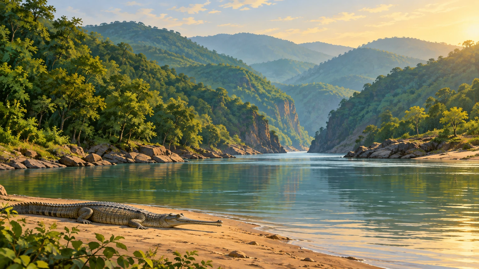
Water gives Angul much of its structure. The Mahanadi is the defining river of the Satkosia landscape. Here, it passes through a dramatic gorge system rather than simply serving as a distant boundary. The Brahmani flows through the Talcher side of the district, and the Tikira is also listed among Angul’s important rivers. The Rengali dam is on the Brahmani; Derjang reservoir was built across the Ningara and Matalia streams. These are working water landscapes as well as places of scenery, irrigation, settlement and memory.
Forests remain central to Angul’s identity, particularly around Satkosia and in the Athamallik–Pallahara region. Odisha Tourism describes Satkosia’s tropical deciduous habitat with sal, teak and bamboo, and reports elephants, leopards, sambar, spotted deer, wild boar and varied birdlife. The Mahanadi supports gharial and mugger crocodile conservation. These are habitat descriptions, not a promise of sightings; keep distance and follow forest guidance. The district’s official “at a glance” page records 2,716.82 square kilometres as forest area, though visitors should treat such administrative statistics as period-specific rather than a map of accessible woodland. In practical terms, much forest is protected, seasonally managed or unsuitable for casual entry. The correct way to experience it is through recognised entry points, confirmed accommodation, authorised guides where required and current forest instructions.
Climate shapes the itinerary more than any brochure does. The hot pre-monsoon months can be severe, especially in exposed valleys, towns and industrial areas. The monsoon transforms the colour and flow of the landscape but can bring slippery roads, high water and weather disruption. The cooler period after the rains through winter is generally the most comfortable time for road travel, temple visits and forest-edge views. Odisha Tourism describes October to March as the preferred broad season for Satkosia, while its Tiger Reserve listing suggests November to March; either way, travellers should check weather, road conditions and official access rules immediately before departure.
Angul’s economy is inseparable from industry. Talcher and the Brahmani valley are major coal and energy landscapes; NALCO, NTPC, Mahanadi Coalfields and other large facilities feature in the district’s public profile. This is not a district to portray as untouched wilderness. Instead, its tourism value lies in seeing how forests, rivers, farming, pilgrimage and heavy industry occupy the same region. Visitors should respect safety boundaries around industrial infrastructure, avoid stopping in operational zones and keep expectations focused on public visitor sites rather than plant interiors.
Mythological & historical significance
Angul has deep historical associations, but it is important to separate documented administration and archaeology from oral tradition. The district administration describes evidence of prehistoric and protohistoric remains at places including Bhimkand, Kankili, Kulei, Samal, Sanakerjang, Kaliakata, Paranga, Kerjang, Tikarpada and Pallahara. It also associates the wider area with successive political formations including the Bhaumakaras, Shulkis, Somavanshis, Eastern Gangas and Gajapati kingdom. These references establish Angul as a long-inhabited cultural region, even where the surviving visitor experience is modest and site interpretation limited.
The modern district has a clearer timeline. The official district overview says Angul estate and the then Phulbani subdivision were constituted as a district in 1891. That district was abolished in 1936, when Angul subdivision was added to Cuttack district. For the present district, two dates have distinct meanings: the notification dividing Dhenkanal and Angul was dated 27 March 1993, while the official district survey report records Angul’s separate existence from 1 April 1993. Neither is an ancient foundation date.
Talcher’s historical identity is closely tied to the Brahmani and to its former princely estate. Official district material says the town stands on the river’s right bank and records a tradition that the state was renamed Talcher after the family deity Taleswari by ruler Padmanabha Birabara Harichandan. This is best read as an estate tradition preserved in local historical writing, rather than as an independently verified origin story. Today, Talcher’s significance comes equally from its industrial growth, religious institutions and river setting.
Athamallik has one of Angul’s most telling origin traditions. The district history calls the story of eight divisions, each governed by a Mallik, a “tradition”; the name Athamallik is explained as land of eight chieftains. Palace records are said to list 42 rulers of the dynasty, but the origin account should not be presented as proven early medieval fact. For travellers, its value is cultural: it explains why local temples, royal associations and the old settlement landscape remain meaningful.
Sacred travel in Angul is not limited to monumental architecture. At Hingula Pitha near Gopalprasad, on the Simhada riverbank in the former Talcher estate, faith is expressed through a major regional Shakti tradition. The district tourism page identifies the shrine as a principal place of interest and its art-and-culture page describes Hingula Yatra as the district’s most significant festival. Claims about the goddess’s journeys, ancient links to other places or miraculous origins belong to belief, devotional literature and local legend. They should be respected as living faith, not recast as documentary history.
Angul town itself offers a compact introduction to this religious landscape. Budhi Thakurani, associated with Sunasagad hill, is described by the district as an expression of Budha–Budhi worship in local tribal culture. Its official account explicitly says that the earlier period of worship is unclear and also records hearsay about a Kandha ruler named Sunas. That uncertainty is valuable: it calls for a visitor’s curiosity, not a confident invented chronology. Nearby Saila Srikhetra, the Jagannath temple on the hill, is a more recent civic sacred landmark. The district page records its foundation in 1996 and public opening after consecration in 2002.
Around Talcher, Bhimkand connects riverbank geography with devotional art. It is a distinct site from the better-known Anantashayana Vishnu at Saranga, which belongs to Dhenkanal district. Angul’s tourism listing describes Bhimkand’s reclining image of Vishnu on the Brahmani’s right bank at the NTPC complex. Confirm permitted public access rather than assuming an industrial site is freely open. Dress conservatively, remove footwear when asked, do not photograph worshippers without consent and avoid treating active shrines as backdrops.
Tourist destinations & lesser-known places
Satkosia and Tikarpada
Satkosia is Angul’s headline nature destination, but accuracy improves the visit. Odisha Tourism says the Satkosia Gorge Wildlife Sanctuary spans Angul and Nayagarh districts. The Mahanadi’s passage through wooded hills is the essential attraction: a broad river narrowed and framed by slopes, sandbanks, changing light and forest. Tikarpada, in Angul district, is one recognised gateway to this landscape and is associated with the gharial conservation centre.
The gorge is not a place for improvised adventure. River levels and currents can change; banks may be unstable; wildlife habitat is not public recreation space. Do not swim, attempt unsupervised boating, walk into unmarked forest or approach animals. If booking an eco-stay, safari, guided walk or boat activity, use official channels and obtain written confirmation. The Satkosia tourist rules page says advance booking is required for overnight stays and lists access routes through Pampasar, Chhamundia and Kusanga. It also publishes time limits for Tikarpada and day-reserve visitors. Rules, gates, routes and seasonal closures can change, so treat those published details as a prompt to verify, not a guarantee for a future trip.
Tikarpada is best visited as a low-impact landscape experience: arrive early with a confirmed plan, listen more than you play sound, keep food sealed and carry all waste back out. The pleasure is in the scale of the river and the surrounding forest, not in ticking off wildlife sightings. A sighting can never be promised, and the absence of one does not diminish the gorge.
Deulajhari and Athamallik
Deulajhari, near Athamallik, combines Shiva worship with geothermal springs. The Angul administration describes it as an ancient centre of Shaivism, about six kilometres from Athamallik and roughly 90 kilometres from Angul town. The site is a strong choice for travellers interested in religious landscapes beyond the better-known circuits of Odisha: the temple setting, local devotional activity and warmth of the springs make it distinctive.
Respectful behaviour is especially important here. Hot-water conditions, bathing arrangements and temple access can vary locally. Do not assume that every pool is safe, open or intended for visitors; ask on site, follow posted instructions and avoid soaps or litter near water. Reaching Deulajhari is simplest by road from Angul or Athamallik. Some travellers use rail connections via Boinda, but train schedules and onward transport should be verified with current railway and local information rather than assumed from older travel accounts.
Athamallik itself rewards a slower stop. Its value lies less in a single landmark than in its association with the old estate, the Deulajhari route and smaller shrines. It is an appropriate base for daylight exploration only when transport and accommodation are confirmed in advance. Rural roads may be slow after rain, and travellers should avoid arriving at isolated sites after dark.
Talcher, Hingula and the Brahmani side
Talcher offers a different Angul: a riverine former princely town transformed by mining and power generation. The Brahmani remains the geographical anchor, while the town’s religious calendar and public culture give it a social texture beyond the industrial skyline. Hingula Pitha near Gopalprasad is the principal pilgrimage stop. During major observances, crowd conditions, traffic controls and local arrangements may change quickly; visitors should use current district and temple guidance, not old blog itineraries.
Bhimkand is a quieter possibility on the Brahmani side: Angul district’s official tourism page places its reclining Vishnu image about 20 kilometres from Angul, at the NTPC complex. Confirm access and the exact approach before including it in a route. Do not confuse it with Saranga in neighbouring Dhenkanal, a separate reclining-Vishnu site. Official pages disagree on Saranga’s distances from Angul and Talcher, so those figures should not guide this Angul itinerary. Do not climb on either image, leave offerings outside designated practice or block worship.
Rani Park is listed by the district as another Talcher-side attraction. Public descriptions vary in detail, so it is sensible to confirm current access before treating it as a fixed itinerary stop. The same caution applies to viewpoints and informal riverbank locations in and around the industrial area: operational traffic, security zones and seasonal water conditions take precedence over sightseeing.
Rengali and Derjang
Rengali, on the Brahmani, is a dam-and-reservoir landscape rather than a conventional heritage destination. The official tourist listing notes the dam and a 120 MW hydroelectric project. Visitors should view infrastructure only from lawful public areas and remember that reservoir operations can affect water levels and access without warning. It is best combined with a road journey through the northern part of the district, rather than planned as a water-sport stop.
Derjang irrigation project is closer to Angul’s central travel circuit. The district describes it as a reservoir scheme across the Ningara and Matalia near Majhikia in Angul block, started in 1960 and completed in 1977–78. Its appeal is the open reservoir setting and an opportunity to pause outside the town. It should not be confused with a protected wilderness or used for unsupervised water entry.
Local reporting dated 21 March 2026 said boating facilities were inaugurated at Derjang in Banarpal area, including several boat types, and reported an anticipated eco-lodge. That report is useful evidence of an event, not proof that every activity or future lodge remains available. Confirm operations, safety equipment, weather cancellations, authorised operators and prices directly before making a detour. Never rely on social-media videos as proof of current service.
Angul town and everyday culture
Angul town is a sensible practical base. Saila Srikhetra and Budhi Thakurani can be visited with time for the hill setting and town life rather than hurried as “photo stops.” The town’s annual Lakshmi Puja is described by the district administration as a long-running community celebration; exact dates follow the ritual calendar and local notices, so travellers should not book around an assumed date.
Food is an everyday part of the experience. Official Angul cultural material identifies rice, dal and vegetables as staples, alongside chuda, mudhi and pakhal. It also notes millet, pulses, beans and sweet potatoes in tribal food traditions. Seek these through clean, busy local eateries or confirmed accommodation meals rather than demanding a supposedly “authentic” menu from communities. Ask what is freshly prepared, choose seasonal food, use safe drinking water and avoid wasteful packaging.
Recent news & tourism developments
An evidence refresh on 19 October 2026 found no newer completion update for the Satkosia infrastructure plan and no dated forthcoming Angul event on the checked Odisha Tourism calendar. Angul’s district listing identifies Lovi Thakurani Yatra with Kartik Purnima but supplies no year-specific date; a confirmed 2026 date is therefore not given here. This is not proof that no later development occurred; it means a visitor should not present an unverified announcement as current fact.
Two dated developments provide useful context. On 17 April 2026, the Chief Minister’s Office reported the opening of the Thirteenth Angul Festival 2026. The release said projects worth ₹559 crore were launched: ₹414 crore in foundation stones and ₹145 crore in inaugurations. These were district development projects across sectors, not a tourism-only investment package. The festival itself is meaningful for regional culture and public gathering, but the release does not establish that each project changes visitor facilities.
Odisha Tourism’s news page, dated 25 January 2026, announced a plan for nearly ₹100 crore of Satkosia ecotourism infrastructure, including upgraded accommodation and sustainable tourism practices. The wording is prospective. It should therefore be read as a proposal or development plan, not as completed infrastructure available for booking in October 2026.
The 21 March 2026 Derjang boating inauguration was reported by Pragativadi and also covered by UNI. It indicates that facilities were publicly launched, but it is not an operating timetable. Before travel, verify whether boating is running on the intended date and follow all operator and water-safety directions. The reported eco-lodge was described as a future Forest Department plan, not a completed stay.
Traveler essentials
Getting there: Fly to Biju Patnaik International Airport in Bhubaneswar, then continue by road or connect onward by rail. Angul and Talcher are the principal railheads identified by the district administration on the Sambalpur–Bhubaneswar corridor; check the actual station and current stopping pattern before booking. NH-55 provides the main east–west road approach toward Cuttack and Sambalpur; NH-149 serves the northern corridor. Distances vary with the airport, town, forest gate and accommodation chosen, so navigate to the confirmed destination rather than a generic Satkosia marker. For Tikarpada, Deulajhari, Hingula, Rengali and Derjang, a hired car or reliable local vehicle is usually more practical than trying to assemble same-day connections. Build in daylight travel time and do not assume frequent public transport to forest-edge destinations.
Build a realistic route: A two-day visit can combine Angul town, Talcher/Hingula and Derjang or a reservoir-side stop. Give Satkosia/Tikarpada a dedicated day, or more if an officially confirmed overnight stay is secured. Deulajhari and Athamallik deserve their own road day from Angul. Do not combine Satkosia and Deulajhari in a rushed day merely because they appear close on a state map.
Choose the season: The post-monsoon and winter months are generally the easiest for outdoor travel. Summer requires early starts, sun protection and generous water carried in reusable bottles. In monsoon, expect rain, slippery edges and changed river conditions. Forest access can be seasonal or restricted; official confirmation is more important than a generic “best time” label.
Stay responsibly: Book recognised accommodation in advance, especially around Satkosia. Carry identification, keep permits and confirmations available, and follow guide and gate instructions without argument. Do not bring single-use plastic into forest or river landscapes, feed wildlife, fly drones without permission, play loud music or collect plants, stones or cultural objects. Keep a respectful distance from every animal and never pursue a sighting.
Use water safely: Reservoirs and rivers are working and changing environments. Swim only where an authorised operator explicitly permits it; do not enter water at Satkosia, dams or informal banks. Use boats only with approved operators, required safety gear and weather clearance. A scenic river is not evidence of safe currents.
Visit shrines with care: Wear modest clothing, ask before photography and accept that some spaces or rituals may be restricted. During crowded observances, keep valuables secure, do not obstruct queues and allow worshippers priority. Buy offerings and food from local vendors where appropriate, but avoid leaving plastic or food waste at sacred sites.
Angul is most rewarding when approached with patience. Its strongest impressions are not manufactured attractions: the long curve of the Mahanadi beneath wooded slopes, the Brahmani’s presence in Talcher, a hill temple above town, warm springs near Athamallik, and the clear evidence that landscape, livelihood and faith are inseparable here. Travel lightly, verify arrangements and let the district set the pace.
Publishing Metadata & Tagging
- Group: Odisha Tourism
- Section/Category: Society And Culture
- Destination: https://pcachary.in
- District: Angul
- Edition: 2026-10-18
- Cycle: 1
- Tags: Odisha Tourism; Angul; Society And Culture
Sources and evidence check
Evidence checked 18 October 2026.
- Angul district overview and history, Government of Odisha, publication date not stated.
- Angul district history, Government of Odisha, publication date not stated.
- Places of interest in Angul, Government of Odisha, publication date not stated.
- Angul art and culture, Government of Odisha, publication date not stated.
- Satkosia Gorge Wildlife Sanctuary, Odisha Tourism, publication date not stated.
- Satkosia tourist rules and regulations, Satkosia, publication date not stated. Timings and access rules require reconfirmation before travel.
- Major ecotourism development at Satkosia Sanctuary, Odisha Tourism, 25 January 2026. This describes a plan, not confirmed completed works.
- Thirteenth Angul Festival 2026, Chief Minister of Odisha, 17 April 2026.
- Derjang boating inauguration report, Pragativadi, 21 March 2026. Non-official reporting; current operations were not independently confirmed.
- Angul district at a glance, Government of Odisha; forest-area statistic. Official pages differ on total geographical area.
- Saranga, Dhenkanal district administration; Saranga is separate from Bhimkand, Angul. Official distance figures conflict.
- Centrally protected monuments list, Archaeological Survey of India; Ananta Sayi Vishnu at Sarang is listed in Dhenkanal district.
- Angul District Survey Report 2026, Government of Odisha; distinguishes the 27 March 1993 notification from separate-district existence on 1 April 1993.
Evidence refreshed 19 October 2026: Odisha Tourism Satkosia habitat; Odisha government Angul access profile; Odisha Tourism events calendar. Year-specific Lovi Thakurani Yatra date not established; no newer Satkosia completion update located.
Disclaimer
This content is a collection of ancient history,books and various articles and collection of library and news and other post ; all details may not be the same. Readers are requested to verify the information themselves. Readers are not allowed to take any disciplinary action; content is only for educational purposes. If readers do not agree about the contents, they may send a personal comment to my personal email ID: achary.purna@gmail.com
