
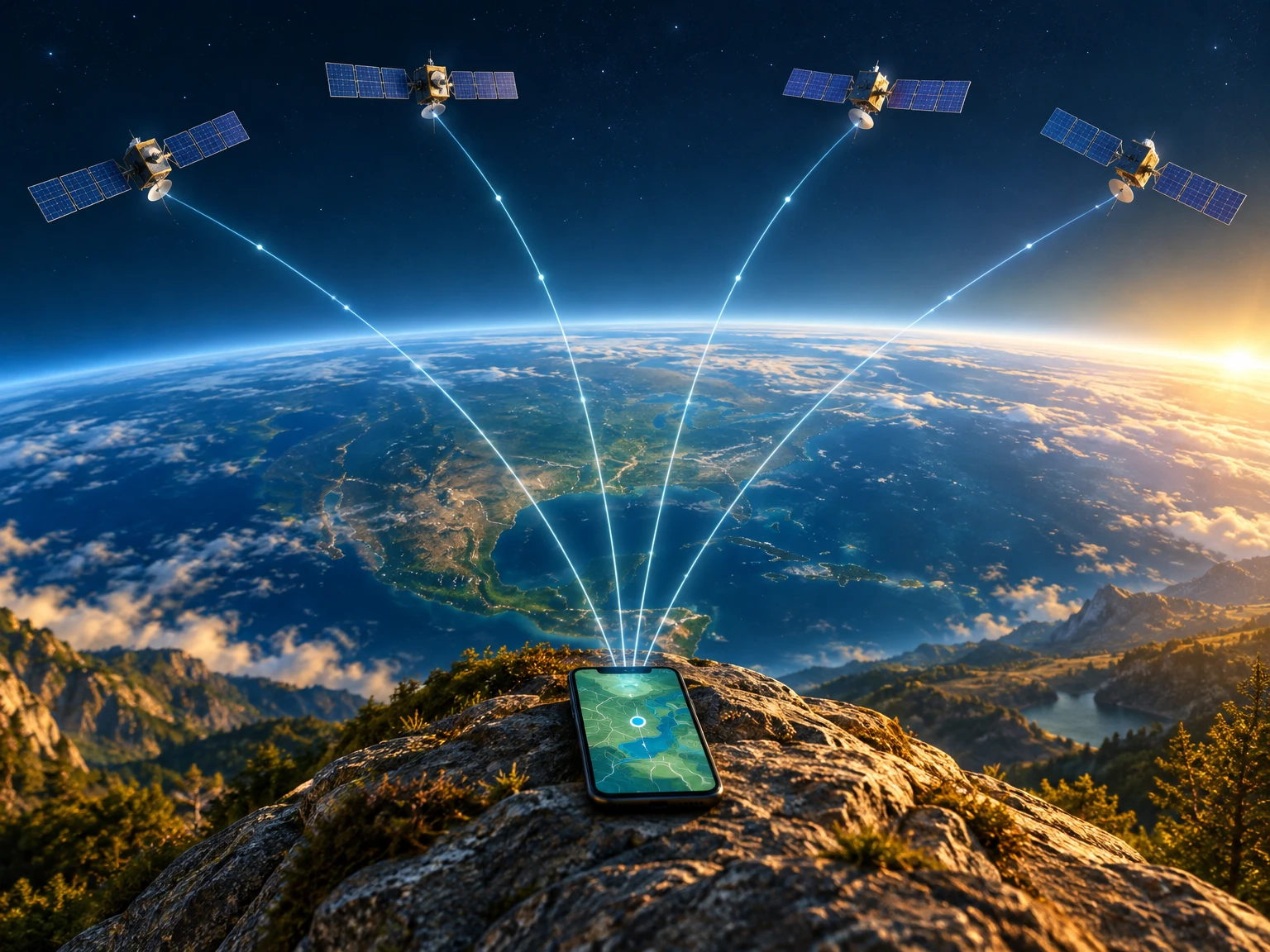
A small dot on a phone map can answer a surprisingly difficult question: where, exactly, am I? The screen makes the answer look effortless. Behind it is a combination of radio signals, precise clocks, orbital information and geometry. Understanding that combination also explains why the dot sometimes wanders, why a tunnel interrupts positioning and why a detailed map is not the same thing as a satellite signal.
GPS stands for the Global Positioning System, the United States’ satellite-based positioning, navigation and timing service. It is one member of the wider family called Global Navigation Satellite Systems, or GNSS. Galileo, GLONASS and BeiDou are other global constellations. A device’s supported systems depend on its hardware; “GPS” is often used casually for satellite positioning more generally.
The satellites broadcast; the receiver calculates
Imagine several very accurate clocks travelling around Earth, each broadcasting a message about its time and position. That is the useful starting point for understanding navigation satellites. According to GPS.gov’s system overview, GPS satellites transmit one-way signals, and user equipment receives those signals to calculate position and time.
Your receiver does not need to ask each satellite, “Where am I?” Nor does basic GPS reception send your calculated location back to the satellites. This distinction does not mean a phone or an app cannot share location through a separate communications connection. Receiving a navigation signal and transmitting personal data are different operations.
There is important work on the ground too. Monitoring and control stations track the constellation, update navigation information and maintain the satellites’ clocks and orbits. The service is a system of space infrastructure, ground infrastructure and receivers, not simply a collection of objects overhead.
Turning a tiny delay into a distance
A satellite’s signal includes timing information and information from which its orbital position can be calculated. The receiver compares transmission time with arrival time. Because radio waves travel at the speed of light, that very small travel time can be converted into an estimate of distance.
The underlying relationship is familiar: distance equals speed multiplied by time. At roughly 300,000 kilometres per second, even a millionth of a second corresponds to about 300 metres of travel. That example is a scale illustration, not a prediction of the error on your phone. It shows why precise timing matters so much.
The measurements are often called pseudoranges because they include clock differences and other effects, rather than being perfect ruler-like distances. The receiver’s task is to find a position and timing correction that fit the available observations.
Why four satellites usually matter
If you knew your exact distance from one satellite, you could be anywhere on an imaginary sphere centred on it. A second distance narrows the possibilities to the intersection of two spheres. Further measurements narrow them again. This is a distance-based geometry problem, commonly described as trilateration, rather than simply measuring compass directions.
But there is another unknown: the receiver’s clock is not an atomic clock perfectly synchronised with the satellites. In a normal three-dimensional solution, the receiver solves for three position coordinates and its clock offset. Signals from at least four satellites provide the measurements needed for that calculation, as the Federal Aviation Administration explains.
Real receivers often use more observations than this minimum. More usable signals can help, but their quality and arrangement across the sky matter too. Four poorly placed or obstructed signals are not equivalent to a clear, well-distributed view.
Why the location dot drifts
The journey from satellite to receiver is not perfectly simple. The atmosphere affects signal travel, and the receiver must account for those effects. Buildings, bridges and trees can block or weaken signals. Reflections off nearby surfaces can make a signal appear to have followed a longer path: an effect called multipath.
These problems help explain why positioning can worsen between tall buildings, indoors or underground. A clear view of the sky generally gives a receiver better opportunities to collect useful signals. It does not turn the displayed position into an exact, error-free point.
GPS.gov gives about 4.9 metres as a typical smartphone accuracy radius under open sky, while stressing that local conditions and receiver design affect the result. Treat that as an illustrative typical figure, not a guarantee for every device, moment or location. Professional equipment and correction services can achieve much higher accuracy under suitable conditions; an ordinary phone should not be assumed to have survey-grade precision.
Position, maps and directions are separate layers
Satellite positioning produces coordinates and timing information. A mapping application places that position on a representation of roads, buildings and places. Route planning adds another layer: deciding how to travel between locations using the map’s network and rules.
A dot on the wrong road can therefore have several explanations. The position estimate may be imperfect, the road data may be wrong, or the software may have matched a position to the wrong feature. GPS.gov explicitly distinguishes signal-related problems from inaccurate maps and mislabeled destinations.
Basic satellite reception is not the same as downloading a map over the internet. Offline navigation depends on what the device and application have stored and can do without a connection. Live traffic, fresh place information and other online functions are separate services. A visible location dot alone does not establish that all those functions are available.
A more useful way to read the screen
Think of the dot as an estimate produced by several cooperating technologies, not an infallible instruction. A sudden jump near buildings need not mean the satellites themselves have moved incorrectly. A missing road need not mean the receiver has failed. Distinguishing the positioning layer from the mapping layer makes these ordinary puzzles easier to understand.
The central achievement remains remarkable: a receiver can turn faint messages from distant clocks into a useful estimate of its place on Earth. The apparent simplicity of a map dot rests on precise measurement, continual infrastructure maintenance and careful handling of uncertainty.
A closer look at the three cooperating parts
The space segment supplies moving reference points. Their usefulness comes from knowing where they are when a signal is sent, not from having them hover above a particular town. As a satellite moves along its orbit, its position changes. The navigation information allows a receiver to relate the time of transmission to the satellite’s location. A receiver is therefore using a changing set of reference points rather than taking measurements to permanent landmarks on the ground.
The control segment makes those reference points dependable. GPS.gov describes a worldwide network of monitoring and control facilities that observes the satellites, tracks their performance and sends commands and updated navigation data. This continuous maintenance is easily overlooked when looking at a phone. The fact that the final calculation happens in a receiver does not mean the receiver is independent of the quality of the information maintained throughout the system.
The user segment includes the equipment doing that final calculation. A handheld walking receiver, a phone and a specialised positioning instrument share basic principles, but they do not necessarily have the same antennas, supported signals, processing methods or working environment. Comparing their results without considering those differences can be misleading. The service in space is only one part of the complete measurement chain.
A worked timing example, without false precision
Consider a deliberately simplified measurement. Suppose a radio signal takes 0.07 seconds to travel from a satellite to a receiver. Multiplying that time by approximately 300,000 kilometres per second gives a path length of about 21,000 kilometres. This is an arithmetic illustration of the method, not a claim that every satellite is exactly that far away or that every signal has that travel time. The actual distance depends on where the satellite and receiver are.
Now imagine that the measured time is wrong by one thousandth of a second. At the same approximate speed, that is equivalent to 300 kilometres of extra apparent travel. Even a much smaller timing difference can matter. The receiver cannot simply read a cheap clock, subtract two rounded numbers and expect a precise answer. It needs a calculation that accounts for its own timing offset and the other effects present in the measurements.
A common receiver-clock error affects measurements from several satellites together. By looking for a position and a clock correction that jointly explain those observations, the receiver can separate much of that shared timing problem from the geographical position. This is why the clock offset belongs in the list of unknowns. Adding a fourth measurement is not an arbitrary rule invented by a navigation application; it follows from the ordinary three-dimensional problem being solved.
Why the shape of the satellite pattern matters
The arrangement of reference points changes how confidently a position can be estimated. Imagine trying to locate an object using distances measured from several points almost next to one another. Small distance errors can leave a relatively large region of uncertainty in some directions. Using well-separated reference points gives the measurements different perspectives on the object’s location. Satellite geometry is the three-dimensional version of that problem.
GPS.gov identifies satellite geometry as one factor in positioning accuracy. It is therefore not enough to count the satellites a receiver can detect. Several may be concentrated in a restricted part of the sky because a building or hillside blocks the rest. A different arrangement can constrain the solution better even when the number of observations is similar. The distribution and quality of the observations must be considered together.
This also helps explain why moving a short distance can sometimes change reception significantly. A doorway, a roof edge or the corner of a tall building can reveal or hide a sizeable part of the sky. That change affects which signals are usable and how they are arranged. The effect is local; it does not require a failure of the entire constellation or a change to the map stored on the device.
Atmosphere: the signal does not travel through empty space all the way
Much of a navigation signal’s journey is through space, but the final part passes through Earth’s atmosphere. The FAA and ESA describe atmospheric effects as part of the positioning problem. The ionosphere contains charged particles that affect radio propagation. The lower atmosphere also affects signal travel. A receiver that treated the entire path as an ideal journey through a vacuum would leave relevant effects out of its distance estimate.
These effects belong to the signal path, not to the road database or the label printed on a map. Their size and the available corrections depend on conditions and equipment. It would be inaccurate to attach one universal number to every atmospheric error or assume a consumer receiver removes it perfectly. The useful lesson is that converting a measured delay into a distance requires more than knowing the approximate speed of light.
Different errors can coexist. A receiver beside a building may have an unfavourable satellite arrangement, reflected signals and atmospheric influences at the same time. An explanation of one mechanism does not prove it caused a particular jump on one person’s screen. Diagnosing an individual event would require information about the receiver, its observations and the surroundings, not just a general description of how GPS works.
Multipath: when the signal takes a detour
A reflection makes the distance problem especially intuitive. A signal arriving directly from a satellite follows one route. A copy that bounces off a nearby surface follows a different, longer route before reaching the receiver. If the receiver interprets that delayed copy incorrectly, it can infer a distance that is too long. GPS.gov calls this signal multipath and lists buildings and other large surfaces among environments where it can be troublesome.
More visible sky usually helps, but it is not a promise that every received signal is direct and clean. Receivers and antennas differ in how they handle difficult observations. A phone held next to a window inside a building is not automatically operating under the same conditions as a receiver well away from nearby structures outdoors. “It can see a satellite” is a less demanding statement than “it has a reliable measurement from that satellite.”
A moving dot in such a location need not represent actual movement. The calculation may be responding to a changing mixture of measurements and reflected paths. Conversely, a calm, steady dot does not prove the estimate is exactly correct. Software can smooth a display. Stability, numerical precision and accuracy are related ideas, but none is a substitute for the others.
Reading accuracy figures carefully
An accuracy statement needs its conditions. GPS.gov’s typical smartphone example concerns open-sky use and explicitly warns that nearby obstacles can worsen the result. A number presented without that setting can create an unrealistic expectation in a market, railway station or dense city street. The kind of receiver also matters. A typical result for one class of equipment is not a guaranteed minimum standard for every device sold with a GPS label.
There is also a difference between the accuracy of the satellite signal and the accuracy of a person’s final position. GPS.gov distinguishes signal-in-space range error from user accuracy. The first concerns one part of the measurement chain. The second includes the consequences of geometry, the local environment, receiver performance and other factors. Quoting a small range-error number as though it were the accuracy of every phone skips those additional parts.
Statistical language matters as much as the units. A typical radius, an average error and a figure stated for a particular percentage of observations are not interchangeable claims. They answer different questions about a distribution of results. This is why two institutional descriptions can contain different-looking numbers without necessarily contradicting one another. Before comparing figures, check what was measured, what conditions applied and how the result was summarised.
More satellites and more systems: useful, but not magic
The original name GPS refers to the United States system. GNSS is the broader term for satellite navigation systems, and the FAA identifies several constellations. A receiver capable of using multiple systems may have more potential observations available than one using only a single constellation. Whether it actually uses them depends on its hardware and software, the supported signals and the environment at the moment of measurement.
Additional observations can help a receiver maintain useful geometry when part of the sky is blocked. They do not remove the physical difficulty of receiving weak radio signals through a tunnel roof or deep inside a structure. Nor do they repair a road missing from a map. Counting constellation names on a product description is therefore not a complete way to predict real-world navigation performance.
Advanced correction methods and specialised receivers are a separate reason some applications achieve much better accuracy than ordinary phone navigation. GPS.gov discusses augmentation and professional equipment in its accuracy guidance. Such capability comes with requirements for suitable equipment and conditions. It should not be inferred merely because a consumer screen displays many decimal places. The number of digits is a formatting choice; dependable accuracy requires supporting measurements and an appropriate method.
From coordinates to a useful journey
A coordinate estimate does not, by itself, identify an entrance, a pavement or a legal route. A mapping application needs data describing the world around that coordinate. It may associate a position with a nearby road, display a place name or calculate a route through connected streets. Each of those steps introduces information and decisions that are separate from the satellite timing calculation.
Suppose the position estimate falls between two parallel roads. Software may choose one as the most plausible match, using its own rules and available context. If it chooses the wrong road, the displayed route can appear confused even though the underlying coordinates are only modestly inaccurate. Alternatively, the coordinates may be reasonable while a destination marker has been placed at the wrong entrance. GPS.gov specifically recognises inaccurate maps and mislabeled destinations as distinct problems.
This distinction is useful when reporting an error. A missing bridge or an incorrect address should be described as a map-data problem, with the relevant feature identified. An unstable position under trees is a different observation. Separating what the screen shows from what seems physically wrong gives a service provider a clearer report than simply saying that GPS is broken. It also avoids blaming the wrong part of the system.
Using the location estimate responsibly
In ordinary travel, the practical response to uncertainty is to compare the screen with the surroundings rather than follow it blindly. A route instruction does not override a closure, a barrier, a sign or an unsafe condition. The technology supplies useful information, but it is not a substitute for observing the actual place. Someone driving should stop safely before trying to investigate confusing directions or change application settings.
Where safe and appropriate, a clearer view of the sky can help distinguish an obstructed-signal problem from a map-data problem. Giving the receiver time to obtain a stable result may be useful, but there is no universal waiting period that guarantees accuracy. If a position remains uncertain, describe it as uncertain. Repeatedly zooming in does not create better measurements, and a larger dot on a more detailed map is still an estimate.
For specialist or safety-critical work, use equipment, procedures and standards intended for that purpose. A consumer navigation screen should not be treated as proof of a land boundary, a certified measurement or an aviation navigation solution. The fact that professional systems use satellite navigation does not transfer their assurance, monitoring or operational requirements to an unrelated phone application. Matching the tool to the task is as important as understanding the signal.
Four questions that make a map dot easier to understand
First, ask what produced the position. A device may support GPS and other GNSS signals, while applications may combine location information in different ways. The general satellite explanation does not prove which inputs one application is using at a particular moment. Its own documentation and permission settings are the appropriate starting points for those device-specific questions.
Second, ask what the surroundings permit. Open sky, nearby walls, foliage and roofs change reception conditions. Third, ask whether the problem concerns the estimate or the map: a drifting position and a missing street are different symptoms. Fourth, ask what level of accuracy the task actually requires. Finding a neighbourhood and establishing a precise surveyed point are not equivalent demands.
These questions keep the achievement in perspective. GPS turns timing observations into a useful position through maintained infrastructure and mathematical estimation. Maps turn that position into recognisable places and routes. The result is extraordinarily useful precisely because several layers cooperate. Understanding their boundaries makes it easier to benefit from the system without mistaking its confident-looking display for a promise of perfect knowledge.
Sources and reading
Institutional sources consulted on 20 October 2026. This original educational explanation describes established principles, not a newly announced discovery or a guarantee of navigation performance.
- GPS.gov: GPS system overview — one-way broadcasts and space, control and user segments.
- FAA: Satellite Navigation — GPS — How It Works — timing, receiver calculations, four satellites and global constellations.
- European Space Agency: How satellite navigation works — distance from signal travel time, geometry, infrastructure and interference.
- GPS.gov: GPS Accuracy — smartphone accuracy, local limitations, multipath and mapping errors.
Featured-image provenance: original AI-generated conceptual illustration created for this article. Satellite sizes, spacing, visible signal paths and the relationship between the landscape and Earth are artistic, not a scale model, documentary photograph or engineering diagram. No text is embedded in the artwork.
Disclaimer
This content is a collection of ancient history,books and various articles and collection of library and news and other post ; all details may not be the same. Readers are requested to verify the information themselves. Readers are not allowed to take any disciplinary action; content is only for educational purposes. If readers do not agree about the contents, they may send a personal comment to my personal email ID: achary.purna@gmail.com
