
District Overview & Geography
Deogarh is a western Odisha district with much to reward travellers who prefer landscape, local history and unhurried town life to a checklist of large monuments. Its district headquarters, Deogarh town, grew around the former Bamanda or Bamra princely estate. Today the district has one subdivision, headquartered at Deogarh, and three development blocks: Barkote, Reamal and Tileibani. The 2011 Census population cited by the district administration is 312,164; it should be understood as a historic census figure, not a current population estimate. District administration Demography
The district belongs to Odisha’s north-western upland belt, a transition country of undulating hills, wooded slopes, farmed valleys and small watercourses. It does not offer the broad coastal plains familiar from Bhubaneswar or Puri. Its character is instead shaped by elevation changes and drainage lines: roads rise and fall through a mosaic of sal, mixed woodland, fields and settlement clusters. This is a landscape that asks a visitor to slow down. A waterfall may lie near town on a map yet feel remote in the last stretch because the surrounding ground is folded, rocky and green.
Deogarh is part of the Brahmani river basin. The district’s official economic profile identifies the Brahmani and Tikira among its important rivers and notes the role of the Rengali and Gohira reservoirs in local livelihoods. Agriculture, horticulture, forest-linked work and water resources remain central to the district’s economy. Older percentage figures on official pages are best treated as background rather than a description of present-day employment or forest condition. Economy The traveller’s visible experience of this water system is varied: a cascade close to Deogarh town, a reservoir edge near Gohira, seasonal streams in forested country, and cultivated land dependent on the same monsoon rhythm.
Water is both landscape and livelihood here. Reservoirs such as Gohira and Rengali serve more than the visitor’s desire for a quiet view; district material links them to agriculture and local water resources. The smaller falls and streams, too, belong to a watershed that changes with the monsoon rather than a fixed recreation circuit. This is why a beautiful bank should not be mistaken for an authorised bathing place or boat launch. Stay away from dam structures, irrigation works and unstable edges, and ask locally before approaching a channel that appears to cross private land. A respectful visit notices the water without interrupting the way it is used. In dry months, streams may be reduced; after heavy rain, the same routes can become hazardous. Make the plan around current conditions, not a photograph from another season.
Forests are not a scenic backdrop separate from everyday life. They are part of the district’s cultural and economic setting, particularly for communities whose livelihoods have long drawn on agriculture and forest resources. Visitors should therefore resist the habit of treating every wooded track as an open recreational trail. Forest access, road conditions and permissions can change. Stay on public approaches, follow local instructions and avoid entering protected or unfamiliar terrain without clear authorization. Do not collect plants, disturb wildlife, make amplified sound or leave picnic waste in stream beds.
The official climate account describes a hot, dry summer; a south-west monsoon season; a post-monsoon interval; and a moist winter. Summer broadly runs from mid-March to mid-June, monsoon rains generally arrive around mid-June and continue into late September, and winter begins late in November and lasts to the end of February. These are useful seasonal patterns, not a weather guarantee for a particular journey. Climate Heat can be severe before the rains. Monsoon makes the waterfalls visually dramatic but also makes rock, paths and road edges slippery. In winter, clearer days make a practical choice for temple visits, town walks and long road excursions, while mornings and evenings can feel distinctly cool.
October, the month of this edition, is normally part of the post-monsoon transition. The countryside may remain green and watercourses may still carry substantial flow, but travellers should not assume a waterfall’s volume from photographs or older reports. Rainfall varies from year to year, and a responsible itinerary leaves room for local conditions. Check weather and road information close to departure, carry drinking water, and allow daylight for drives beyond the town.
Deogarh’s food culture is best encountered modestly rather than packaged as a single “must-eat” dish. In and around the town, look for simple Odisha meals built around rice, dal, seasonal vegetables, leafy preparations and local snacks. In rural areas, availability changes with market day, harvest and household practice. If invited to eat, accept local guidance on etiquette; if buying food, ask what is freshly prepared and avoid demanding items out of season. The district’s appeal lies in this relationship between season, water, field and forest rather than in a fixed restaurant circuit.
Mythological & Historical Significance
Deogarh’s historical identity is inseparable from Bamanda, also written Bamra. The name appears across official records, local memory and the surviving built landscape of Deogarh town. The district was created on 1 January 1994 after being separated from Sambalpur district, but its historical narrative reaches through the former princely estate, its courts, public institutions and cultural ambitions. About the district
It is important to keep distinct layers of evidence separate. Local stories explain place names, shrines and striking natural formations through divine events or royal episodes. Such stories are culturally important and often shape how a site is worshipped or remembered. They are not, however, automatically documentary proof of an ancient event, a precise date or an etymology. A good visit to Deogarh makes room for belief without turning folklore into settled history.
The district’s official history presents Bamanda as a historic centre of creative activity and links later political developments with the Ganga dynasty and Deogarh as a capital. It highlights Raja Basudev Sudhal Dev as an important ruler associated with administrative and cultural initiatives. The same official account records the establishment of Jagannath Ballav Press in 1886 and the weekly Sambalpur Hitaishini in 1889. These details are valuable evidence of Bamanda’s intellectual life, although superlative claims attached to old institutions should be read as the district site’s account unless independently verified.
The dates of the press and weekly are especially useful because they give the royal story a public and cultural dimension. A printing press is not only a palace possession: it speaks to the circulation of notices, writing and ideas in a region where distance from larger centres could make communication difficult. The district history also records telephone and postal initiatives, and a later ruler’s interest in hydroelectric power. Each belongs to a different chapter of infrastructure, but together they make Bamanda more than an isolated court surrounded by forest. The culture page’s record of theatre forms and oral literature fills in another part of the picture: public life also travelled through performance, song and storytelling. Neither record should be used to claim that older oral traditions disappeared when new technologies arrived. They existed side by side, and the visitor can approach both as parts of a wider cultural history. History of Deogarh
Bamanda’s significance is especially clear in the way it used modern communication and print alongside princely authority. The official narrative credits Basudev Sudhal Dev’s period with roads and public institutions, a telephone line between Bamanda and Barkote, and an independent postal system later integrated with the British postal network. It also mentions stamps and paper currency. These are compelling chapters in the estate’s self-fashioning: a small inland polity engaging with technologies that connected administration, trade and public communication. They should not be simplified into a claim that Deogarh alone transformed the region; rather, they show how a princely centre could cultivate modern infrastructure while maintaining a distinctive courtly identity.
Raja Satchidananda Tribhuban Dev, remembered in official district accounts as Basudev Sudhal Dev’s successor, is closely associated with the Kurudkot hydroelectric undertaking and with buildings near Pradhanpat. The Bamra estate merged with Odisha on 1 January 1948 during the reign of Raja Bhanuganga Tribhuban Dev, ending princely administration and beginning a different relationship with the state. History of Deogarh This sequence matters to visitors because Deogarh’s palace-era structures, temple patronage and technological remnants are not isolated curiosities: together they express the changing priorities of a former estate.
Religious life is another living archive. Sri Jagannath Temple in Deogarh is described by the district tourism page as dating to 1705, with an annual six-day Ratha Yatra in Ashadha. That page is an important local source, but festival dates vary with the lunar calendar and present arrangements must be confirmed locally before travel. Sri Jagannath Temple The temple’s place in town life is better understood through observance, food offerings, processions and community participation than through an attempt to compare it competitively with Puri.
Jhadeswar Temple provides an equally useful lesson in reading history and devotion together. The district page dates its construction to 1854 and narrates a dream-and-discovery tradition surrounding the Shiva shrine. The structure’s nineteenth-century attribution may be cited as the official account; the dream narrative should be respected as local religious tradition rather than presented as an independently established historical event. Jhadeswar Temple Remove footwear where required, dress respectfully, ask before photographing worshippers and do not enter restricted ritual spaces.
Cultural life in Deogarh extends beyond monuments. The district culture page points to oral and tribal literary traditions, theatre practices, religious observances and the long-running Utsav Pradhanpat. It describes the festival as an event of three evenings, but that description does not establish a current programme or date. Culture For a visitor, the right approach is to seek public information locally, watch with courtesy and avoid assuming that a community festival exists for tourism alone.
Tourist Destinations & Hidden Gems
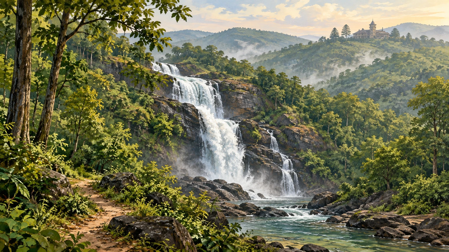
Pradhanpat Waterfall is Deogarh’s essential landscape experience and a rare case where the district’s main attraction is genuinely close to its administrative town. The official tourism page places it about one kilometre from Deogarh town and identifies the nearby shrines of Maa Pradhani or Pradhan Pateswari and Champakaswar as part of the site’s religious meaning. Pradhanpat Arrive with enough time to observe the waterfall from safe public vantage points rather than rushing down wet rocks for a dramatic photograph.
The attraction is not merely the drop of water. It is the compact meeting of rock, forest cover, religious observance and former royal patronage. The district page links Basant Nivas and Lalit Basant, nearby historic retreats, to Raja Satchidananda Tribhuban Deb. Their presence gives the vicinity a Bamanda-era layer: natural scenery was not outside courtly culture but part of how it was inhabited and represented. Current access to any heritage building should never be assumed. View from lawful public areas and seek permission from the relevant authority or custodian before entering premises.
Pradhanpat also hosts the cultural memory of Utsav Pradhanpat. The district tourism account says the gathering has been held since 1996 and associates it with cultural programmes, poetry and a Pallishree Mela. That background explains why the falls are more than a picnic location. Yet a festival history is not a promise of an event on a traveller’s chosen dates. Confirm whether there is an official programme, traffic arrangement or site restriction before making plans.
Koradkot, also rendered Kurudkot in historical accounts, offers a different kind of waterfall visit: one where industrial heritage is as interesting as the watercourse. The district tourism page says that a hydroelectric project was initiated in 1915 and commissioned in January 1916, supplying power to Deogarh before it ceased operations in 1971. It attributes a “second in Asia” distinction to the project; that particular ranking should be treated as an official local claim, not as independently verified fact. Koradkot Fall The surviving setting invites reflection on an early experiment in local electrification, not unsafe exploration of old machinery, channels or ruins.
Deojharan Fall in Reamal block is quieter in reputation and should be approached with particular care. The district describes it as a forest spring and records a tale connected with a Bamanda–Rairakhol camp, explicitly presenting that episode as local lore. Deojharan Fall This is precisely the kind of place where responsible travel matters most. Verify the route on the day, do not follow unmarked side tracks, avoid isolated travel, and turn back if weather or local advice makes access unsuitable. A photograph is not a reason to cross a swollen stream or enter a forested area after dusk.
Gohira Dam is a water landscape rather than a guaranteed recreation facility. According to the district tourism page, the dam dates from 1981, supports irrigation and has a Shiva shrine in a nearby village. Gohira Dam The reservoir can be appreciated from approved banks and roads, but visitors should not infer that boating, swimming, fishing or lakeside entry is permitted. Water levels, shoreline stability and operational rules can change. Keep a distance from infrastructure, respect warning signs and never enter water without explicit local authorization and safety arrangements. Kailash Palace speaks to the former estate’s built heritage. The district tourist directory states that Raja Dibya Shankar Deb built it between 1916 and 1919. Tourist places directory This is a valuable date range for understanding the town’s twentieth-century royal landscape, but it does not confirm public visiting hours or interior access today. Regard the palace as a heritage landmark, not as a museum with assumed entry. Architecture seen from lawful public space can still reveal scale, symmetry and the way a princely residence sat within the town.
Deogarh town itself is often the overlooked destination. A thoughtful day can connect the Jagannath and Jhadeswar temples, the town’s Bamanda associations, a local market stop and Pradhanpat. This is more rewarding than treating the town simply as an overnight halt. Markets are useful places to notice seasonal produce, Odia spoken in everyday exchange and the practical rhythms of an upland district. Ask before photographing vendors or religious objects, buy small local products where appropriate, and avoid bargaining in a way that turns routine transactions into a spectacle.
The official district list also includes Katasar Ghat, Daragadi, Olata Bata and other local points of interest. Tourist places directory They are worth noting, but a responsible writer should not turn every named spot into a promise of visitor facilities. Some may be meaningful chiefly to nearby communities, may require local knowledge, or may be affected by seasonal conditions. Treat these as leads for a conversation with the district tourism office, residents or authorised local guides, not as “hidden gems” to be discovered by ignoring boundaries.
Across all waterfall sites, keep safety ahead of spectacle. Rocks are often slick even when rain has stopped; plunge pools can have hidden depth, current and uneven footing. Do not swim or wade unless an authority has expressly designated the activity as safe. Keep children close, avoid alcohol near water, carry back all waste and do not use soap, detergent or food waste in streams. The least intrusive visitor is the one most likely to leave Deogarh’s water landscapes intact for worshippers, residents and future travellers.
Recent News & Tourism Developments
As checked on 24 October 2026, the clearest recent district-specific tourism-related item located on the official Deogarh website is an Expression of Interest for event management of Utsav Pradhanpat-2026, listed on the district’s “What’s New” page. The same page also lists tender material relating to Pallishree Mela 2026. Deogarh What’s New, page 4
These notices are evidence of procurement and planning. They do not, on their own, confirm final festival dates, a completed event, public programming, entry arrangements or a new tourism facility. Visitors considering Deogarh around a proposed festival should therefore consult the district administration’s latest notices and local announcements nearer the journey. Do not book an itinerary around an assumed programme merely because an event-management tender exists.
No separately verified recent completion of a major tourism project in Deogarh was identified in the official material reviewed for this edition. That absence matters. It is better to say plainly that a completion has not been verified than to repeat promotional claims about upgraded amenities, new access roads, accommodation or water activities. The district’s attractions remain compelling without inflated development narratives: Pradhanpat’s landscape, Bamanda’s historical record, sacred sites and the reservoir-and-forest setting are sufficient reasons to visit thoughtfully. Dated background helps put current planning in context. The official Pradhanpat page says Utsav Pradhanpat has been organised since 1996, while the district culture page describes a three-evening cultural format. Pradhanpat Culture Neither statement is proof of the 2026 programme. The distinction is not bureaucratic nit-picking; it protects travellers from confusing a long-standing tradition with a confirmed contemporary schedule.
At state level, the Department of Tourism’s published list of identified tourist centres, dated February 2025, includes Pradhanpat Waterfall and Kailash under Deogarh. Identified tourist centres in Odisha_0.pdf) Inclusion in such a list recognizes tourism relevance, but it should not be read as a guarantee of transport, staffing, accessibility or unrestricted entry. Planning still begins with direct local confirmation.
Traveler Essentials
Deogarh is best approached as a road-based destination. The district’s Pradhanpat page gives Bhubaneswar aerodrome and Rairakhol railway station as broad orientation points, with older approximate distances of about 270 kilometres and 90 kilometres respectively. Pradhanpat travel notes These figures are not live journey advice. Railway connections, roadworks, diversions and local transport availability can change, so verify routes and timetables through current official transport channels before departure.
For most visitors, the practical sequence is to reach a major railhead or airport, continue by road to Deogarh town, and use the town as the base for short excursions.
A gentle first day can stay within the town’s orbit: settle in, visit Pradhanpat in daylight, and leave time for the nearby shrines and a meal rather than trying to combine every local landmark. On a second day, choose one direction and confirm the road conditions with a local host or driver: Gohira for a reservoir landscape, Deojharan for a forest spring, or Koradkot for the waterfall and its hydroelectric history. These are alternatives, not three stops that should automatically be squeezed into one itinerary. Their apparent proximity on a district map does not tell you how long the final approach will take, whether a route is suitable after rain or whether access is currently open. If a current Utsav Pradhanpat programme is later announced, check the event location and traffic arrangements before shifting the plan; the tender notices alone do not set a visitor schedule. Keep a return plan, leave remote sites in daylight and make space for a pause when local conditions ask for it. A private vehicle or hired local transport can be more flexible than relying on an assumed service frequency, especially for dispersed sites in Reamal, Barkote or Tileibani areas. Do not drive unfamiliar forest roads after dark. Fuel up in larger towns, keep offline maps, and ask locally about road condition after heavy rain.
Winter and the post-monsoon months are generally comfortable for a broad itinerary, with the caveat that conditions vary. Monsoon is compelling for green scenery and active falls but demands conservative judgement. Summer travel requires early starts, hydration, sun protection and realistic expectations about heat. During thunderstorms or heavy rain, leave exposed viewpoints, avoid ravines and never shelter beneath isolated trees.
Pack light but deliberately: shoes with grip, a rain layer in wet months, drinking water, a reusable bottle, basic first aid, power backup and modest clothing for shrine visits. Mobile coverage can be variable outside town; tell someone your route when heading to a remote site. Carry cash as well as digital payment options, but do not display valuables in crowded areas. Keep identity documents and emergency contacts accessible.
Respect is the most useful travel skill in Deogarh. At temples, follow the custodian’s directions. At waterfalls and dams, obey barriers and do not treat public photographs as evidence that an activity is permitted. In villages, ask before entering courtyards or photographing people. Do not purchase wildlife products, collect forest material or leave plastic behind. Choose licensed or clearly authorised guides where guides are offered, and accept that some places are best seen from a public road or not at all.
A meaningful Deogarh itinerary is not a race between cascades. Give one day to town, Pradhanpat and the Bamanda-era story; reserve another for a carefully confirmed excursion such as Gohira, Deojharan or Koradkot. Leave space for weather, temple observance and conversation. This district rewards attention: to water moving over dark rock, to a former princely state’s experiments with print and power, and to the ordinary, living culture that makes heritage more than a list of sites.
Featured illustration: Original AI-generated, text-free editorial artwork created for this article; it evokes Deogarh’s waterfall-and-forest setting and is not a documentary photograph. Alt text: “A forested hillside waterfall descends toward a clear stream beneath rocky cliffs, with a small heritage retreat in the distance.”
Publishing Metadata & Tagging
- Group: Odisha Tourism
- Section/Category: Society And Culture
- Destination: https://pcachary.in
- District: Deogarh
- Edition: 2026-10-25
- Cycle: 1
- Tags: Odisha Tourism; Deogarh; Society And Culture
Disclaimer
This content is a collection of ancient history,books and various articles and collection of library and news and other post ; all details may not be the same. Readers are requested to verify the information themselves. Readers are not allowed to take any disciplinary action; content is only for educational purposes. If readers do not agree about the contents, they may send a personal comment to my personal email ID: achary.purna@gmail.com
