
District Overview & Geography
Gajapati is Odisha’s south-eastern mountain district: a place where the great green folds of the Eastern Ghats meet older routes between the Odia-speaking plateau and the northern Andhra country. Its character is markedly different from the deltaic Odisha often imagined by first-time visitors. Here, roads climb and turn through cultivated valleys, forested slopes and small settlements before reaching Paralakhemundi, the district headquarters and historic centre of the former estate.
The district was created on 2 October 1992 after being separated from Ganjam. It was named for Maharaja Sri Krushna Chandra Gajapati Narayan Deo of Paralakhemundi, remembered in Odisha’s public history for his role in the movement for a separate Odisha province. The official district profile records an area of 3,850 square kilometres, with more than 60 per cent described as hilly or highland. It borders Andhra Pradesh to the south, Ganjam to the east, Rayagada to the west and Kandhamal to the north. That borderland geography is not a footnote: it shapes the languages heard in markets, the terrain of journeys and the cultural links that reach beyond a single district. The district profile records one subdivision, seven tahasils and seven blocks, along with a population of 577,817 in the 2011 Census. Those are administrative and census snapshots, not current totals; population change since that enumeration should not be inferred from them. The profile’s description of a highland-majority landscape helps explain why agricultural activity, horticulture and forest stewardship are recurring themes in accounts of local life. It also explains why the district’s settlements cannot be reduced to one easy town-to-town itinerary: the conditions and services that matter to a traveller vary across the plains, road corridors and upland villages.
Gajapati’s relief is part of the Eastern Ghats, an old and broken mountain system rather than one continuous wall. Low valleys, ridges, isolated summits and deeply weathered slopes create sharp local differences in temperature, rainfall and vegetation. Mahendragiri, in Rayagada block within Gajapati district, rises to about 1,501 metres according to the district tourism page. It is the district’s defining highland landmark, but it should not eclipse the smaller hills and basin settlements that make the approach to the peak so distinctive.
The Mahendratanaya is an important river in the district’s cultural landscape, passing by Paralakhemundi and associated with the setting of B.N. Palace. Elsewhere, seasonal streams descend through wooded terrain, feeding cascades and agricultural valleys. Their appearance changes radically through the year. Monsoon water makes the hills lush and animated but can also make roads, falls and paths slippery or disrupted; dry months bring clearer views but reduced water in smaller streams. A waterfall photograph or a monsoon travel anecdote should never be read as a guarantee of present conditions.
Climate is broadly tropical, modified by elevation. The lower tracts can be hot before the monsoon; the uplands offer a perceptibly cooler atmosphere, especially in the early morning and evening. Rainfall supports paddy, horticulture and forest growth, but visitors should treat the rainy season as a time for caution rather than a promise of easy sightseeing. In hill country, a short distance on a map can take longer than expected, while cloud, rain and low light can transform a familiar road into a demanding one.
Forest is central to Gajapati’s visual identity and ecological value. The National Biodiversity Authority’s profile identifies Mahendragiri Hill as a Biodiversity Heritage Site covering 4,250 hectares. It describes elevations from roughly 700 to 1,501 metres and a sequence of tropical shola, semi-evergreen, moist-deciduous and dry-deciduous vegetation. The profile records 1,358 plant species, including 1,042 angiosperms, 60 pteridophytes, 104 bryophytes, 53 lichens, 72 macro-fungi and two gymnosperms. These are the authority’s published inventory figures, not a live field checklist or a guarantee that a visitor will encounter any particular species. Elevation and microclimate help explain why a short drive can pass through changing vegetation and weather. They also make careless disturbance more consequential: a footpath, stream edge or forest margin is habitat, not spare space for a picnic or an improvised vehicle turn. Travellers can contribute by staying on authorised routes, leaving plants, stones and wildlife undisturbed, carrying out all waste, and following local conservation or site-management instructions. The hill’s protected character is therefore not a label to add to a sightseeing list; it is a reason to behave with restraint.
Gajapati’s people and livelihoods are equally varied. Agriculture and horticulture remain important, while the district profile lists crafts including cane and bamboo work, horn work, Jaikhadi bags, Ganjappa cards, Pattachitra mukha, Siali-leaf plates and Tibetan wool carpets. The list is useful as a record of local practices, not an assurance that every item is readily available in every town or village. Buying directly from recognised local makers, cooperatives or established outlets is more meaningful than treating craft as a souvenir checklist. Each craft also asks for a little context. A woven or leaf-made object carries knowledge of materials, time and the hands that shaped it; an item bought with permission and a fair price can support a local maker more directly than a mass-produced token. But visitors should not assume that every craft is made by one community, that a particular object is always for sale, or that a roadside seller represents all local practice. Ask respectfully, listen to the answer and accept that some objects or stories are not intended for tourists. The official district culture and heritage page also describes the Saora community and its cultural presence. Its historical narrative contains dated terminology and broad generalisations, so this article avoids repeating those characterisations; contemporary communities are not museum exhibits, and visitors should seek current, community-led information rather than assume an outsider’s description is complete.
Mythological & Historical Significance
Gajapati asks the visitor to hold several kinds of history together without confusing them. There is documented political history: the former Paralakhemundi estate, its rulers and the making of modern Odisha. There are also powerful sacred narratives, especially around Mahendragiri, where epic associations are sustained through worship, pilgrimage and local memory. Neither needs to diminish the other, but they should not be presented as the same kind of evidence.
The district’s name honours Krushna Chandra Gajapati Narayan Deo, the former ruler of Paralakhemundi. The official district history links the estate and its royal lineage to the wider political story of Odisha’s formation, and records the district’s establishment in 1992. Paralakhemundi’s historical importance therefore lies not only in palace architecture or aristocratic memory, but also in its connection to twentieth-century Odia political aspirations.
The official narrative includes dynastic accounts and older references to the Gajapati tradition. Such accounts are valuable as the region’s own historical record, though specific early chronologies and lineage claims should be read as attributed courtly and local history unless independently corroborated by archival or archaeological research. For the traveller, this distinction makes the town more interesting: it is a place where public memory, royal patronage and modern district administration overlap. The district’s official account connects Krushna Chandra Gajapati Narayan Deo with the movement for a separate Odisha province and the later incorporation of Paralakhemundi into Odisha. That broad contribution is a key part of the town’s civic memory, while the page does not supply a complete archival chronology of each stage. A careful account can recognise the Maharaja’s political significance without turning a short tourism profile into proof of every dynastic claim. The same care applies to monuments: a palace may evoke a ruling era, but its visible fabric, ownership, conservation history and present access are separate questions. Visitors who want to understand the town more deeply can look for current local museum, archival or heritage interpretation rather than infer dates from architectural appearance alone.
B.N. Palace, formerly Brundaban Palace, stands beside the Mahendratanaya. The district tourism page describes it as a royal summer retreat and a reminder of the artistic inheritance of the Paralakhemundi estate. Its exterior and riverine setting are evocative, but the available official listing does not establish current public opening hours, ticketing or interior access. It is best approached respectfully as a heritage landmark: ask locally before planning a detailed visit, do not assume unrestricted entry, and avoid treating a private or protected building as a backdrop for intrusive photography.
Mahendragiri is Gajapati’s most resonant sacred landscape. It is counted in religious tradition among the seven Kula Parvata, and the hill’s shrines are associated in popular belief with figures from the Mahabharata. The National Biodiversity Authority notes temples of Kunti, Shima, Arjuna and Yudhisthir and states that they have been declared protected monuments by the Odisha government under the Ancient Monuments and Archaeological Sites and Remains Act. Their presence gives the peak a layered meaning: ritual destination, archaeological inheritance and living mountain ecosystem.
The belief that the Pandavas lived or worshipped here belongs to epic tradition and pilgrimage, not to documentary proof of their historical presence. A respectful visitor can acknowledge the story as the reason the place is sacred to many devotees while avoiding the careless language of “proof” or “discovery.” At Mahendragiri, faith is not an attraction added to landscape; it is part of the way the landscape has been understood and cared for across generations.
Chandragiri, in Lobarsing gram panchayat of Mohana block, tells a different but equally important story of movement and refuge. The area is associated with Tibetan settlement and Buddhist practice, most visibly at Jirang’s Padmasambhava Mahavihara. The district page on Chandragiri says the Buddhist temple was inaugurated by the Dalai Lama in 2010; Odisha Tourism describes Jirang as a Tibetan settlement established in 1959 and identifies the monastery as a centre for Buddhist learning and practice. Its page is here. The district page also makes an unverified superlative claim about the site; there is no need to repeat it. What matters is the monastery’s contemporary religious and cultural presence in the southern Odisha hills.
Chandragiri rewards visitors who arrive with curiosity rather than spectacle in mind. Monastic spaces are places of worship and community life. Dress modestly, observe quiet, ask before photographing people or rituals, and do not enter restricted areas. The Tibetan presence has added a distinct thread to Gajapati’s plural cultural fabric, but it should not be reduced to colourful architecture or a quick stop between waterfalls.
The district’s calendar also contains Ratha Yatra, Dussehra, Kumar Purnima, Thakurani Yatra and Pongal, as listed by the district administration. Festival observance, dates and local practices can vary by place and year. Rather than publish a fixed festival itinerary without confirmation, travellers should consult local authorities, temple committees or hosts shortly before departure. Festivals are best experienced as community occasions, with attention to local protocols rather than as guaranteed entertainment programmes.
Tourist Destinations & Hidden Gems
Mahendragiri is the essential Gajapati destination, though it deserves more than a hurried ascent. The mountain sits in the Eastern Ghats of Rayagada block, not in neighbouring Rayagada district. The distinction matters, particularly when planning transport, local permissions or emergency assistance. Odisha Tourism presents the hill as a place of biodiversity, heritage and responsible outdoor activity; the district administration identifies it as a principal attraction. The most rewarding visit holds all three dimensions together.
At 1,501 metres, Mahendragiri’s elevation creates a different sensory world from the plains: slopes of changing green, exposed rock, shrine clusters, mist in wet weather and long views when skies clear. Yet mountain travel should never be treated casually. Conditions depend on rain, cloud cover, road status and local guidance. Go in daylight, wear shoes suited to uneven ground, carry drinking water and take back all waste. Avoid loud music, drones or off-route scrambling. Do not collect plants, stones or religious objects, and never presume that a track is open simply because it appears online.
The site’s ecological stature is specific. The National Biodiversity Authority profile identifies 1,358 plant species in the hill ecosystem and describes several forest types shaped by altitude and microclimate. Its list includes 1,042 angiosperms, 60 pteridophytes, 104 bryophytes, 53 lichens, 72 macro-fungi and two gymnosperms. Those figures are from the authority’s published profile, not a field checklist for casual visitors. The appropriate response is not to seek rare species, but to stay on permitted routes, keep group sizes modest and allow the forest to remain more than a viewing platform.
Gandahati Waterfalls near Paralakhemundi offers a contrasting landscape of falling water and forested rock. The official page places it in Rayagada block, about 27 kilometres from district headquarters, and describes a waterfall around 20 metres high. It also recounts a local explanation that the name reflects a former association with elephants. That is a local tradition, not a verified account of present wildlife conditions. The page’s older claim of perennial water and year-round visitation should likewise not be taken as a current hydrological or access update.
Gandahati is best visited with the ordinary caution appropriate to any waterfall. Water volume, path safety and crowding are seasonal; wet rock is hazardous even when a pool looks calm. Do not swim or climb beyond marked safe areas, do not take children close to the edge, and never enter water during heavy rain, thunder or a sudden rise in flow. Carry food waste out, use established facilities where available and respect instructions from local staff or residents. A waterfall remains beautiful when observed from a safe distance.
Khasada Waterfall, listed by the district administration near Chandragiri, is a quieter name in the district’s tourism directory. That label should not be mistaken for a guarantee of developed facilities or always-safe access. It is best considered an optional stop only after confirming the current route and conditions locally. In a hill district, the responsible traveller values a site enough to turn back if weather, road quality or local advice says it is unsuitable.
Paralakhemundi itself deserves unhurried time. Many visitors use it as a logistical base for Mahendragiri and Gandahati, but its older streets and royal associations reveal a different Gajapati: a town shaped by the estate, river and administrative life. B.N. Palace is its best-known landmark, but the town’s value is also in the rhythm of ordinary commerce, local conversation and the gradual recognition that this is not a generic gateway settlement. Use the town to arrange verified local transport, purchase supplies and ask for current information rather than relying solely on static travel pages.
Chandragiri and Jirang are Gajapati’s cultural counterpoint to the royal town and the sacred hill. The journey through Mohana block leads toward a Tibetan Buddhist landscape that feels both deeply rooted and historically recent in comparison with Mahendragiri’s epic associations. Odisha Tourism describes the settlement as established in 1959 and Padmasambhava Mahavihara as a centre of learning, meditation and cultural exchange. These descriptions speak to a living community, not a staged display. The monastery’s official travel page gives general visiting information, but conditions and visitor arrangements may change; check directly before travelling. Padmasambhava Mahavihara should be approached as a living monastery rather than an attraction to be consumed quickly. Pause to understand why the site matters, follow posted etiquette and support local businesses without intruding into community spaces. A visit can be meaningful without entering every hall or photographing every detail. Keep a low voice, avoid interrupting prayer or study, and ask staff before taking photographs inside. A respectful itinerary allows time for the surrounding settlement and its everyday life, while remembering that residents are not obliged to explain or perform their culture for visitors.
The real hidden gems of Gajapati are often not pin-dropped “secret spots.” They are the small experiences that reward patient travel: early light over a cultivated valley, a village market where one asks before photographing, a handwoven or bamboo object bought from its maker, or the changing scent of damp forest after rain. Calling inhabited places secret can erase the people who live there. Better to travel with humility, spend locally and leave no trace.
Recent News & Tourism Developments Gajapati’s most visible tourism-related developments in 2026 have centred on Mahendragiri, but the dates matter. Odisha Tourism promoted the Mahendragiri Eco-Adventure Fest for 25 and 26 April 2026. Its stated purpose was to combine adventure activities with ecological awareness and community engagement. By this edition date, that event is already past; its accommodation, activity and registration information should not be treated as a current offer or a standing permission to undertake independent adventure activity.
A second completed event followed in early October. A Times of India report dated 2 October 2026 said that the four-day National Mountain Terrain Bike Cycling Championship began at Mahendragiri with around 800 riders, according to organisers and the Cycling Federation of India. The report referred to a four-kilometre competition track and support from the Odisha Cycling Association and district administration. This was a time-bound sporting event, not evidence that the course is an open public cycling trail now. Visitors should not ride, walk or drive on any route without present local authorisation.
No separately verified completed new tourism infrastructure project in Gajapati has been identified for this edition. That absence matters: proposals, festival publicity and temporary event arrangements should not be described as permanent improvements. The more durable development is the public recognition of Mahendragiri’s ecological and cultural importance, including its Biodiversity Heritage Site status, but recognition does not remove the need for sensitive management.
The India Meteorological Department’s district-level Odisha forecast issued on 24 October 2026 shows dry weather through 08:30 IST on 26 October, then isolated light-to-moderate rain with thunderstorm through 08:30 IST on 27 October. It forecasts frequent-to-widespread light-to-moderate rain from 27 to 29 October, widespread rain from 28 to 30 October, and frequent-to-widespread rain from 30 to 31 October. This is a dated forecast, not observed weather or a guarantee for a particular route. Before travel, check the latest district forecast, warnings and local-authority updates; defer hill, waterfall or road journeys if conditions or official advice make them unsafe.
Traveler Essentials
Gajapati rewards flexible planning. The official how-to-reach page gives useful broad reference points: Bhubaneswar is listed at about 300 kilometres and Palasa railway station at about 40 kilometres. These are published guide figures, not current journey-time estimates or transport schedules. Railway connections, road conditions and onward vehicles must be checked close to travel. Paralakhemundi is the natural administrative base; Berhampur, Palasa, Visakhapatnam and Bhubaneswar may each suit different starting points, depending on current services and the visitor’s itinerary.
By air, Bhubaneswar is the airport named on the district’s static access page; Visakhapatnam may also be a regional option, but confirm current routes and onward connections before building an itinerary around it. By rail, Palasa is the station specifically listed by the district, around 40 kilometres away in Andhra Pradesh. Berhampur and Paralakhemundi are mentioned in other destination guidance, but the actual train service, frequency and connections must be checked directly with Indian Railways. By road, use established highways and current navigation to major towns rather than relying on unverified map shortcuts through hills. Daylight travel is preferable, particularly during monsoon or when advisories are in force. The district page’s distance figures are broad reference points; they are not door-to-door journey estimates, live schedules or guarantees that a local vehicle will be waiting. Plan time for weather, roadworks, stops and changing terrain, and reconfirm onward transport with a local operator before leaving a larger town.
October to February is often more comfortable for general exploration, with cooler mornings at higher elevation. The monsoon makes forests, falls and slopes vivid, but it also increases risks from rain, lightning, fallen debris, slippery trails and altered road conditions. Summer can be demanding in lower terrain. The right season depends on the kind of visit planned; pilgrimage, landscape observation, cultural travel and mountain walking have different needs.
Accommodation and food options are concentrated in towns and larger settlements. Confirm lodging directly before arrival, especially around holidays or events. Carry essential medicines, cash where appropriate and a charged phone with offline maps, while remembering that connectivity can vary. Do not treat remote villages as places where supplies, fuel, ATMs or medical services can be assumed.
Local eating should be approached with the same curiosity and restraint as local culture. Rice-based meals, seasonal vegetables, lentils, greens and chutneys are common elements of Odia food, while borderland exchanges add regional variety. Ask a trusted local eatery what is fresh and appropriate rather than demanding a catalogue of “must-try” dishes. The district’s official profile lists Siali-leaf plates among local crafts; choosing reusable containers where possible and refusing disposable plastic remains the better environmental choice.
Respect for local communities is practical, not ornamental. Seek consent before photographing people, homes, worship or craft work. Dress conservatively at temples and monasteries. Avoid alcohol, litter, amplified music and disruptive behaviour near sacred sites and forests. Buy craft directly from known makers where possible, but do not bargain in ways that demean skilled labour. If visiting tribal-majority or remote areas, do not arrive expecting a staged cultural performance.
Finally, let current advice override a fixed itinerary. Gajapati is at its finest when approached as a living highland district, not as a list of viewpoints to be conquered. Mahendragiri’s forests, Paralakhemundi’s historical memory, Chandragiri’s Buddhist community and Gandahati’s seasonal drama all ask for the same qualities: patience, attention and care.
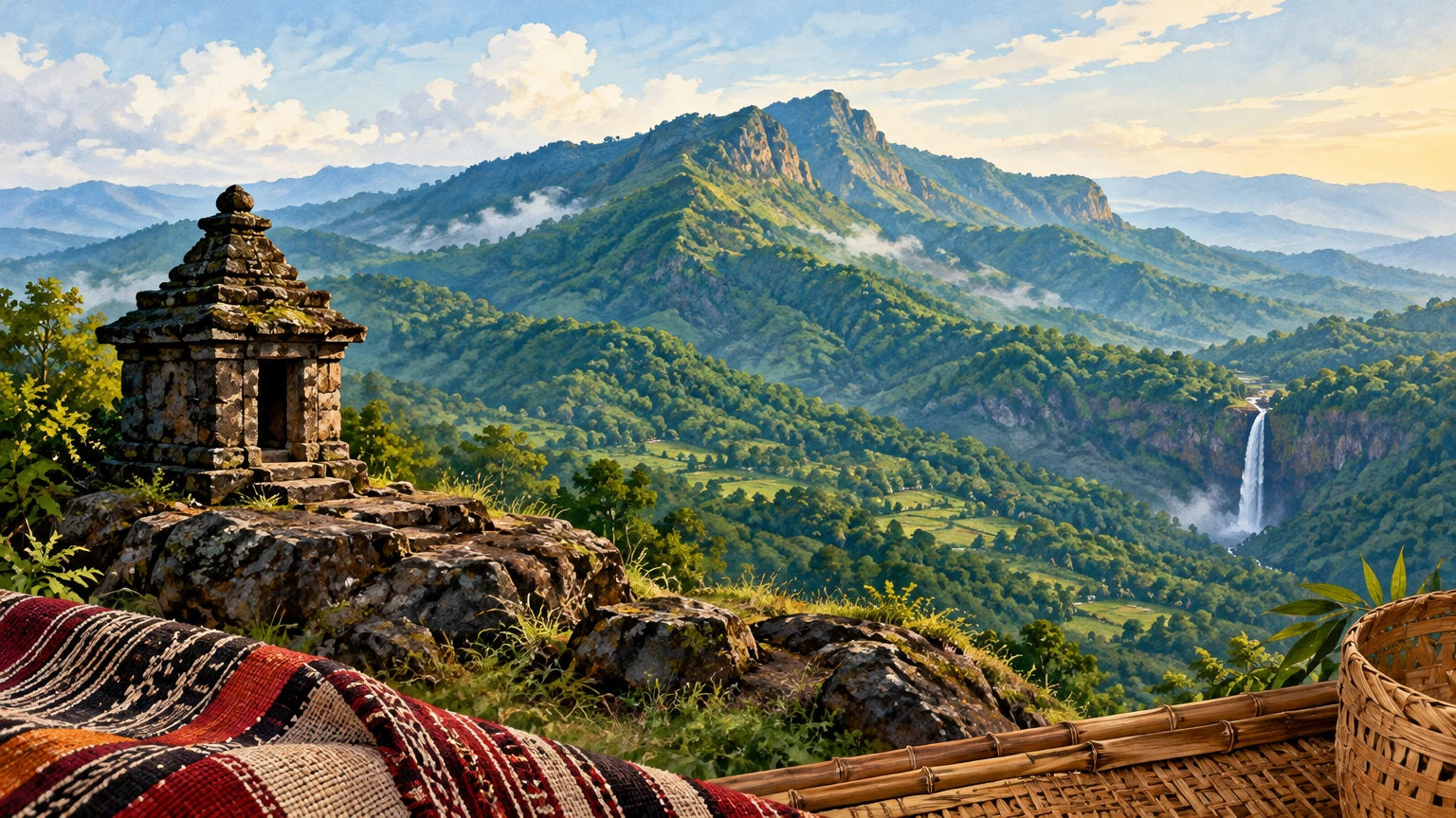
Featured illustration: Original AI-generated, text-free editorial artwork made for this article. It evokes a Gajapati highland landscape and is not a documentary photograph. Alt text: “Forested Eastern Ghats ridge, a small hill-shrine silhouette and a distant waterfall in Gajapati.”
Publishing Metadata & Tagging
- Group: Odisha Tourism
- Section/Category: Society And Culture
- Destination: https://pcachary.in
- District: Gajapati
- Edition: 2026-10-27
- Cycle: 1
- Tags: Odisha Tourism; Gajapati; Society And Culture
Disclaimer
This content is a collection of ancient history,books and various articles and collection of library and news and other post ; all details may not be the same. Readers are requested to verify the information themselves. Readers are not allowed to take any disciplinary action; content is only for educational purposes. If readers do not agree about the contents, they may send a personal comment to my personal email ID: achary.purna@gmail.com
