
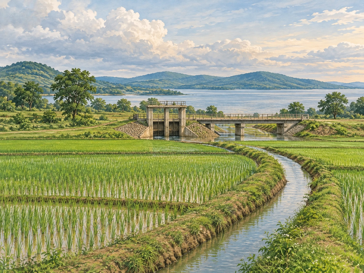
The water that shapes Bargarh is not always in sight. It may be held behind a great dam near Sambalpur, moving through a regulated canal, standing in a village tank or sinking into a field after rain. Follow these connections and the district becomes more than the familiar image of a rice-growing plain: it is a landscape made by rivers, engineering, cultivation and difficult choices.
A journey here is best approached with curiosity rather than a checklist. Canals are working infrastructure, not promenades; reservoir margins are homes and habitats as well as views. The reward is an understanding of how water travels, who depends on it and why its history is not the same for everyone.
## District Overview & Geography
Bargarh lies in western Odisha, toward the Chhattisgarh border. Its inhabited plains and agricultural settlements give way to wooded hills and the broad, changeable edge of the Hirakud reservoir. Bargarh town is a useful base for exploring this region; the reservoir and its wider catchment extend across district boundaries rather than belonging to Bargarh alone.
The Mahanadi is the principal river in this story. Hirakud impounds its waters near Sambalpur, while the Ib joins the reservoir from the north. On the Bargarh side, the Barapahar hills press toward the water, and the landscape shifts from riverine reaches to the more open expanse of the reservoir. A [Hirakud wetland management document](https://rsis.ramsar.org/RISapp/files/31485724/documents/IN2494_mgt210916.pdf?language=en) describes both this changing character and the effects of seasonal inundation.
The Bargarh Main Canal carries part of the reservoir’s water away from the right dyke toward agricultural command areas. According to the [Bargarh Irrigation Division’s official manual](https://rtiodisha.gov.in/Pages/printAllManual/office_id:798/lang/), the main channel is 84.28 km long. It is the beginning of a distribution system, not a single channel feeding every field directly.
**A command area is not the same thing as an area irrigated in a particular season.** The division’s manual lists the administrative command areas of Bargarh and Barpali divisions separately; those figures describe responsibilities across a wider system, including land beyond today’s Bargarh district. They do not establish how much water reached farms in 2026.
Monsoon rain remains central to the district’s farming calendar. The wet months generally bring greener fields and swollen drainage channels; after the rains, clearer weather makes the landscape easier to read. Winter is usually the more comfortable period for travel. Summer can be very hot, and reservoir levels and exposed margins change with both inflows and dam operations. Odisha Tourism suggests [October to March](https://odishatourism.gov.in/en/destinations/baragada) as a broad visiting season, though conditions in any particular year will differ.
Not every part of Bargarh has the same access to canal water. A historical [district census handbook](https://censusindia.gov.in/nada/index.php/catalog/44121/download/47777/DH_21_2001_BAR.pdf) records tanks, wells and diverted streams as irrigation sources before Hirakud. Those older forms help explain why a journey through the district encounters many kinds of waterbody, not simply one continuous canal landscape.
The handbook also describes sal and mixed deciduous forest, including kendu, mahua and simul. The Hirakud wetland study lists trees such as mahua and kusum in the wider catchment. These are historical or regional ecological records, not a promise that a visitor will find any particular tree at a chosen stop.
## Mythological & Historical Significance
In western Odisha, a harvest is not merely the result of a successful channel or a good monsoon. Odisha Tourism describes **Nuakhai** as a regional celebration of the new crop and agrarian life. The observance gives cultural expression to gratitude for food and farming, but its rituals and timing should not be confused with evidence for the age of a particular canal or tank. Check local announcements if attending; no festival date is assumed here. [Odisha Tourism](https://odishatourism.gov.in/en/destinations/baragada)
Water also belongs to living sacred landscapes. At Sorna, the district tourism department’s searchable description identifies the Shiva shrine of Swapneswar and a large pond in front of it. It attributes construction to the reign of Sambalpur’s Ajit Singh, under the supervision of Dewan Dakshinray. The attribution places the site in the region’s Chauhan-era history; it should not be turned into a more precise construction date without further evidence. The [district page](https://bargarh.odisha.gov.in/en/tourism/tourist-places/six-astasambhus) was not readable in full during this check, so its search extract is the limit of this account.
The pond matters to the travel writer because it keeps a religious setting and a water landscape in the same frame. It does not follow that the pond was an irrigation work, that a particular legend explains its construction, or that visitors may enter the water. Ask locally about respectful access to the shrine and its surroundings rather than treating it as a waterside recreation site.
Much of the visible canal system is considerably younger. Hirakud was conceived as a multipurpose project: storing Mahanadi water for irrigation and power while helping moderate flooding downstream. The reservoir was formed in the 1950s; the irrigation division records the Bargarh Canal Division’s establishment in 1960. The dam itself is near Sambalpur, outside Bargarh district, even though its waters and consequences reach deeply into Bargarh. [Irrigation division](https://rtiodisha.gov.in/Pages/printAllManual/office_id:798/lang/); [Hirakud wetland document](https://rsis.ramsar.org/RISapp/files/31485724/documents/IN2494_mgt210916.pdf?language=en)
Its benefits have never been the whole story. The reservoir submerged settlements and required families to leave land and homes. Numbers differ among published accounts, so a single unqualified total would give a false impression of certainty. [Land Conflict Watch](https://www.landconflictwatch.org/conflicts/hirakud-dam) documents continuing demands concerning compensation and rehabilitation across the affected region.
A report in *The New Indian Express* on **1 October 2015** described Kurumkel in Ambabhona, on the Bargarh side of the reservoir, and the difficulties its residents then faced with roads, land records and livelihoods. Those observations are important historical evidence, not a verified description of services there in 2026. Kurumkel should not be treated as an excursion destination merely because its residents’ experience illuminates the dam’s history. [Read the 2015 report](https://www.newindianexpress.com/states/odisha/2015/Oct/01/hirakud-oustees-struggle-for-basic-amenities-823048.html).
Looking across Hirakud, therefore, calls for two simultaneous readings: water stored for farms and towns, and a landscape in which people remember what storage displaced. Neither cancels the other.
## Tourist Destinations & Hidden Gems
### Bargarh town and the canal country
Begin in Bargarh town, then use the surrounding roads to understand the agricultural plain. This is not a prescribed canal-bank trail: stop only where parking and public access are safe and permitted. A road crossing can offer a clear view of the contrast between a large engineered channel and the smaller watercourses that serve cultivated land.
The irrigation division describes regulators and other structures as part of its maintenance responsibility. A regulator helps control water moving through the system; smaller channels distribute it farther into the command. Together they show why a canal is more than an attractive strip of water. Its usefulness depends on management, maintenance and decisions made beyond the point visible from a bridge. [Bargarh Irrigation Division](https://rtiodisha.gov.in/Pages/printAllManual/office_id:798/lang/)
The same official manual identifies **Pani Panchayats**, organised farmer bodies, as part of the effort to involve cultivators in water management. Their presence is a reminder that irrigation is social infrastructure as well as masonry and earth. Water allocation, upkeep and communication matter to the people working downstream.
Do not infer that every farmer receives a steady supply simply because a canal appears on a map. The division itself notes maintenance and staffing challenges. A field close to a watercourse, a field farther along a distribution branch and a rain-dependent field elsewhere in the district may face very different conditions.
For a sensitive visit, keep vehicles off field edges and never operate gates, walk on a regulator or enter a fenced installation. If someone is working nearby, a polite conversation can be more informative than a photograph—but farmers are not obliged to explain their work to visitors. Ask before photographing people or entering cultivated land.
### Attabira, Barpali and Bheden: Reading a farming landscape
The plains around Attabira, Barpali, Bargarh and Bheden are useful places to consider the district’s connection to irrigation. Rather than promising a fixed spectacle, plan a road journey through settlements and fields, pausing at ordinary public places. The appearance of the land will depend on rainfall, cropping decisions, harvest and water availability.
A more precise way to read the farming landscape is to keep seasonal crop area, irrigated crop area and procurement separate. The Directorate of Agriculture’s *Odisha Agriculture Statistics 2023–24* reports, in its crop-wise irrigation table, 172.09 thousand hectares of irrigated paddy in Bargarh during Kharif 2023, and 101.57 thousand hectares of irrigated rice in Rabi 2023–24. The corresponding total irrigated cereal areas are 175.96 thousand and 103.03 thousand hectares. These are seasonal entries, not a count of unique land: some land may be cropped in more than one season. Nor does the table say that all this water came through the Hirakud system; wells, lift irrigation and other sources also appear in the state statistics. The figures describe the reporting year, not a promise of water delivery in 2026. [Odisha Agriculture Statistics 2023–24](https://agri.odisha.gov.in/sites/default/files/2025-05/OAS%20A4.pdf)
A separate table in the same publication records 249.40 thousand hectares of Kharif paddy coverage for Bargarh, while its major-indicators table lists net irrigated area of 236.37 thousand hectares and gross irrigated area of 398.52 thousand hectares. Those are different measures: crop coverage is not identical to irrigation potential, and gross seasonal area can count land more than once. The volume also gives some crop-area totals that differ across tables, so it is wiser to cite the named indicator and table year than to collapse all figures into one supposedly exact acreage. None of these numbers identifies the fields a visitor sees from a particular road.
The same official volume’s procurement table records roughly 736,714 tonnes of Kharif paddy and 499,519 tonnes of Rabi paddy procured in Bargarh for KMS 2023–24. Procurement is the quantity recorded through the system, not the district’s total harvest, not proof that every grower sold there and not a current market-day forecast. Still, the paired seasons make the agricultural calendar visible in a different way: the region’s water story reaches from crop planning and field work into transport, storage and public procurement. [Odisha Agriculture Statistics 2023–24](https://agri.odisha.gov.in/sites/default/files/2025-05/OAS%20A4.pdf)
The [Hirakud wetland study](https://rsis.ramsar.org/RISapp/files/31485724/documents/IN2494_mgt210916.pdf?language=en) discusses paddy as well as vegetables, oilseeds and sugarcane in the wider command. That is a regional description, not a current crop inventory for every Bargarh village. For a visitor, the most honest reading is modest: seasonal green can reflect rain, irrigation, crop choice and timing together. A canal is one part of that picture, and a field’s appearance cannot tell you which source supplied it.
The distinction between a season and a year is especially important when reading agricultural figures. Even where the same land is cultivated in two seasons, seasonal crop areas cannot simply be added and described as separate farmland. Nor does a historical irrigation total tell a traveller whether a particular channel is flowing today.
Bheden offers another way to think about the landscape: settlements, cultivated ground and drainage are related, but none should be reduced to a postcard. In the rains, water can collect where the dry-season road appears straightforward. In the cooler months, field preparation or harvesting may make a roadside stop busy with people and machinery. Give both ample space.
Barpali is also the name of an irrigation division in the official canal account. That administrative fact is more useful here than an invented sightseeing claim: it shows that the main canal is managed in sections, each with a defined responsibility. The names on an irrigation map do not automatically mark visitor facilities.
### The Hirakud reservoir edge
The reservoir’s Bargarh-side landscape, particularly in the Ambabhona region, brings the farming story back to its source. Here the eye moves from cultivated and settled ground toward water and wooded hills. The exact shoreline is not fixed: as storage rises and falls, bays, exposed ground and the apparent distance to the opposite shore change.
Hirakud is a wetland of international importance. The management document records waterbirds including the **bar-headed goose** and describes winter gatherings of ducks, geese and waders. It also records aquatic plants including **Hydrilla** and **Vallisneria spiralis** in the wider river-reservoir system. These are recorded species, not guaranteed sightings at a Bargarh roadside viewpoint. [Hirakud wetland document](https://rsis.ramsar.org/RISapp/files/31485724/documents/IN2494_mgt210916.pdf?language=en)
Bring binoculars and watch from a permitted public location at a distance. Do not approach nesting or resting birds, play calls, fly drones over wildlife or walk out onto exposed mud. A dry-looking margin may be soft, privately used or newly exposed by falling water. The absence of a fence is not proof of public access.
The reservoir supports fishing as well as biodiversity. The wetland document describes fisheries as a livelihood across the wider waterbody, while the Kurumkel report shows how market access mattered to fishers on the Bargarh side in 2015. Nets, landing places and working boats should be left undisturbed. Ask before photographing people, catches or equipment.
The reservoir is not a single Bargarh attraction with interchangeable entry points. Hirakud dam viewpoints near Sambalpur, other shores in Jharsuguda and Bargarh-side settlements have different jurisdictions and access arrangements. Confirm the place and its district before setting out, and use only routes and facilities that local authorities say are open.
### Smaller waterbodies and the older landscape
Hirakud did not erase every older relationship with stored rainwater. The census handbook identifies **kata, munda and bandh** as kinds of tank used before the dam, alongside wells and diverted streams. These terms offer a useful starting point for asking how particular settlements obtained and shared water, although their precise local use and physical form should be checked place by place. [Census handbook](https://censusindia.gov.in/nada/index.php/catalog/44121/download/47777/DH_21_2001_BAR.pdf)
A village tank may serve several purposes over time: storage, domestic use, ritual or livelihood. Do not assume that any particular tank performs all of them, or that it is open for tourism. Seen responsibly from a public road, a tank can nevertheless make the scale of water management legible: local storage sits alongside the much larger reservoir-and-canal system.
Sorna’s temple pond offers a different perspective again. Its setting links water with worship rather than allowing the visitor to assume an agricultural function. A short, respectful stop at a shrine—if locally accessible—can complement the canal country without turning a working village or an entire religious circuit into a rushed itinerary.
Leave plants, stones and offerings where they are. Avoid washing, swimming or disposing of waste in tanks and channels. A visitor’s restraint protects the uses that brought these places into being.
## Recent News & Tourism Developments
As of this edition, the most consequential verified recent discussion is regional, with a specific possible effect on Bargarh. On **17 November 2026**, a state steering committee reviewed the Hirakud tourism master plan, work already under way in the region and remaining tender processes, according to [OMMCOM News](https://ommcomnews.com/odisha-news/hirakud-to-emerge-as-major-national-international-tourism-destination-steering-committee-reviews-master-plan/) and [Pragativadi](https://pragativadi.com/odisha-unveils-mega-master-plan-for-hirakud-tourism-development/).
Ideas discussed included waterfront facilities, a dam museum, accommodation, water sports, cruise facilities and ecotourism. These are not all Bargarh projects, and the meeting’s review of some ongoing work does not establish that every listed attraction has been built or opened. Readers should treat the master plan as a programme at mixed stages, not a catalogue of bookable experiences.
The reports identify a proposed cruise-terminal location in Bargarh, but the site was still to be selected. The reporting differs in how it describes the prospective locations across the reservoir. The reliable practical conclusion is narrower: **no specific Bargarh terminal is verified here as selected, completed or open**.
Earlier, on **26 October 2026**, [The Times of India](https://timesofindia.indiatimes.com/city/bhubaneswar/floating-jetties-plan-to-improve-rural-connectivity-around-hirakud/articleshow/135213012.cms) reported that the state had asked Bargarh, Sambalpur and Jharsuguda administrations to survey possible additional floating-jetty sites for rural connectivity. The article distinguished these from separately proposed terminal facilities and said the Bargarh terminal location would be finalised after a survey.
That report also said a detailed project report for extending the Mahanadi waterway toward Naya Raipur was expected by November and that an amended state support agreement awaited approval. An expectation is not a completed report or an approved agreement. No completed DPR or operational passenger route is verified in the evidence used for this edition.
For travellers, the distinction matters. Do not arrive expecting a new cruise terminal, jetty network or boat connection on the strength of a planning announcement. Ask the relevant authority about any service separately, and use a boat only where it is authorised and suitable safety arrangements are in place.
The proposals also raise questions worth carrying into future coverage: who will be consulted, how shoreline livelihoods and bird habitat will be protected, and how access will be managed as water levels change. Those are questions for project documents and affected communities, not evidence that a particular scheme has already produced either benefits or harm.
## Traveler Essentials
**Getting there.** Odisha Tourism identifies Veer Surendra Sai Airport at Jharsuguda as an air gateway for Bargarh; its page also mentions Bhubaneswar in a separate air section, so compare actual flight and onward-road options rather than relying on its inconsistent nearest-airport wording. Bargarh Road is the district’s practical rail gateway. Check current train stops and flight schedules with operators before booking. [Odisha Tourism](https://odishatourism.gov.in/en/destinations/baragada)
By road, Bargarh lies on the principal route between Sambalpur and the Chhattisgarh side; [Routeyst’s regional guide](https://routeyst.com/india/odisha/sambalpur) identifies it as NH 53. From Bargarh town, plan separate road outings toward the agricultural settlements or Ambabhona rather than assuming a continuous drive along the water. Confirm local road conditions and the precise destination before departure.
A sensible short visit uses Bargarh town as a base: spend part of a day observing the canal-and-field landscape from safe public roads, then make a separate trip toward an accessible reservoir-side area. A shrine or village-tank stop can add context if access is confirmed. Allow daylight and flexibility; this is a working landscape, not a signed water-heritage trail.
**When to go.** October to March is the broad, more comfortable window suggested by Odisha Tourism. Winter can also be rewarding for distant waterbird observation. The monsoon brings a different, greener landscape but may affect roads and make banks slippery; summer requires particular care with heat. Never assume that a quiet-looking canal or reservoir margin is safe to enter.
**Food.** Odisha Tourism lists **masala mudhi**, puffed rice mixed with vegetables, mustard oil and spices, among Bargarh’s local foods. It also names arisa and kakara pitha. A regional guide describes chaul bara, rice-and-lentil fritters, and pakhala, cooled fermented rice. Availability and preparation vary, so ask what is freshly made rather than expecting every dish at every stop. [Odisha Tourism](https://odishatourism.gov.in/en/destinations/baragada); [regional food guide](https://routeyst.com/india/odisha/sambalpur)
Carry drinking water, sun protection and any necessary medicines, and take rubbish back with you. Ask permission before entering farms, photographing people or visiting community spaces. Respect forest and water-resource restrictions, and check current local guidance before approaching any protected area or infrastructure.
Above all, allow the district’s water story to remain complicated. A canal can support a harvest; the reservoir behind it can sustain birds and fisheries; its creation also displaced communities. Travelling thoughtfully means seeing those connections without claiming that a brief view from the road tells the whole story.
## Publishing Metadata & Tagging
– Group: Odisha Tourism
– Section/Category: Society And Culture
– Destination: https://pcachary.in
– District: Bargarh
– Edition: 2026-11-20
– Cycle: 2
– Tags: Odisha Tourism; Bargarh; Society And Culture
## Sources & checks
Evidence check: 18 November 2026, with the edition dated 20 November 2026. Sources describe historical or reported conditions unless stated otherwise.
– [Bargarh Irrigation Division, official RTI manual](https://rtiodisha.gov.in/Pages/printAllManual/office_id:798/lang/) — canal, administrative command and Pani Panchayat responsibilities; publication date not stated.
– [Hirakud reservoir wetland management document, Ramsar Sites Information Service](https://rsis.ramsar.org/RISapp/files/31485724/documents/IN2494_mgt210916.pdf?language=en) — hydrology, ecology and regional livelihoods; historical figures are not current counts.
– [Bargarh district census handbook, Census of India](https://censusindia.gov.in/nada/index.php/catalog/44121/download/47777/DH_21_2001_BAR.pdf) — older irrigation practices and forest descriptions; 2001 census series.
– [Odisha Tourism, Baragada destination page](https://odishatourism.gov.in/en/destinations/baragada) — travel season, gateways, food and Nuakhai. Its airport descriptions are internally inconsistent.
– [Land Conflict Watch, Hirakud dam](https://www.landconflictwatch.org/conflicts/hirakud-dam) — displacement and rehabilitation history. Published displacement totals differ between sources.
– [The New Indian Express, Kurumkel report](https://www.newindianexpress.com/states/odisha/2015/Oct/01/hirakud-oustees-struggle-for-basic-amenities-823048.html) — 1 October 2015; historical conditions, not a current access assessment.
– [OMMCOM News, Hirakud master-plan review](https://ommcomnews.com/odisha-news/hirakud-to-emerge-as-major-national-international-tourism-destination-steering-committee-reviews-master-plan/) and [Pragativadi, regional development plan](https://pragativadi.com/odisha-unveils-mega-master-plan-for-hirakud-tourism-development/) — 17 November 2026. Terminal-location descriptions differ; the Bargarh site remains unverified.
– [The Times of India, floating-jetty proposal](https://timesofindia.indiatimes.com/city/bhubaneswar/floating-jetties-plan-to-improve-rural-connectivity-around-hirakud/articleshow/135213012.cms) — 26 October 2026; surveys and proposed planning, not an operating service.
– [Routeyst, Sambalpur and western Odisha guide](https://routeyst.com/india/odisha/sambalpur) — regional road approach and food descriptions; publication date not stated.
– The Bargarh district’s [Astasambhu page](https://bargarh.odisha.gov.in/en/tourism/tourist-places/six-astasambhus) supplied the Sorna temple attribution in a search extract; the full page was not readable during checking. Its precise dating remains unverified.
– Featured image: original AI-generated, text-free editorial illustration created for this article, not a documentary photograph. Alt text: Irrigation water crosses Bargarh’s paddy landscape toward distant wooded hills.
– [Government of Odisha, Directorate of Agriculture & Food Production, Odisha Agriculture Statistics 2023–24](https://agri.odisha.gov.in/sites/default/files/2025-05/OAS%20A4.pdf) — state tables for crop-wise irrigated area, crop coverage, major indicators and KMS 2023–24 district paddy procurement; publication year is 2023–24, checked 18 November 2026.
## Disclaimer
> This content is a collection of ancient history,books and various articles and collection of library and news and other post ; all details may not be the same. Readers are requested to verify the information themselves. Readers are not allowed to take any disciplinary action; content is only for educational purposes. If readers do not agree about the contents, they may send a personal comment to my personal email ID: achary.purna@gmail.com
