
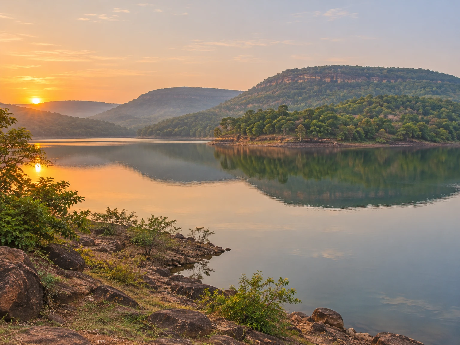
Nuapada rewards an unhurried kind of travel. In Odisha’s far west, the district brings together cultivated valleys, broad uplands, river courses, forested slopes and a borderland history that is larger than any one monument. It is a place where a reservoir on the Jonk can be read as both working water infrastructure and a landscape, where a perennial spring has accumulated religious meaning, and where archaeological possibility needs to be separated carefully from proof.
This is not a district best approached as a checklist of waterfalls or as an extension of better-known destinations elsewhere in Odisha. Its character lies in connections: between the Eastern Ghats’ outlying hills and plains, between the Mahanadi drainage and the Chhattisgarh borderland, between the former Khariar polity and modern district administration, and between living faith and the restraint required at forests, springs and protected habitats. A good visit leaves time for these relationships rather than treating them as scenery.
District Overview & Geography
Nuapada lies in western Odisha, in a borderland adjoining Chhattisgarh. The district administration’s profile gives its area as 3,852 square kilometres, identifies Nuapada town as headquarters and names Bargarh, Balangir and Kalahandi on the Odisha side. The district became separate on 1 April 1993 after division of undivided Kalahandi, following a state notification dated 27 March 1993. Older writing may use “Kalahandi” or “Khariar” for places and events now discussed within Nuapada’s boundaries.
The district’s relief explains much of its travel experience. The official profile describes plains edged by rugged hill ranges extending southward from the main line of the Eastern Ghats, with extensive plateau country and long tropical grass. In practice, the journey shifts repeatedly between open agricultural land, low and higher hill forms, wooded stretches and watercourses. The Sunabeda plateau is the most evocative of these uplands, but it should not be imagined as empty wilderness: it is a lived and ecologically sensitive landscape adjoining Chhattisgarh.
Water shapes both settlement and travel in Nuapada. At Patora, the district’s official destination description places the Upper Jonk Irrigation Project on the Jonk River, creating a reservoir landscape enclosed by hills. The district profile describes a wider network of rivers, seasonal channels and springs. These waters connect cultivated land, local settlement and devotional places, but a static directory is not live access information.
The climate is that of inland western Odisha: hot conditions build before the monsoon, rains transform the hills and drainage lines, and the cooler months make road travel and open-air visits more comfortable. This broad seasonal rhythm is more useful than a promise of a single “best” month. Summer heat can be severe; rain can affect roads, water levels and safe access around slopes and streams; and winter mornings and evenings may be pleasant while midday remains bright and dry. Visitors should check local weather, road conditions and official advisories immediately before travelling.
Forest is not merely a backdrop. The state wildlife portal describes Sunabeda Wildlife Sanctuary as a 600-square-kilometre plateau landscape with waterfalls, caves and archaeological remains, adjoining Chhattisgarh. It is a wildlife sanctuary, not an established tiger reserve. The distinction is important: popular destination copy can misplace or exaggerate attractions, while a sanctuary’s actual access rules, routes and seasonal restrictions must be confirmed with the responsible authorities. Forests and grasslands are habitats first, and photographs, picnics and drives must remain subordinate to that fact.
Nuapada is socially diverse. The district’s official profile records Scheduled Tribes as 33.8 percent of the population in the 2011 Census; that is a historical figure, not a current estimate. No statistic can stand in for individual lives or justify treating communities as attractions. Visitors should not presume access to homes, rituals, customary places or performances; ask permission where appropriate and respect a refusal.
Mythological & Historical Significance
Nuapada’s history must be told at several scales. The present district is young administratively, but its terrain belonged to older political and cultural regions. The district’s history account places the wider Kalahandi tract within narratives of ancient Mahakantara, South Kosala, Somavamsi influence, later Telugu Chola and Eastern Ganga power, and changing regional authority. This is useful regional context, not proof that every present-day Nuapada site was founded or directly governed by each dynasty. Evidence is uneven; local histories need site-specific archaeological work.
According to the district’s historical account, the Somavamsis of South Kosala held influence during the eighth century when Mahasivagupta Balarjuna ruled from Sripur. It further traces later political change through the early eleventh century, Eastern Ganga ascendancy in the broader region and the changing fortunes of Kalahandi. Such accounts help explain why western Odisha’s historical map cannot be reduced to the coastal history of the state. Political frontiers, tributary ties, estates and revenue arrangements changed repeatedly across this interior.
Khariar is particularly important to Nuapada’s historical memory. The official district narrative says that Gopal Ray, a scion of the Patna Chauhan family, became king of Khariar in 1590 and began a line of semi-independent rulers. It describes Khariar as coming under Maratha power in 1741 and British occupation in 1818, before later administrative rearrangements connected the area to Sambalpur and subsequently Kalahandi. These are administrative and political milestones, not a substitute for the histories of cultivators, artisans, forest users and communities whose lives continued through each transition.
The modern district emerged through an equally consequential sequence. Khariar was associated with the former Nuapada subdivision, which was added to Kalahandi after post-Independence changes; Nuapada was finally separated from undivided Kalahandi in 1993. For travelers, that layered history is a reminder to read old references with care. A source may speak of Khariar estate, Sambalpur district, Kalahandi district or Nuapada district while referring to overlapping territories in different periods.
Sacred geography is another archive, though it has a different standard of evidence. At Patalganga, the district tourism listing calls the perennial spring sacred and records a local belief that Rama, Lakshmana and Sita visited during exile, with Lakshmana’s arrow bringing forth water when Sita was thirsty. This is a devotional and oral tradition, not a documented event in historical chronology. Its importance lies in the way communities have understood the spring, not in whether a visitor can convert belief into proof. Bathing customs and rites associated with the spring deserve quiet respect, especially when local worshippers are present.
Upkaganga carries a related sense of water emerging from land. The district’s tourist-place listing situates it in forest near the Sunabeda River, between Guru Dongor and Pati Dongor, and describes water issuing in three flows. It also notes local reverence for Shiva and Jagannath. The language of sacred water here is part of a living religious landscape. Visitors should avoid contaminating springs, entering ritual spaces without invitation or assuming that every sacred location is a recreation site.
Budhikomna’s Pataleswar Temple gives Nuapada an important architectural reference point. A 2005 Orissa Review article describes the brick Patalesvara temple as state-conserved and attributes it to about the ninth century. The district’s Culture & Heritage page also identifies the Dadhibaman Temple at Khariar as a State Protected Monument. Directory material carries conflicting assertions about the latter temple’s age, so the safer reading is to value its protected status and local religious significance without forcing a precise date. Temple visits are most meaningful when they begin with attention to worship, conservation and local etiquette rather than with a hunt for dramatic claims.
The Maraguda Valley adds archaeological depth, but it requires especially careful phrasing. Odisha’s State Archaeology page says excavation work in Maraguda Valley began in 1991 and that its last phase is over. This confirms an archaeological programme, not an active excavation, a fully interpreted visitor facility or unrestricted access to sites. A 2016 peer-reviewed study, “Prehistoric Settlement Pattern of Jonk River; Upper Mahanadi Basin”, reported 62 sites across its wider study area. That research demonstrates the basin’s archaeological potential; it does not date every mound, fort-like feature or place-name in Nuapada. The responsible traveler should accept these limits rather than converting possibility into certainty.
Saliha is a different kind of historical place: one rooted in anti-colonial public action. Nuapada’s official tourism listing says that people of the Khariar estate gathered at Salihagarh on 30 September 1930 to protest taxation. That concise official record establishes the date and broad issue. It should not be embellished with casualty figures, speeches or details that the cited official page does not provide. A visit here can be a prompt to consider how the freedom movement was experienced in estates and rural localities, not only in provincial capitals.
Tourist Destinations & Hidden Gems
Patora is Nuapada’s clearest introduction to the meeting of water, engineering and hills. The official Patora page places it on the Jonk River at the Upper Jonk Irrigation Project and identifies the nearby Yogeswar Temple and Manikgarh as associated points of interest. The reservoir’s broad water and folded horizon invite looking rather than rushing: light changes across the banks, dry-season waterlines reveal the shape of the land, and the hills make clear why this is not an ordinary plain-country dam site.
Odisha Tourism’s Nuapada destination page, updated 3 November 2026, names Patora Nature Camp as a preferred stay; that listing does not establish current booking availability or which amenities are operating. The district’s Patora page still describes a tourist centre as potential and garden/fountain features as in the making, so do not assume they are open. Confirm stay, access and permitted activities with official local channels before departure. Do not enter water, hire a boat or approach operational infrastructure unless authorized locally. Reservoir banks can be unstable, water levels change, and a scenic surface does not indicate safe swimming.
Yogeswar Temple gives Patora a devotional dimension. For many visitors, the appropriate rhythm is simple: arrive quietly, dress conservatively, observe any instructions at the site, and allow worshippers priority. Photography around shrines should be guided by permission, not assumption. The temple and reservoir are best understood as neighbouring elements of a working and sacred landscape, not as a theme-park pairing.
Sunabeda Wildlife Sanctuary is Nuapada’s major ecological destination, but it demands patience and caution. The Government of Odisha’s protected-area directory describes a plateau of 600 square kilometres adjoining Chhattisgarh, marked by waterfalls, caves and archaeological ruins. This establishes the sanctuary’s significance, but not a visitor’s right to enter every forest road, cave, plateau edge or watercourse. Access may depend on weather, conservation needs, local rules and permissions. Current gate timings, permits, guide arrangements and visitor circuits should be confirmed directly with the responsible forest authorities.
That uncertainty should shape the itinerary. Contact the Forest Department and the Nuapada tourist office before setting out. Travel only on routes confirmed as open. Do not attempt unmarked walks, night drives, off-road travel, waterfall-edge photography or entry into caves. Keep distance from wildlife, never feed animals, carry all waste out, and avoid music, drones and loud group behaviour. A sanctuary visit is successful if it leaves the habitat undisturbed; seeing a charismatic species is not an entitlement.
The district tourism listing mentions Godhosh waterfall in connection with Sunabeda. The wildlife portal’s broader reference to waterfalls supports the area’s water-shaped landscape, but neither source should be taken as confirmation of a safe or currently open bathing place. Waterfalls are particularly hazardous in and after the monsoon, when slippery rock, hidden depth and sudden flow can turn a short stop into an emergency. View from a recognized safe point only, obey local restrictions and never enter pools simply because other visitors do.
Patalganga is quieter in mood and should be approached as a place of faith before it is approached as a nature stop. The official district page calls it a perennial spring and reports its sacred standing among local people. The Rama, Lakshmana and Sita account belongs to local legend. The important practical consequence is straightforward: avoid soaps, food waste, plastic and intrusive photography; do not obstruct rituals; and do not assume that sacred bathing is an invitation to recreational swimming. Water quality and depth should never be guessed from appearance.
Upkaganga offers another encounter with spring water and wooded terrain. Its official description of three flows emerging near Guru Dongor and Pati Dongor conveys why the place has gathered reverence. Yet the same qualities that make such sites compelling—wet rock, shade, narrow approaches and seasonal water—also demand care. Visit in daylight, take local advice on footing and access, and do not cross barriers or follow informal tracks into forest. In places where official live visitor information is limited, restraint is a practical skill.
Budhikomna’s Pataleswar Temple deserves time for its brickwork and historical setting. The Orissa Review article’s approximate ninth-century attribution is an informed scholarly description rather than a final word on every phase of construction and repair. Look closely, but do not climb fabric, touch carved or fragile surfaces, or treat a protected monument as a backdrop for elaborate shoots. Its value lies in the survival of a regional temple tradition in a district whose historical identity is often overshadowed by more famous centres.
In Khariar, Dadhibaman Temple provides an accessible encounter with protected religious heritage. The official district culture page identifies it as a State Protected Monument and associates it with the Dadhibaman cult. That is sufficient reason to visit with care. The building’s chronological claims vary across secondary directories, so visitors should avoid repeating an unsupported exact age. Ask locally about worship protocols and whether photography is acceptable.
Saliha, often known as Salihagarh in the official tourism listing, is a modest but significant stop for travelers interested in Odisha’s freedom movement. Its meaning does not depend on grand architecture. The place recalls collective protest against estate taxation on 30 September 1930, and it encourages a broader question: how did anti-colonial politics move through villages, estates and administrative frontiers? Read the site respectfully, avoid turning memorial space into a picnic ground, and seek reliable local interpretation where available.
Maraguda Valley is best considered an archaeological landscape rather than a single packaged attraction. State Archaeology confirms that excavations begun in 1991 have concluded. That status calls for intellectual curiosity and physical restraint. Do not remove pottery fragments, stones or anything that looks old; do not dig, disturb mounds or enter privately held land without consent. Archaeology is not a souvenir hunt. If local authorities identify a lawful viewpoint, museum display or guided interpretation, that is the right way to engage with the valley’s past.
Nuapada’s less showy pleasures are equally valuable: a slow road between plains and upland contours, a morning temple visit, the view of cultivated land meeting distant hills, or a conversation with a shopkeeper about conditions ahead. These are not “hidden gems” in the sense of secret, undiscovered places. They are the district’s ordinary, visible textures. Responsible tourism should not manufacture secrecy around fragile sites or publicize routes through communities that have not invited visitors.
Recent News & Tourism Developments
Two 2026 reports describe plans rather than verified completed attractions. On 18 February, The Times of India reported a plan to restart day tourism at Sunabeda’s Godhus, Beniadhus and Kharaldhas waterfalls, with viewpoints, rest sheds, dining, parking and kiosks proposed; it also reported rough roads and that night visits were not allowed at that time. On 3 May, a follow-up report said waterfall amenities were being created and officials were exploring cottages outside the sanctuary at Cherechua. These dated reports do not establish that the facilities are complete, open, bookable or currently accessible. Confirm current rules, permits and road conditions with forest authorities before travel.
One dated official record is relevant background. The Nuapada district notice extended a catering-services tender for Maraguda Mahotsav 2026 on 17 March, setting 25 March 2026 at 1 pm as the extended deadline. The notice indicates procurement activity connected with the event. It does not, by itself, prove that the festival was held, specify its eventual programme or demonstrate permanent tourism infrastructure. It should therefore be read as a limited administrative record, not as an invitation to assume a recurring festival date or guaranteed future edition.
Secondary reporting in Tathya’s “Balwant Singh’s Grassroots Blueprint” describes a review visit by Tourism Secretary Balwant Singh in Nuapada, saying officials were asked to accelerate foundational hospitality infrastructure, identify possible land for hotels and restaurants, monitor works and improve safety and amenities. The accessed report did not display a publication date. Its language concerns review, direction and planning; it does not confirm land acquisition, funding approval, construction completion or operational hotels. Until a dated government order or completion notice is available, travelers should book only services that can be directly confirmed.
An EcoTour Odisha Patora listing is available, but a destination page is not proof of current operating conditions. Accommodation, food, activities, booking availability, guide services and access can change and should be reconfirmed with the responsible official channels before departure. The same principle applies to Sunabeda: ecological significance does not automatically translate into a ready-made visitor package.
For a grounded itinerary, start with the district administration’s own tourist-place list, then confirm each site’s current location and access locally. This avoids copying broad regional circuit pages that can mix attractions from different districts, and helps keep travel plans realistic in a state where hill, river and temple circuits cross administrative boundaries.
Traveler Essentials
Odisha Tourism’s Nuapada page lists Swami Vivekananda Airport at Raipur (117 km) and Khadial Road railway station (12 km) in its quick facts, but its separate “How to Reach” text instead names Bhubaneswar airport and gives only generic rail guidance. Treat those distances as starting points, not a settled itinerary; confirm the right airport or station, current schedules, transfers and road conditions for your dates. Generic highway information does not establish local bus or cab frequency.
Nuapada town works as the administrative anchor for a first visit. Patora can be considered from the district headquarters side, while Khariar, Komna, Boden, Sinapali and the Sunabeda-side landscape require additional road planning. Build margin into the day. This is not a district for an itinerary that assumes every stop is an hour apart, every road is equally smooth or every attraction has food and toilets beside it.
Odisha Tourism currently gives October through March as Nuapada’s broad best-time window; treat that as seasonal guidance, not a guarantee of safe access or comfortable weather. The monsoon can bring difficult roads, leeches, slippery slopes and dangerous flows. In hot weather, start early, carry water and avoid strenuous activity in the strongest afternoon heat. During heavy rain, keep away from spillways, streams, waterfall channels and reservoir edges.
Before visiting Patora, Sunabeda, Patalganga, Upkaganga or a temple, make a short confirmation call. Odisha Tourism’s official tourist-office directory lists the Nuapada tourist office at the Collectorate, Nuapada, PIN 766105, with the Tourist Officer (I/c) reachable on 9437427083 and at oritournuapada@gmail.com. Ask specifically about access, road condition, accommodation, local guides, photography rules, safety advisories and whether any permission is required. For forest entry, follow the directions of forest authorities rather than relying solely on tourism contacts.
Carry cash as a backup, drinking water, sun protection, a basic first-aid kit, a charged phone and offline maps. Mobile coverage can vary outside town areas. Dress for temples and uneven ground: modest clothing for sacred places, closed shoes for trails and a rain layer in the wet season. Avoid single-use plastic, especially around springs, reservoirs and forest edges. Take rubbish back to town if no appropriate disposal system is present.
Nuapada’s food experience is best approached with curiosity rather than a pre-written menu. Eat at clean, busy local establishments, ask what is freshly prepared, and respect dietary preferences in temple-adjacent settings. Rice-based meals, lentils, vegetables and seasonal ingredients are common across western Odisha, but availability and preparation vary by town, season and household. Do not claim a dish is a district speciality unless a reliable local source identifies it as such. Carrying a small supply of fruit or simple travel food is sensible on longer rural drives, without leaving packaging behind.
Photography needs the same care as route planning. Ask before photographing people, worship, homes, markets, security infrastructure or forest staff. Never photograph wildlife at close range or use flash in sensitive settings. Do not fly drones without the relevant permission. At memorials, temples and springs, the most respectful image may be the one not taken.
Finally, keep expectations proportionate to the evidence. Nuapada offers a compelling western Odisha landscape, but some official descriptions are static and some secondary accounts are promotional. Confirm what is open, distinguish a proposal from a completed facility, and allow the district’s rivers, plateau horizons, protected forest and living religious spaces to set the pace. That restraint is not a limitation; it is the right way to encounter a place whose deepest interest lies in land, memory and continuity.
Sources & checks
- About Us — Nuapada District Administration, Government of Odisha. District profile and historical census. Checked 25 October 2026.
- History — Nuapada District Administration, Government of Odisha. Regional and administrative history. Checked 25 October 2026.
- Tourist Places — Nuapada District Administration, Government of Odisha. District-listed sites and local historical traditions. Checked 25 October 2026.
- Patora — Nuapada District Administration, Government of Odisha. Jonk River/irrigation project and nearby sites; older facility claims treated cautiously. Checked 25 October 2026.
- Culture & Heritage — Nuapada District Administration, Government of Odisha. Khariar protected-monument designation. Checked 25 October 2026.
- Protected Areas — Wildlife Odisha, Government of Odisha. Sunabeda Wildlife Sanctuary profile. Checked 25 October 2026.
- State Archaeology, Government of Odisha. Maraguda Valley excavation history. Checked 25 October 2026.
- Archaeological Explorations and Excavations in Western Orissa, Orissa Review, December 2005. Patalesvara Temple description. Checked 25 October 2026.
- Prehistoric Settlement Pattern of Jonk River; Upper Mahanadi Basin, Tosabanta Padhan, 2016. Regional survey findings. Checked 25 October 2026.
- Tourist Offices, Odisha Tourism, Government of Odisha. Nuapada tourist-office details. Checked 25 October 2026.
- Maraguda Mahotsav 2026 catering tender extension, Nuapada District Administration, 17 March 2026. Checked 25 October 2026.
- Balwant Singh’s Grassroots Blueprint, Tathya. Tourism-infrastructure review report; publication date not displayed. Checked 25 October 2026.
- Patora destination listing, EcoTour Odisha. Destination listing; live availability and current operating details not confirmed. Checked 25 October 2026.
- Nuapada — Odisha Tourism, Government of Odisha. Destination information and stay listing, updated 3 November 2026; quick facts conflict with the page’s “How to Reach” section on airport and rail access. Checked 11 November 2026.
- Plan to restart day tourism at 3 waterfalls in Sunabeda, The Times of India, 18 February 2026. Report on proposed day-tourism amenities and access conditions at the time. Checked 11 November 2026.
- End to Maoists prompts Sunabeda to explore night-stay cottages outside sanctuary limits, The Times of India via NewsPoint, 3 May 2026. Report on work in progress and proposed accommodation, not proof of completed facilities. Checked 11 November 2026.
- Tiger Reserves of India, National Tiger Conservation Authority. Reserve list; Sunabeda is not listed as a tiger reserve. Checked 11 November 2026.
Disclaimer
This content is a collection of ancient history,books and various articles and collection of library and news and other post ; all details may not be the same. Readers are requested to verify the information themselves. Readers are not allowed to take any disciplinary action; content is only for educational purposes. If readers do not agree about the contents, they may send a personal comment to my personal email ID: achary.purna@gmail.com
