
District Overview & Geography
Malkangiri lies in southwestern Odisha, a large, dispersed landscape where water, slopes, forest and settlement patterns shape every journey. It does not unfold as a compact checklist of monuments. Roads connect a district headquarters, agricultural plains, reservoir edges and hill country, but distances can feel larger than they appear on a map. The reward for travelling slowly is an understanding of a place whose identity lies in relationships: between the Eastern Ghats and lowlands, the Saberi and Sileru river systems, irrigated fields and forested ridges, and communities with distinct histories rather than a single uniform “tribal” culture.
The district administration’s profile records an area of 5,791 square kilometres and describes two broad physical divisions. In the east, steep ghats, plateaus and valleys create a more rugged terrain. Elsewhere, gentler undulations and plains support cultivation and settlements. This is southern Odisha’s inland edge: Malkangiri meets Koraput within Odisha and lies near the state borders with Andhra Pradesh and Chhattisgarh. The borderland position is geographical rather than merely administrative. River valleys, trade routes, migration and shared watershed histories have long connected places on either side of today’s state lines.
Water provides the district’s clearest organising principle. Official district tourism records show how water shapes livelihood and infrastructure: the Satiguda reservoir is described as supporting irrigation, while Balimela is a hydroelectric project on the Sileru system. Seasonal rain changes water levels and can alter road conditions. These are working water landscapes, not just scenic backdrops, and access to reservoirs or power facilities may be controlled.
Forested tracts are part of the district’s landscape, but this does not establish public access or wildlife viewing. Treat forest entry as restricted unless current local permission is clear.
Climate is best understood through movement rather than averages. Winter and the early part of the dry season can make road travel and outdoor exploration more comfortable. Summer heat can be intense in lower and exposed country. The monsoon transforms the scenery but can also turn a route into a risk: water levels rise, small bridges may submerge, and hill roads can be affected by rain. In September 2026, heavy rain disrupted links including stretches of NH-326 and caused bridge submergence in the district, as reported by The New Indian Express. That was a dated weather event, not evidence of a continuing closure. It is, however, a useful reminder to check conditions on the eve of travel.
The district profile names Bonda, Koya, Paraja and Didayi communities; its listing is not a complete account of local identities. Malkangiri also includes residents shaped by migration, public service and trade. Communities are contemporary and diverse, not tourism props. A respectful visitor asks before photographing a person, ritual, home or cultivation.
Mythological & Historical Significance
Malkangiri’s official history page is rich in local memory, dynastic references and sacred geography. It must be read with care. The page connects the region to episodes of the Ramayana and Mahabharata, links the Tamasa river and Malyavantagiri to Valmiki and Rama, and associates Sita Kunda near Mudulipada with Sita. These are valued traditions of belief and place-making. They are not, by themselves, archaeological proof that the epic events occurred here. The same distinction is necessary for claims on the page about an Indus Valley connection: the available official narrative does not establish this as a settled archaeological conclusion.
What can be said more securely is that the landscape has long carried sacred associations. Caves, springs, riverbanks and hilltops are often understood through stories that give moral and devotional meaning to terrain. A traveller can visit such places with seriousness without trying to turn folklore into a dated historical record. The most useful question is not “did the epic happen here?” but “how does this story continue to shape the significance of this particular hill, water source or shrine?” A careful reader can respect these traditions while distinguishing them from documentary evidence. An official history page records how local institutions present heritage; a government notification can document an administrative date; an inscription or excavated object needs its own context and interpretation. Where a district page makes a strong archaeological claim, treat it as an attributed claim unless independent scholarship supports it.
The official history narrative also refers to Malkangiri as a hilly kingdom in the period of the Eastern Ganga dynasty and uses the name Kumbudiri, citing the 1941 Koraput gazetteer. It records a reported inscription of 1376 and describes a princely polity administered through muthas including Mout, Podia, Korukonda and Padmagiri. These references point to a historically layered political landscape, but many details need fuller epigraphic and archival study before they can be treated as definitive. For visitors, the value lies in recognising that Malkangiri was not a blank periphery: it had local institutions, authority structures and sacred networks well before its present district boundaries.
The nineteenth and early twentieth centuries brought deeper external administration and conflict. The district history page discusses Koya resistance and names Tama Dora and Alluri Sitarama Raju in its account of anti-colonial unrest in the wider frontier region. These figures and memories should be approached in their proper regional context rather than compressed into a single heroic tourism narrative. Malkangiri’s history intersects with the political geography of the old Madras Presidency, the adjacent Andhra region and the former Koraput district.
Administrative change is better documented. Before Odisha was formed in 1936, Malkangiri was part of the Madras Presidency. In 1936 it became a taluk within Koraput district’s Nabarangpur subdivision. Malkangiri subdivision was created in 1962. The present district was formed through a government notification dated 1 October 1992 and took effect on 2 October 1992. This sequence, confirmed by the district profile, explains why older maps, gazetteers and family histories may frame the region through Koraput rather than Malkangiri.
Another essential twentieth-century chapter is the Dandakaranya project, which the official history page dates from 1958 to 1988. The project reshaped parts of southern Odisha through settlement and infrastructure, bringing new residents and altering social as well as physical landscapes. It is not a simple story of empty land being developed; the district already had communities, rights, memories and ecological relationships. A historically responsible account holds both realities together: migration mattered, and so did the people and places into which it occurred.
Religious life today is similarly plural. Shaiva shrines, goddess temples, Jagannath worship, local sacred sites and community-specific observances coexist across the district. The district tourism pages list Bhairabi, Goi and Tarini temples, Mallikeswar, a Jagannath temple at Motu, and the Shiva shrine near Satiguda. Do not assume a festival date from an old webpage or make a special journey for a ritual without confirming it locally. Religious places are first places of worship, not sets for visitor photography.
Tourist Destinations & Hidden Gems
The most meaningful “hidden gems” in Malkangiri are not secret or unregulated spots. They are the quieter, often overlooked dimensions of publicly known places: an early view of a reservoir, a temple approached with appropriate restraint, the changing line of hills beyond a road, or a locally made meal purchased without expectation that every village must entertain a visitor. The district’s attractions are geographically spread out and should be planned as separate excursions, not combined into an unrealistic one-day circuit.
Satiguda Dam is the most accessible starting point from Malkangiri town. The district administration lists it as an irrigation reservoir near the headquarters, surrounded by small hills and forested scenery. Its importance is practical as well as visual: the reservoir supports cultivation in the Malkangiri and Korukonda area. A Shiva shrine near the dam adds a devotional dimension. The official tourism page says boating has been available, but static online information is not proof that boats, safety equipment, weather conditions or public access are available on a given day. Ask locally and use only authorised facilities. Avoid swimming, improvised boat rides and shoreline shortcuts.
Satiguda offers a useful lesson in reading the district. The scene may appear tranquil, but the water body belongs to an irrigation system, and its levels and edges can change. Visit in daylight, take back all litter and do not treat the area as a party venue. For travellers based in town, it is an opportunity to begin with a water landscape before attempting longer drives into hill country.
Balimela and the Chitrakonda reservoir occupy a different scale. The district administration describes Balimela as a hydroelectric project developed jointly by Odisha and Andhra Pradesh on the Sileru system, while Chitrakonda is associated with the reservoir landscape and dam infrastructure. These are not interchangeable names for a single postcard view. They represent a major transformed watershed: valleys, water, hills and engineering are seen together, and access can depend on operational, security and weather conditions.
The official places-of-interest page provides background on Balimela and Chitrakonda but contains legacy technical and logistical information that should not be used as live travel advice. Visitors should not infer that a dam, powerhouse, jetty or reservoir edge is open for inspection. Photography around critical infrastructure may be restricted. Enjoy authorised public viewpoints, respect barriers, and ask district or site authorities about current access. The visual pleasure of the reservoir is strongest when it is paired with this awareness: the broad water and island-like hill forms are part of a working and politically shared river system.
Ammakunda, in the Khairput area, is listed by the district as a waterfall and natural gorge setting. It is often described in travel writing as a cool retreat, but a waterfall is not automatically a safe bathing place. Rock surfaces can be slippery, pools can conceal depth or strong currents, and monsoon flow changes quickly. Treat Ammakunda as a landscape for observation rather than a place to enter water. Before leaving the main road, confirm local conditions, vehicle suitability and whether access is permitted.
Manyamkonda, around Kalimela, is another district-listed hill destination whose appeal is its elevated, wooded terrain and local religious associations. It is best approached without promises of a particular viewpoint, trek route or facility. Roads in this part of Malkangiri may be affected by weather and maintenance. A hill visit should be an unhurried daylight excursion, with enough fuel, water and a return plan rather than an attempt to chase sunset on unfamiliar roads.
Motu and Mugi Point give travellers a different geographical perspective. Motu lies in the district’s southern side near the Andhra Pradesh border and is listed by the administration with Madhusudan Park, the Jagannath temple and nearby points of interest. It is a place to appreciate Malkangiri’s borderland geography, not a reason to cross state lines casually or assume seamless transport. Carry identification, follow any local checking procedures and use mapped, lawful routes. The nearby Tribeni Sangam at Padia is also named by the district administration; its religious and riverine character merits quiet, clean and non-intrusive conduct.
Bhairabi Temple in Malkangiri town, along with Goi and Tarini shrines named on the district tourism list, offers a more direct encounter with the district’s devotional map. Temple provenance is often transmitted through local tradition rather than published architectural histories. It is therefore better to describe these as living worship sites than assign unsupported antiquity or dynastic patronage. Dress modestly, remove footwear where required, follow the resident congregation’s directions and do not photograph inside a shrine unless permission is clear.
Bonda Hills are not an ethnographic attraction. They are home territory, not an open-air museum. District tourism pages include outdated, disrespectful descriptions of the communities they name, so these should not be repeated as neutral facts. Before visiting, verify current access permissions with the district administration; rules can vary. Do not enter settlements uninvited, arrange staged portraits, distribute gifts, or photograph residents without clear consent.
The same ethic applies to weekly markets and roadside settlements. A market is a place of trade, family obligations and local exchange, not a performance scheduled for outsiders. Buy only what is offered, ask before photographing, avoid hard bargaining over low-value goods, and do not obstruct traders. A locally knowledgeable, authorised guide can help a visitor understand language, etiquette and current permissions, but no guide can substitute for consent.
Published official sources checked for this article do not establish a single district-wide specialty or a dependable restaurant list. Plan meals before longer drives and ask what is available when you arrive; do not expect a household or community to serve visitors.
Recent News & Tourism Developments
The most significant tourism-related development reported in 2026 is exploratory rather than operational.
On 4 November, a report quoting a press release from the Malkangiri Divisional Forest Officer said the radio-collared tiger that had entered the Motu Range from Andhra Pradesh had crossed back into Andhra Pradesh and was about 7 km beyond the inter-state border. Border monitoring and village awareness were continuing, and residents were asked to follow field advice, avoid dense forest patches at dawn and dusk, and report fresh signs. This is a dated location report, not a guarantee of where the animal will be on a later visit; do not approach it or seek sightings.
Early-November reports on Cyclone Murasu described precautionary suspensions of boating and tourism activities at Satiguda, Chitrakonda and other sites, and boat transport serving Swabhiman Anchal, during the forecast period ending by 5 November. These reports do not establish whether services have since resumed; confirm with local authorities before travelling or expecting a boat. On 13 July 2026, The New Indian Express reported that a team associated with the National Institute of Water Sports and Odisha Tourism conducted a two-day feasibility survey. It considered rafting, kayaking and canoeing possibilities at the Upper Saberi Gorge, a Poteru Hill section, Chitrakonda reservoir and Sileru Valley.
This is worth noting because it acknowledges the district’s river-and-hill geography, but it must not be inflated into a claim that adventure sports are running. A feasibility survey is a preliminary assessment. It does not establish that equipment, trained operators, rescue systems, insurance, permissions, environmental safeguards or public bookings exist. Until a competent official authority announces a programme and its safety arrangements, visitors should not seek informal rafting, kayaking or canyoning trips in Malkangiri’s rivers or reservoirs.
Air connectivity also requires careful wording. A 23 July 2026 report in The New Indian Express described a trial aircraft landing at Malkangiri from Jeypore and reported an announcement of proposed non-scheduled passenger service. OdishaBytes reported on 26 August that a service was scheduled to begin on 3 September. Neither report, by itself, verifies a currently operating service, published timetable or bookable route for November 2026. Travellers should not rely on air travel to Malkangiri unless they can independently confirm a current operator, schedule and booking.
The September rain disruption is another important 2026 update. On 25 September, reporting described flooded bridges, evacuations and interruptions on road links during heavy rain. The episode does not mean that the district remains inaccessible; it shows why monsoon and post-monsoon travel cannot be planned from a static map alone. Before departure, check weather forecasts, district notices, transport operators and local contacts. If officials advise against travel, postpone rather than attempting an alternate rural road.
There is no separately verified 2026 opening date, new district tourism circuit, confirmed accommodation rollout or permanent water-sports operation in the sources reviewed for this edition. That absence matters. Malkangiri does not need invented facilities to be compelling. Its real tourism future will depend on safe transport, community consent, environmental care, transparent information and benefits that do not turn residents or sensitive habitats into commodities.
Traveler Essentials
Begin planning from the scale of the district. Malkangiri town is the administrative centre and a practical place to organise supplies and confirm local information, but it is not a guarantee that every attraction is nearby. Jeypore, in neighbouring Koraput district, is commonly used as a rail-connected approach in older official tourism pages. Those pages also mention Visakhapatnam as an air approach. Treat both as broad route possibilities, not as promises of onward public transport, journey time or current flight service. Confirm the final road leg directly with a reliable operator or local contact. Even small published distances may diverge: the district’s general tourism listing puts Satiguda 8 km from Malkangiri town, while its dedicated Satiguda entry says 5 km. Treat these as approximate directory references, not promises of route length or driving time. If you plan remote stops, confirm access, transport and any local permissions with the district administration or an authorised local operator before setting out. A visitor with one day should choose a single cluster and leave time to return before dark rather than stacking separated sites.
By road, use major mapped routes and travel in daylight. NH-326 is an important corridor in the region, but rain, repairs, local restrictions and temporary disruptions can affect its usability. Do not depend on an app’s estimated time for hill roads. Build in a buffer, keep fuel well above minimum, carry offline maps and tell someone where you are going. Private vehicles should be in good condition; drivers unfamiliar with wet hills should avoid night travel and flooded crossings.
Rail and air planning require the same caution. Check official railway systems for the current route to the nearest workable station and verify the onward journey separately. If considering Malkangiri airstrip services, seek direct confirmation from the operating carrier or relevant authority, not a news announcement. Do not book non-refundable connections around an unverified local flight.
The most comfortable broad window for many visitors is after the principal monsoon rains and before severe summer heat, often roughly from late autumn into winter. Conditions vary by elevation and year. Monsoon travel can be beautiful but carries higher uncertainty: landslips, waterlogging, bridge submergence and sudden changes in water bodies are practical risks. Summer calls for sun protection, rest, water and conservative daytime scheduling. Whatever the season, carry rain protection, a torch, a basic first-aid kit, personal medicines, charged power banks and enough cash for places where digital payments may not work reliably.
Respectful travel is a safety practice as much as an ethical one. Seek consent before any portrait or recording. Never fly a drone near settlements, worship sites, forest areas, dams or border-sensitive locations without explicit written permission. Do not enter homes, fields, schools or community spaces without invitation. Do not ask people to pose, dance or dress in a particular way. Visitors who are uncertain about access should choose a public viewpoint, shrine exterior, town market or authorised tourism location instead.
Water deserves special caution. Do not swim in reservoirs, waterfalls, river pools or canals. Do not step onto dam structures, cross spillways, board an unlicensed craft or accept a boat ride without clear authorisation and proper safety arrangements. Reservoir shorelines can drop away suddenly and operating conditions change. A photograph from a safe public edge is enough.
Use wildlife and forest etiquette that causes the least disturbance: remain on authorised roads or paths, keep sound low, do not feed animals, do not collect wood or plants, and carry waste back to town. There is no need to advertise locations of nests, dens, remote pools or sensitive community sites online. The best souvenir is an informed memory, not a geotag that encourages careless access.
Finally, leave space for local judgement. Malkangiri is not a destination to conquer in forty-eight hours. Plan fewer stops, spend more time at each authorised place, and accept that weather or local advice may change the itinerary. That is not a failure of travel; it is the correct way to meet a district where rivers, hills, working landscapes and human dignity set the terms.
Publishing Metadata & Tagging
-
Group: Odisha Tourism
-
Section/Category: Society And Culture
-
Destination: https://pcachary.in
-
District: Malkangiri
-
Edition: 2026-11-07
-
Cycle: 1
-
Tags: Odisha Tourism; Malkangiri; Society And Culture
Sources & checks
Sources and image provenance
Evidence checked 25 October 2026.
-
About Malkangiri — Government of Odisha, Malkangiri district administration. District formation, area and physical geography.
-
History — Government of Odisha, Malkangiri district administration. Local historical narrative and administrative transitions; epic and archaeological assertions treated as attributed tradition unless independently established.
-
Places of Interest — Government of Odisha, Malkangiri district administration. District-listed destinations and reservoir context.
-
Tourist Places — Government of Odisha, Malkangiri district administration. Static destination listings; facilities and access require fresh confirmation.
-
Expert team conducts feasibility study of adventure sports tourism in Odisha’s Malkangiri — The New Indian Express, 13 July 2026.
-
Aircraft trial run successful, flight service from Malkangiri in a month — The New Indian Express, 23 July 2026.
-
Malkangiri air service set for Sept 3 takeoff — OdishaBytes, 26 August 2026. A scheduled launch is not confirmation of current operations.
-
Odisha-AP road link cut off as bridges go under water — The New Indian Express, 25 September 2026.
-
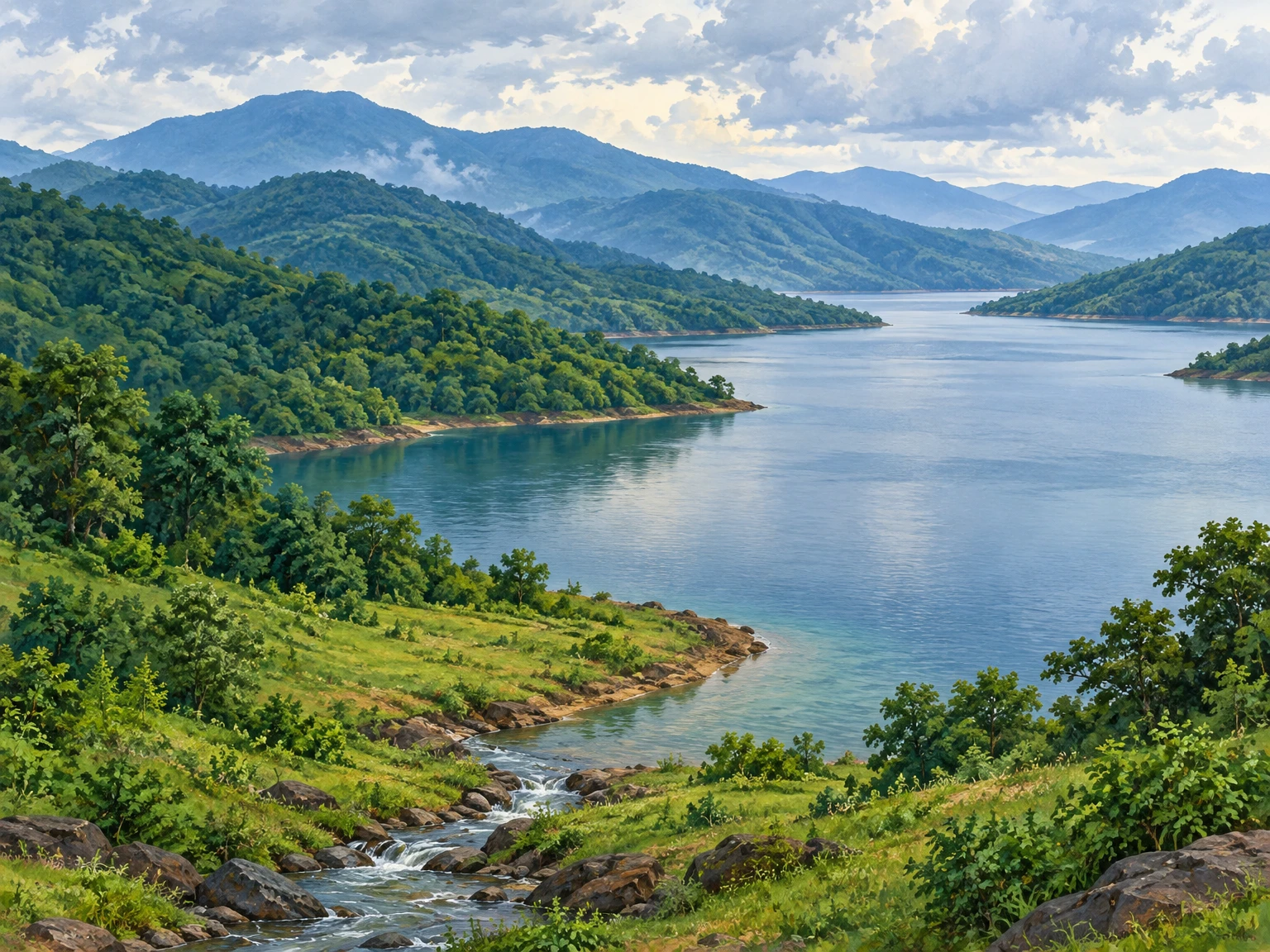
Cover image: original text-free landscape illustration generated for this article; no third-party photograph reused.
7 November 2026 source update
-
Radio-Collared Tiger Crosses Back into Andhra Pradesh from Odisha’s Malkangiri; Forest Department Maintains Border Vigil — Pragativadi, 4 November 2026; reports a Malkangiri DFO press release.
-
Malkangiri prepares for Cyclone Murasu, schools and anganwadis to remain closed from Nov 2 to 5 — The New Indian Express, 2 November 2026; reports temporary tourism and boating suspensions.
-
Cyclone Murasu Halts Boat Services to Malkangiri’s Swabhiman Anchal — Urban Acres, 3 November 2026; reports boat-service suspension through 5 November.
Disclaimer
This content is a collection of ancient history,books and various articles and collection of library and news and other post ; all details may not be the same. Readers are requested to verify the information themselves. Readers are not allowed to take any disciplinary action; content is only for educational purposes. If readers do not agree about the contents, they may send a personal comment to my personal email ID: achary.purna@gmail.com
