
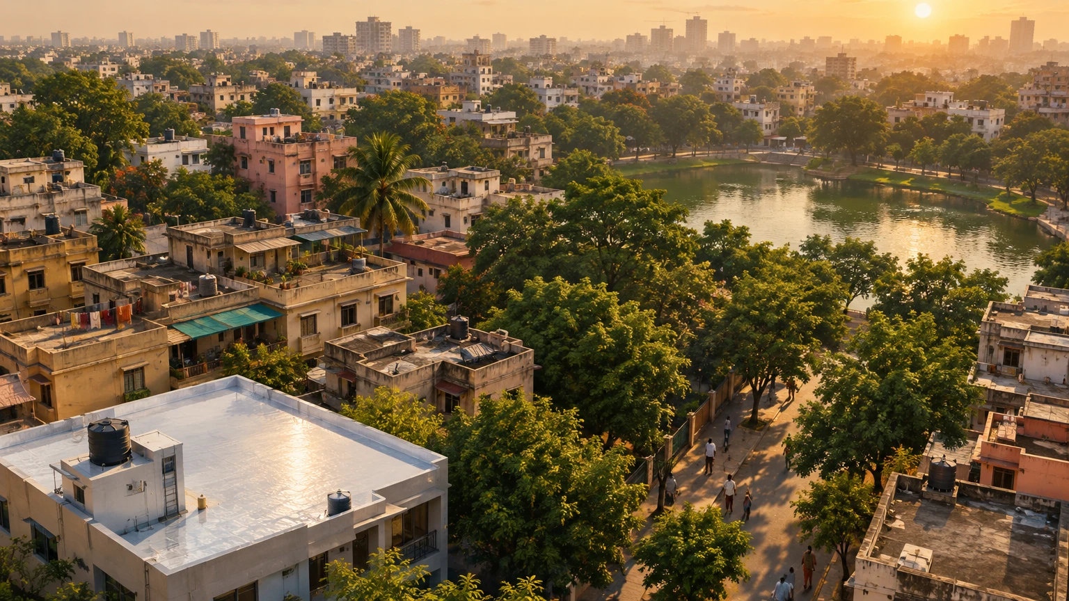
At the edge of a city’s hottest afternoon, heat is not just a number on a weather app. It is a roof that keeps radiating warmth after sunset, a bus stop without shade, a room that has no cross-breeze, or a worker whose route cannot be moved to a cooler hour. The same forecast can therefore describe very different days for people living a few streets apart. Understanding urban heat means looking at the weather, the built environment, and who can protect themselves when the temperature rises.
India’s cities are diverse: coastal and inland, dry and humid, dense and spacious, old and newly built. There is no single design fix that suits every place. Yet a common planning principle emerges from meteorology, public-health guidance and urban design: warnings matter, but they work best when paired with practical ways to reduce exposure, cool homes and workplaces, and reach people who are least able to change their schedule or surroundings.
First, what do we mean by heat?
People use “heatwave,” “hot day,” “heat stress” and “urban heat island” as though they were interchangeable. They are related, but each describes something different. A heatwave is a weather event identified against regional temperature criteria. Heat stress describes the strain that heat can place on a person or system. An urban heat island is a local pattern in which built-up places are warmer than surrounding areas under particular conditions. A city may face heat stress without a formal heatwave declaration, and a heatwave can affect rural as well as urban areas.
The India Meteorological Department’s heatwave FAQ describes criteria that depend on the local climate. In plains, the threshold for considering a heatwave includes a station maximum of at least 40°C; in hilly regions it is at least 30°C. Classification can also use departure from normal: a heatwave departure of 4.5–6.4°C and a severe heatwave departure above 6.4°C. The FAQ also describes actual-maximum categories beginning at 45°C and severe at 47°C. For the stated subdivision declaration, the criteria must be met at least at two stations for two consecutive days, with declaration on the second day.
Those thresholds are a consistent way to describe a meteorological event, not a personal safety boundary. The official definition does not mean that conditions below a threshold are comfortable, harmless or equally manageable for everyone. Nor does a station reading describe every courtyard, shaded lane or upper-floor room nearby. It is useful to keep the terms separate: a forecast tells us about expected weather; local design shapes the exposure; and public-health advice explains ways to reduce risk.
How a city stores the afternoon
Sunlight heats roofs, roads, walls and paved yards. Materials differ in how much solar energy they reflect, absorb or store. A dark surface can take in substantial solar energy and return some of it as heat later. Concrete and masonry can store heat during the day and release it gradually after sunset. A neighbourhood with little shade and extensive paved surface may therefore remain warm after the air temperature begins to fall. This is one reason a late-evening walk can still feel punishing after a very hot day.
The urban heat island is not a single uniform bubble above a city. It varies by land cover, building form, wind, moisture, time of day and season. Dense blocks may restrict airflow; street canyons can shade one side while trapping warmth in another. Trees can shade a footpath, yet their cooling benefit depends on where they are planted, whether they survive, and whether their canopy reaches people using the street. Water bodies and moist soils can influence local conditions, but their effect depends on scale, design and weather. An urban map of surface temperatures is not automatically a map of the temperature a person experiences.
Humidity also matters. The body cools itself partly by evaporating sweat, and high humidity can make that process less effective. Wind, shade, clothing, physical exertion and time spent outside all affect how a hot spell is experienced. A weather station’s air temperature, a satellite’s land-surface temperature and the conditions in a bedroom are different measurements. Each can be useful, but they answer different questions. Good heat planning does not reduce a city to one headline number.
Climate change adds another layer to this picture. The IPCC’s assessment of weather and climate extremes discusses how urbanization can exacerbate temperature extremes, particularly nighttime heat. That is not a claim that every street warms identically, or that a city’s design alone explains a hot season. It is a reason to plan for the combined pressure of a warming climate and local land-use choices, while preserving distinctions between observed trends, projections and individual weather events.
Why nighttime heat deserves attention
Hot afternoons are visible: the bright sun, the hot pavement, the crowded shade. The night can be less obvious. Buildings and streets that absorbed heat may release it after sunset; warm nights can limit the chance for indoor spaces to cool naturally. If a home stays hot into the evening, a person may have little relief even when the outdoor forecast has improved. This is especially important where bedrooms have limited ventilation, where the building stores heat, or where residents cannot afford or safely use mechanical cooling.
Nighttime conditions vary from place to place. A breezy, shaded street and a dense, exposed block may not cool at the same pace. Open windows may help in one setting and be impractical in another because of noise, safety, pollution, insects or privacy. These trade-offs mean that advice such as “air out the house at night” cannot be treated as a universal solution. Heat-ready design should make cooling options realistic for the people who live there rather than assume a particular home layout or household budget.
Public discussion often focuses on the day’s maximum because it is familiar and forecasts are widely reported. Planning should also ask how warm the night remains, whether rooms can shed heat, and whether people have a safe way to recover. Those questions connect urban design to housing quality, energy access and public health. They also explain why measurements at multiple times and locations can tell a more useful story than a single afternoon peak.
Heat exposure is not evenly shared
Not everyone can respond to a hot forecast in the same way. A person working outdoors may not control the location or timing of a shift. Street vendors, delivery workers, construction crews, sanitation workers, traffic staff and market workers can face long periods of sun exposure and limited access to shade or drinking water. People using public transport may spend time waiting beside traffic or crossing open plazas. At home, an upper-floor room under a sun-exposed roof can remain warmer than a shaded ground-floor room. These are examples of exposure pathways, not claims that every worker or building has the same conditions.
Ability to adapt matters as much as exposure. Flexible working hours are of little use if a worker loses income by taking a break. A cooling centre is not an effective refuge if it is too far away, inaccessible, unfamiliar or open at the wrong time. A public water point cannot help if it is not functioning or safe to use. Heat plans need to consider the everyday conditions that determine whether a recommendation is feasible: distance, opening hours, work rules, mobility, caregiving, housing, language and trust.
Heat risk is also not limited to people outdoors. Crowded indoor settings can add to risk, and a room without shade or airflow can stay hot. The NCDC’s 2026 public-health advisory notes that crowded indoor or outdoor situations can increase the risk of acute heat-related illness even when there is no active heatwave alert for the area. It also identifies exertion, direct sun, overcrowding and difficult access to water, food and shade as factors that may worsen risk in vulnerable groups. The practical implication is not panic; it is to avoid treating a missing alert as proof that all local conditions are safe.
Equity therefore belongs at the centre of heat planning. A city can ask who is exposed, who has choices, and who is likely to be missed by official messages. The answer should shape where shade is built, where water is available, how warnings are shared and whether workplaces can adjust schedules. An average temperature tells us something about the city; it does not tell us whether protection reaches the people who need it.
From forecast to action
Warnings are useful when they arrive with enough lead time, in a form people can understand, and with a practical action attached. IMD’s heatwave FAQ describes special morning bulletins that guide the next 24 hours and evening bulletins that provide warnings for the next five days, alongside district-wise warnings issued through state-level meteorological centres or regional centres. Forecast products can inform health departments, disaster managers, transport agencies, employers, schools and the public. But the forecast is only one link in a longer chain.
A heat action plan can set out who receives an alert, who decides to act, which services change, and how the public learns what is available. IMD describes heat action plans as frameworks for early warning, public awareness and community outreach, inter-agency coordination, response responsibilities, health-professional capacity, reducing heat exposure and promoting adaptive measures for vulnerable groups. That framework is broader than a poster or a single emergency phone number. It requires institutions to agree in advance on roles and to practice using them.
Timing and specificity matter. A message that says “extreme heat expected” is less useful than one that also tells people where to find shade or water, which public services are open, what hours have changed, and how to reach medical help. This does not require a forecast to predict the exact temperature at every address. It does require clear communication about the forecast’s area and timeframe, and about what people can do under different circumstances.
Warnings should reach people through channels they actually use: local radio, television, mobile messages, community networks, public announcements or workplace noticeboards. Multiple channels can help when one fails. Messages should be legible, translated where needed and written for people who may be busy, outdoors or under stress. A long technical bulletin can support agencies; a short public alert has a different job. Both are useful, but they should not be confused.
Most importantly, warnings must not shift responsibility entirely onto individuals. Telling a worker to avoid midday sun means little if the job schedule cannot change. Advising residents to drink water is insufficient if drinking water is not available. The public message should be matched by service delivery: shade, rest, water, adjusted hours, accessible cooling spaces and trained response capacity. Plans become credible when a warning triggers visible, reliable steps.
Protecting people at work and in public space
Workplace protection can begin with simple changes that are agreed before the season: identify exposed tasks, provide shaded rest areas, make cool drinking water accessible, plan strenuous tasks for cooler periods when feasible, allow breaks and train people to recognize heat-related symptoms. The NCDC’s 2026 advisory includes these kinds of measures for workers, along with acclimatization, a buddy system, first-aid availability and an emergency response plan. Employers should consult the full advisory and qualified health and safety professionals for context-specific procedures rather than treating a general article as a safety protocol.
There is no one work schedule that fits every occupation. A construction site, a street market, a factory floor and a delivery route have different hazards and operational constraints. A workable plan should identify which tasks can move to cooler hours, what changes require staffing or transport adjustments, where shade can be created, and how a worker can report symptoms without fear of punishment. If rest breaks reduce pay or work quotas remain unchanged, a written break policy may not translate into real protection.
Public space can be designed to reduce forced exposure. Shaded bus stops, covered walkways, drinking-water access, tree canopy where it is suitable, and cooler waiting areas can make essential trips less difficult. These facilities should be placed along routes used by people, not merely counted as citywide totals. Accessibility matters: a shaded bench is less useful if there is no safe path to reach it, and a cooling centre should be understandable to people unfamiliar with the building.
Heat planning also has to include transport. A person may be exposed while walking between home and a stop, waiting for a bus, transferring between routes or crossing a sunlit road. Planners can identify places where people queue or wait and prioritize shade and water there. Employers and transport agencies can communicate service changes and heat alerts in advance. These steps are not substitutes for broader urban adaptation, but they address exposure that happens during ordinary daily movement.
Cooler homes without one-size-fits-all advice
Housing is central because people spend much of their time indoors, yet “indoors” does not guarantee cool conditions. Roof materials, insulation, ventilation, window orientation, floor level, surrounding shade, occupancy and appliance use all matter. A household may have limited control over a rental property or a shared building. A retrofit that works for one roof or climate may be unsuitable for another. Effective heat policy should make safer building improvements accessible to tenants and lower-income households, not only to owners able to pay upfront.
Cool roofs are one approach: roof surfaces designed to reflect more sunlight and absorb less heat than conventional darker surfaces. Green roofs, shading, insulation and ventilation strategies can also be relevant, depending on local climate, structure, maintenance and water availability. These options have different costs and performance conditions. They should not be advertised as interchangeable or guaranteed to cool every room by a fixed amount without measurements for the actual building.
India’s 2026 government communication on urban heat mitigation describes measures including cool roofs, green infrastructure, water-sensitive planning, passive cooling and climate-responsive urban planning. It reports that heat action plans have been prepared by 23 states, 195 districts and 64 cities, and that a pilot for scientific assessment of heat mitigation is planned across 12 cities. Those figures describe government-reported planning coverage and an announced pilot; they do not by themselves show that every plan is implemented, that every neighbourhood is protected, or that a particular intervention has already produced a measured reduction in heat exposure.
Household advice should be practical and conditional. Shading a window from direct sun may help in some designs; opening windows may help when outdoor air is cooler and conditions allow, but may be inappropriate for safety, air quality or noise reasons. Fans can improve comfort in some conditions but do not reduce the air temperature. Cooling appliances can reduce indoor heat but depend on reliable electricity, affordable operation and safe installation. Public guidance should explain these limits and provide alternatives for households that cannot rely on a particular technology.
Programs can support residents through grants, community retrofit projects, building codes, public housing upgrades or technical assistance. They can also ensure that cooling improvements do not push housing costs upward or displace tenants. Measuring a project’s success should include indoor temperatures, energy use, maintenance and who benefits, not just the number of roofs coated or buildings enrolled.
Shade, trees and the shape of streets
Trees are often the most visible symbol of urban cooling, and shade can make a street more comfortable for people walking or waiting. Yet planting is the start of a process, not the end. Tree selection, rooting space, water, soil conditions, maintenance, overhead wires, underground services and visibility all affect whether a planting survives and provides useful shade. A row of saplings does not offer the same near-term protection as mature canopy. Planning should state the time horizon and distinguish planting counts from surviving trees and actual shaded area.
Urban form matters too. Street orientation, building height and spacing, surface materials, open spaces and ventilation pathways influence how sunlight and air move through a neighbourhood. The Ministry of Housing and Urban Affairs’ planning guidance, as described in a 2026 government release, includes microclimate-responsive measures such as street and building orientation, water-body conservation, open spaces, vegetation, semi-pervious surfaces and green roofs. These are planning considerations, not a recipe that can be copied identically into every city block. Local climate and urban use should guide the design.
Shade is a service. It should be located where people actually travel, wait, study, work and rest. That may mean prioritizing market streets, bus stops, school approaches, health-facility entrances, public squares or pedestrian links between neighbourhoods. A city can map heat exposure alongside population density, age, income, outdoor work and access to transport or healthcare. Such maps help identify priorities, but they should be checked on the ground with residents because datasets can miss informal routes, changing uses or small pockets of vulnerability.
Cool surfaces can also help, but material choice involves trade-offs. Reflective roofs may reduce solar absorption on the roof surface; reflective pavement can alter glare and the radiant heat experienced by pedestrians. A measure that lowers one surface temperature does not automatically improve every nearby person’s comfort. Before scaling a solution, cities can test it on representative buildings or streets, measure relevant conditions and ask users about comfort and accessibility.
Greening must be designed with water realities in mind. In a water-stressed location, the maintenance plan for new trees should explain how they will be watered without undermining drinking-water needs or local ecosystems. Native or climate-appropriate species may be part of a considered plan, but the selection should rely on local horticultural expertise rather than a generic list. Protecting existing mature trees and wetlands can be as important as planting anew. A heat-resilient city does not trade away water security for a symbolic increase in green cover.
Cooling centres, health services and care networks
Cooling centres can offer temporary relief, especially for people whose homes are unsafe or too hot. Their value depends on location, operating hours, accessibility, safety, staffing, power reliability, drinking water and public awareness. A centre that opens only during office hours may not serve a worker returning late; a building several transfers away may be unreachable for a person with limited mobility. Cities can link these spaces to transport and community facilities, publish clear hours and eligibility rules, and check that facilities are actually open during alerts.
Health services need preparation as well. The Ministry of Health and Family Welfare’s NCDC 2026 communications ask states to strengthen health-sector preparedness, early warning to health functionaries, workforce capacity and surveillance. A separate 2026 communication summarized in the public material calls for heat-stroke management capacity, ambulance preparedness and reporting. These are institutional responsibilities; they do not mean a reader should diagnose or treat an illness using an article. People experiencing severe or worrying symptoms should seek appropriate medical care through local services.
Community organizations can help identify people who may be isolated or difficult to reach, share verified alerts and connect residents to local support. This should be done with respect for privacy and without assuming that neighbours want their health or household conditions publicly disclosed. Community networks work best when they complement formal services, not when governments use them as a substitute for reliable public infrastructure.
Schools, childcare settings, care homes, hospitals and crowded workplaces can each plan for heat in ways suited to their users. Useful questions include: which rooms remain hottest, what happens during a power interruption, how are families informed, where can people take a break, and who is responsible for checking conditions? Preparedness should be tested before a crisis, then updated when a facility changes or a lesson is learned.
Plan for a whole season, not a single alert
A heat action plan is strongest when it joins everyday preparedness with emergency response. Before the hot season, agencies can review vulnerable locations, inspect shade and water facilities, train staff, test messages, and identify roles across health, disaster management, housing, labour, transport and municipal services. During an alert, agencies can activate agreed steps. After the season, they can review what worked, what failed and what needs funding. This cycle makes the plan more than a document filed after publication.
Coordination can be challenging because no single department controls every factor. A meteorological agency forecasts; public health monitors illness; municipal authorities manage streets and water; employers decide working arrangements; housing agencies influence building quality; and community groups have local knowledge. A shared protocol can clarify how forecasts trigger action and which agency reports completion. Clear responsibility prevents a common failure mode: every institution assumes that someone else will open the cooling room or send the message.
In a September 2026 release, the Press Information Bureau reported the numbers of states, districts and cities with heat action plans, described national and city-level planning guidance, and outlined recommended protections for informal workers such as shaded vending zones, hydration facilities, cooling centres, flexible working hours and timely alerts. The release also described a pilot for scientific assessment of heat mitigation in 12 cities. This is useful evidence of policy activity, but coverage counts are not outcome measures. A plan’s existence is different from a functioning service, and a program announcement is different from a completed evaluation.
Budgeting and accountability should reflect that distinction. A city can publish the locations and opening hours of public cooling spaces, report whether they were open during alerts, and document maintenance of water points and shade. It can identify who owns each task and how residents can report a failure. For longer-term investments, agencies can publish the expected timeline, funding source and progress. Transparency makes it easier to see where resources are reaching people and where a plan remains only on paper.
Measure outcomes, not just activity
It is easy to count inputs: trees planted, messages sent, staff trained, buildings painted or cooling spaces designated. These figures can be useful, but they do not answer the most important question: did the intervention reduce exposure or improve access to protection? A planted tree may not survive; a text alert may not reach someone without a phone; a building retrofit may not cool occupied rooms; and a cooling centre may have no visitors because its location or hours are unsuitable.
Evaluation should match the intervention. For a shade project, measure whether people’s routes and waiting areas gained usable shade, and whether the shade persists at relevant times of day. For a roof program, compare indoor conditions before and after, consider building differences, and document who received the improvement. For public warnings, examine reach, timing, comprehension and actions taken. For health services, review whether staff and equipment were ready and whether surveillance data were reported in a consistent way. These evaluations should be designed with competent technical partners and respect for personal data.
Weather varies from year to year, so simple before-and-after comparisons can mislead. A cooler outcome may reflect a milder season; a worse health outcome could reflect a broader event or changes in reporting. Evaluation needs appropriate comparison and careful explanation of uncertainty. The aim is not to make every intervention prove a dramatic effect; it is to learn whether a specific measure is useful under known conditions and how it can be improved.
Residents can contribute by reporting where heat is hardest to manage, whether shade or water points work, and which routes feel exposed. Such reports are valuable observations, not a substitute for systematic measurement. A planning process that combines local experience with climate and health data can reveal gaps that either source alone might miss.
What residents can do, and what cities owe them
People can use official forecasts, pay attention to local public-health advice, limit unnecessary exertion during dangerous conditions when possible, seek shade, and check on people who may have less access to cooling. The NCDC advisory lists signs and precautionary information for heat-related illness; local medical services remain the right source for personal diagnosis or treatment. If an alert is active, follow the official advice for the area and use available local services rather than relying on a general article.
But the most effective response cannot depend on individual choice alone. A resident cannot plant shade along a public road, set a workplace schedule, repair a rental roof, open a municipal cooling centre or ensure an ambulance is prepared. These are collective and institutional responsibilities. Public authorities and employers should turn forecasts into accessible services, while residents and community groups can help identify whether those services meet actual needs.
Urban heat becomes more manageable when planning connects the forecast to the street, the building and the daily routine. That means distinguishing official heatwave criteria from broader heat stress; measuring more than the afternoon maximum; protecting workers and residents who have limited choices; and investing in shade, housing, health preparedness and water-aware design. No single roof coating or tree-planting campaign solves the problem. A portfolio of locally suitable measures, maintained and evaluated over time, offers a more credible path.
The city after noon is made by decisions taken long before the temperature peaks: where homes are built, what materials are used, how a street is shaded, whether a worker can rest, and who receives a warning. Treating heat as a shared urban service challenge turns those decisions into practical questions that can be planned, funded and checked—one neighbourhood and one season at a time.
Sources and further reading
- India Meteorological Department, FAQ on Heat Wave
- National Centre for Disease Control, Public Health Advisory: Extreme Heat/Heatwave, 2026
- Press Information Bureau, “Mitigating the Urban Heat Island Effect in Indian Cities,” 20 September 2026
- IPCC Sixth Assessment Report, Working Group I, Chapter 11: Weather and Climate Extreme Events in a Changing Climate
- World Meteorological Organization, Extreme Heat
- Ministry of Housing and Urban Affairs, Urban Green Guidelines
This content is a collection of ancient history,books and various articles and collection of library and news and other post ; all details may not be the same. Readers are requested to verify the information themselves. Readers are not allowed to take any disciplinary action; content is only for educational purposes. If readers do not agree about the contents, they may send a personal comment to my personal email ID: achary.purna@gmail.com
