
District Overview & Geography
Khordha is one of Odisha’s most varied districts: a place where the planned avenues and temple spires of Bhubaneswar meet low lateritic hills, former royal country and the northern waters of Chilika. It is easy to reduce it to the state capital, but that would miss its geographical breadth. Bhubaneswar lies within Khordha district; the district headquarters, however, is Khordha town. The district was created from the former Puri district on 1 April 1993, while the official spelling changed from Khurda to Khordha in 2000. The result is a district whose modern administrative identity is recent, but whose cultural landscapes are exceptionally old.
The district administration’s profile places Khordha in Odisha’s eastern and south-eastern coastal plain. Its setting is shaped by proximity to the Bay of Bengal and by Chilika, the large brackish-water lagoon that reaches into the district’s south. This does not mean that Khordha is uniformly coastal. The official profile distinguishes deltaic-alluvial terrain around Balianta, Balipatna and Chilika blocks from a lateritic sub-region that includes Bhubaneswar, Jatni, Khordha, Begunia, Bolagarh, Banpur and Tangi. The contrast is visible on the road: irrigated lowlands and riverine fields give way to red earth, scrubby rises and isolated hill country.
A Khordha District Survey Report on laterite describes western and south-western parts as extensions of Eastern Ghats hill terrain, grading eastward into undulating central land and then toward the Mahanadi floodplain. It identifies the Kuakhai, Daya, Bhargavi and Kushabhadra as important distributaries on the district’s eastern side. Some channels move toward Chilika, while others flow toward the Bay of Bengal. Near Kaipadar, the report notes a watershed between the north-flowing Ran and south-flowing Mandakini. This technical report is a useful description of landform and drainage, not a current travel or water-safety map. Its details explain why Khordha is not one landscape but a sequence of watersheds, cultivated plains, rocky outcrops and wetland margins. They also help give an itinerary a sensible shape: heritage sites on elevated ground, agricultural lowlands and the lagoon shore are distinct settings, with different distances and conditions. A clear day on the coast cannot be taken as evidence that hill paths or inland roads are equally easy, and a view of a river channel does not mean it is open to visitors or boat traffic. Treat the district’s rivers as part of its geography first, and confirm any specific crossing or activity separately.
Forest is present chiefly as hill and scrub vegetation rather than as a single, visitor-ready wilderness. The slopes around Barunei, the Dhauli ridge and the western uplands offer wooded or tree-covered relief, while the southern edge opens onto a lagoon system of shallow water, reedbeds and mudflats. These habitats require different forms of respect. A hill shrine is a living place of worship; a wetland is a working ecological landscape used by fishers and farmers as well as migratory birds. The temptation to treat either as empty scenery obscures the communities that sustain them.
Summers are commonly hot and humid, especially before the monsoon. Rain changes the district’s colour and water levels, but can also complicate road travel, hill walking and lagoon plans. The government profile records the influence of both the Bay of Bengal and Chilika on local bioclimatic conditions. For most visitors, October to March is the broad seasonal window suggested by Odisha Tourism, offering more comfortable conditions for heritage walks and wetland observation. It is guidance, not a promise: rainfall, heat, bird movement, boating permissions and individual-site operations vary.
Khordha rewards an itinerary based on clusters rather than an attempt to see everything in one hurried day. Bhubaneswar and the Dhauli-Udayagiri-Khandagiri corridor make a compelling urban heritage circuit. Khordha town, Barunei and the remembered landscape of Khurdagada belong together historically. A third circuit follows the district south toward Tangi, Mangalajodi and Barkul on Chilika’s northern and western reaches. Allowing time between these zones makes the district legible as geography as well as a list of monuments.
Mythological & Historical Significance
Khordha’s history is often narrated through grand claims, particularly around the Paika uprising. A more useful approach is to hold together inscriptions, archaeological evidence, administrative accounts and local memory without making any one of them say more than it can prove.
The deepest publicly visible historical layer lies at Dhauli, south of Bhubaneswar near the Daya River. The Archaeological Survey of India’s heritage bylaw document identifies the rock inscription, edicts of Ashoka and stone-cut elephant as protected components of the site. It dates the edicts to the third century BCE and notes that they are in Prakrit, written in Brahmi. The weather-damaged lettering is itself part of the experience: this is not a polished modern text but a vulnerable historical surface. Dhauli was protected in 1924.
Popular accounts link Dhauli directly and conclusively to the Kalinga war and to Ashoka’s inner transformation. The place certainly carries enormous symbolic force in those public narratives, but the protected-monument evidence should not be stretched into a precise reconstruction of a battlefield, casualty count or moment of conversion. Visitors can appreciate the powerful association while understanding the distinction between historical interpretation and demonstrable site evidence. The nearby white Shanti Stupa, built in 1973 by the Kalinga Nippon Buddha Sangha according to the district tourism account, gives modern architectural form to the idea of peace. Its presence has made Dhauli a major site of remembrance, reflection and panoramic viewing.
North-west of central Bhubaneswar, the twin hills of Udayagiri and Khandagiri preserve another early chapter. Odisha Tourism describes their Jain rock-cut caves and inscriptions as dating to the second century BCE. The caves are associated with the political and religious world of ancient Kalinga, and the celebrated Hathigumpha inscription has long been central to readings of King Kharavela. The surviving complex contains cells, façades, reliefs, inscriptions and spaces that are far more rewarding when seen slowly than when treated as a backdrop for photographs. Some caves are tiny and austere; others retain sculptural drama despite erosion.
It is wise to resist turning every carving into an unquestioned narrative scene or every chamber into a named royal residence. Archaeology works through evidence, comparison and debate. The certainty here is already remarkable: these hills preserve a major early historic Jain complex within the district, protected as ancient monuments. Before travelling, consult the official Udayagiri-Khandagiri information and verify current Archaeological Survey of India entry arrangements, fees and hours rather than relying on static online listings.
Bhubaneswar gives Khordha a dense later sacred topography. The city’s renowned temple tradition belongs to the wider development of Kalinga architecture: curving sanctum towers, assembly halls, sculpted doorways and a ritual landscape in which tanks, lanes, shrines and households remain connected. The district tourism account points visitors from the early Satrughneswara and Laxmaneswara shrines to the 11th-century Lingaraj and later Ananta Vasudeva temple; these are useful landmarks in a long history, not a complete catalogue or chronology. A visit to the old city makes more sense when the spaces between monuments are noticed too: the approach lanes, tanks, small shrines and everyday movement of worshippers form part of the sacred geography. Lingaraj is among the city’s defining monuments, but many temples remain active places of worship with their own entry customs. Respect posted rules, dress with care and do not presume photography is welcome. The value of Bhubaneswar is not merely the number of temples; it is the way ritual, craft, urban growth and conservation coexist, sometimes uneasily, in one living city. The district’s history page also identifies the name Ekamra Kshetra in the city’s cultural landscape; visitors can use the official district tourism account as orientation while checking individual rules at each site.
Khordha town and Barunei carry a different historical charge. The district history page recounts that Ramachandra Deva established his capital at Khordha in the late sixteenth century, and that the East India Company’s military takeover in 1804 preceded annexation in 1827. It also records the Paika rebellion of 1817–18 and the role of Bakshi Jagabandhu. These statements are best understood as the district administration’s account of the region’s past. They should not be compressed into the promotional claim that the rising was, beyond debate, India’s first war of independence. What is beyond doubt is its lasting importance in Odisha’s political memory: it expresses resistance, dispossession, military service and the end of a regional royal order.
Barunei Hill, associated with the shrines of Barunei and Karunei, is integral to that memory. The goddesses are revered as the presiding deities of the former Khordha kingdom in local and regional tradition. Such belief is not a footnote to history; it is part of the living cultural meaning of the hill. Yet it differs from a dated archival record. A visitor should be able to say both things at once: the hill is connected in public memory with the Paika past, and it remains a sacred landscape whose meanings are maintained by worshippers. The relationship between place and political history is especially visible here: a hill can carry devotional meaning, stories of royal protection and modern remembrance of resistance at the same time, without those strands becoming identical. The district history account names the rebellion and Bakshi Jagabandhu, while reporting on the site records local worship and current stewardship concerns. Those sources tell different kinds of things. A monument page can help orient a visitor, a community’s practice conveys lived significance, and an administrative history selects events for a regional narrative. Keeping these forms of evidence distinct makes the story richer, not weaker. It also discourages turning a complex uprising into a single slogan or treating living shrines as museum displays.
The name Khordha itself has competing explanations. The district history page explicitly notes rival derivations without declaring either authentic. That caution is instructive. In a district rich with stories, legends and etymologies, uncertainty need not diminish interest. It invites travellers to listen closely, ask where a story comes from and distinguish a community’s cherished account from a documented conclusion.
Tourist Destinations & Hidden Gems
Start with Bhubaneswar, but do not mistake a metropolitan base for a shortcut through the district. The city is one of the most practical places to stay, find transport and arrange a guide, while its monuments deserve at least a full day. Pair an early visit to a temple precinct or museum with Udayagiri-Khandagiri in softer light. The caves are exposed, uneven and historically fragile; wear stable footwear, carry water and avoid climbing or touching carvings. An informed guide can help visitors notice the difference between architectural form, inscription, later repair and modern storytelling.
Dhauli works best as a separate, contemplative stop rather than a rushed add-on. The rock edicts and the elephant should be approached as the archaeological heart of the site. The Shanti Stupa belongs to a later era and a different commemorative language, but together the two make a meaningful dialogue between ancient statecraft and modern peace symbolism. Views over the Daya valley are part of the attraction, particularly when fields are green, though the landscape should not be used to romanticise a past violence whose precise details remain historically complex. Keep to designated paths, do not leave litter on the hill and allow worshippers and school groups their space.
At Atri, near the Begunia area, a naturally warm spring and the Hattakeswar Mahadev shrine bring together geology and devotion. The official Atri tourism page notes a bathing complex and refers to Hattakeswar Mahadev and Makar Jatra. The spring has long been meaningful to local visitors, but it should never be presented as a cure for illness. Water temperature, cleanliness, crowding and bathing arrangements are practical questions to check locally on the day. The October 2026 visit of Odisha’s Governor, reported by OdishaBytes, renewed public attention to Atri’s heritage and tourism potential; it did not itself establish that new visitor facilities had been completed.
Barunei is the district’s most evocative historical hill landscape. Come for the temple setting, the Paika associations and the sensation of moving out of the urban corridor into a more rugged cultural geography. Do not come expecting a fully developed hill resort. Reporting in 2026 described inadequate amenities and unresolved development ambitions at several Khordha heritage sites, including Barunei and Khurdagada. That is a reminder to travel self-sufficiently: carry drinking water, use authorised parking where available, do not leave waste, and ask locally before taking a lesser-used path. Sacred hills are not adventure parks.
Khurdagada, the former fort landscape associated with the Khordha kingdom, calls for similar restraint. It is historically important but can be difficult to interpret on the ground without local explanation. The district’s historical narrative connects it with the late royal capital and the political conflict that culminated in the early nineteenth century. Ruins and surviving structures should not be treated as props for vandalism or casual climbing. If access or conservation work appears limited, accept that condition rather than forcing entry. A modest, respectful visit supports a more honest understanding of heritage than a search for dramatic but unsafe photographs.
The southern half of the district opens onto Chilika, a lagoon so large and variable that it must be understood beyond a single postcard view. The Wetlands of India factsheet records Chilika’s Ramsar designation on 1 October 1981 and describes a wetland spread across Puri, Khordha and Ganjam districts. This cross-district geography matters. A journey from Barkul or Tangi is not a claim that every famous Chilika location lies in Khordha, and plans should name the actual departure point and destination.
Barkul is a familiar Khordha-side gateway for appreciating the lagoon’s changing light, open water and distant hill silhouettes. Odisha Tourism lists it among Chilika visitor areas, but water conditions and boat operations are never interchangeable with an online page. Use registered, authorised operators, confirm weather and safety procedures, wear provided safety equipment, and do not ask boat crews to approach wildlife too closely. The Chilika Development Authority reports an estimated population of 15 Irrawaddy dolphins in 2025. That figure is an ecological reference point, not a guarantee of a sighting and never a reason to pursue animals.
Mangalajodi, on Chilika’s north shore, offers a different encounter: wetland rather than open-lagoon spectacle. The district’s Mangalajodi page describes a community-based, low-impact conservation and ecotourism model, and places it roughly 4 kilometres south-east of Tangi and about 70 kilometres south-west of Bhubaneswar. Its October-to-March seasonal advice is useful as a broad birding window, not a guarantee of particular birds or operating services. The area is best experienced as a working wetland rather than a stage set. Water levels, vegetation, fishing activity and the presence of migratory birds change through the year; visitors can learn more by listening to a local guide than by trying to cover the largest possible area. Before booking, ask what route is authorised, how long the outing lasts, what safety equipment is provided and how the operator limits disturbance. A responsible outing keeps voices low, uses binoculars or long lenses instead of approaching birds, and does not leave waste behind. If conditions are poor or birds are distant, accept that as part of a real wetland visit. The value of community-based ecotourism lies partly in local knowledge and stewardship, so choose the services actually available through recognised local arrangements rather than assuming every online listing is current.
Chilika’s visible life is not limited to birds. The Chilika Development Authority ecology page describes a dynamic lagoon ecosystem, with the interaction of fresh and saline water supporting varied habitats. Nalabana is a protected bird sanctuary; visitors must not assume unrestricted entry, landing or access. Follow authority rules, avoid drone use unless specifically permitted, and never feed birds or dolphins. The wetland’s fishing communities, vegetation, fish and seasonal waters are not background to tourism; they are the system tourism must avoid damaging.
A practical Khordha itinerary can be deliberately unambitious. One day can focus on Bhubaneswar, Dhauli and Udayagiri-Khandagiri. A second can follow the Paika and sacred landscape through Khordha town, Barunei and Atri, subject to local conditions. A third can be reserved for either Mangalajodi or the Barkul-Tangi side of Chilika. This arrangement avoids treating a lagoon journey, a hill visit and archaeological exploration as interchangeable stops. It also leaves room for conversations, unexpected closures and the slower rhythms of rural roads. If time is limited, choose one of those circuits rather than trying to connect every pin on a phone map. A cave visit needs time for uneven steps and careful looking; a temple visit depends on local entry customs; a wetland outing may begin early and follows the operator’s authorised route. Those rhythms do not fit neatly into a single transit window. Before setting out, confirm the exact place name and meeting point with the guide or host, especially where several settlements share familiar names. Keep a meal and return-transport plan for the rural portion of the day, and leave enough daylight for the final road leg. If a site is closed, a detour is not automatically an invitation to enter from another side; check with the authority or simply adjust the plan. This slower structure makes it easier to support local businesses and gives each place more attention than a rushed checklist would.
Food offers another way into the district’s diversity. In Bhubaneswar, seek simply prepared Odia meals rather than a generic “local platter”: pakhala with seasonal accompaniments, dalma, santula and vegetable preparations are widely recognised elements of the regional table. In Chilika-side settlements, fish, prawn and crab dishes are important to local food economies where they are responsibly sourced and prepared. Odisha Tourism highlights Chilika seafood alongside Odia staples, but visitors should ask what is locally available rather than demanding a particular catch. Choose busy, clean establishments, be clear about dietary needs, and avoid wasting food. Seasonal pithas and chhena-based sweets are enjoyable additions, not obligations to consume in excess.
Recent News & Tourism Developments
As of this edition’s evidence check on 25 October 2026, no verified announcement establishes the completion or opening of a new district tourism facility. That distinction is important because Khordha has many stated ambitions and an unusually high level of visitor interest, but planning discussions are not completed infrastructure.
On 23 October 2026, OMMCOM News reported a review of district development projects in Bhubaneswar led by the Finance Principal Secretary. Tourism was discussed alongside education, health, construction, rural development, irrigation and other sectors. The report says officials discussed schemes and infrastructure profiles and referred to tourism potential. It does not name a finished tourism project, new attraction or confirmed opening date. Travellers should therefore not plan around presumed new facilities.
A separate report published by OdishaBytes on 4 October 2026 covered the Governor’s 3 October visit to Atri. The visit brought attention to the hot spring’s cultural setting and potential, but it is not evidence that promised amenities, interpretation facilities or expanded access are in place. Visit Atri for what it presently is, and confirm conditions with local authorities or hosts before setting out.
Dated local reporting also supplies a necessary corrective to glossy tourism language. An OrissaPOST report (date not shown in the retrieved page) described concerns over upkeep and visitor amenities at Barunei, Khurdagada, Atri and other sites. It mentioned proposals and claims concerning heritage development, including work contemplated for Khurdagada and Barunei. These should remain proposals or reported intentions until an authoritative completion notice is available. The most responsible form of tourism is not to conceal such constraints but to adapt to them: lower expectations of facilities, pay attention to local guidance and spend with community businesses where possible.
Traveler Essentials
Access and weather update, checked 5 November 2026. IMD Bhubaneswar’s 4 November 18:30 IST bulletin forecast rain or thundershowers at a few places across Odisha on 5 November and again through 08:30 IST on 6 November; its district table includes Khordha in a 30–40 km/h thunderstorm-and-lightning warning for one or two places. This is a forecast, not a route or site closure notice. A temporary suspension of Chilika boat and ferry services was reported through 29 October, but no source checked here confirms whether each service has resumed. Confirm current road, boat and site access with the relevant local authority or registered operator before setting out; do not treat a general tourism listing as a live operations update.
Bhubaneswar is the principal air gateway for Khordha district, with Biju Patnaik International Airport serving the city. Rail travellers can use Bhubaneswar and Khurda Road Junction, among other stations, according to their actual destination. Khurda Road is a major rail junction, while Khordha town is the district headquarters; they should not be treated as the same place. Check current railway timetables, station names and road conditions before departure rather than relying on historical distance tables. The district tourism pages provide older distance and connection descriptions—for example, the Atri page lists Khurda Road as its nearest rail station, while the Barkul page gives Balugaon as the nearby railhead for that shore. Use those references to understand the broad layout, not as real-time routing guarantees. Confirm the onward vehicle, meeting place and return arrangement for the exact site you intend to visit. In a multi-stop day, compare the travel time across each leg rather than using straight-line distance; queues, urban traffic and the final approach on local roads can alter the schedule. If you are arriving late, staying in Bhubaneswar and beginning the rural circuit the next day may be more reliable than assuming a same-day connection. Keep the phone charged, save accommodation and transport details offline, and share the planned route with your travel companions.
By road, Bhubaneswar is the natural base for Dhauli and Udayagiri-Khandagiri. Khordha town and Barunei can be approached from the Bhubaneswar-Khordha corridor, while Tangi, Mangalajodi and Barkul require separate southward planning. Hire vehicles through reputable providers or use confirmed public transport information. Avoid promising yourself an exact bus frequency or last connection: services and roadside stops change. For early wetland departures or a remote hill visit, arrange return transport before leaving the main road.
Pack for heat, sudden rain and uneven ground. Breathable clothing, a reusable water bottle, sun protection, insect protection, a light rain layer and shoes with grip are more useful than excessive luggage. Carry identity documents where accommodation, protected areas or boating operators require them. Cashless payments are common in towns, but small settlements and roadside purchases may be easier with modest cash. Do not photograph people, religious rituals, fishers or boat crews without consent.
October to March is generally the most comfortable period for a mixed heritage-and-wetland itinerary. The cooler months can bring more visitors to famous sites, and migratory bird season attracts observers to Mangalajodi. Summer travel demands careful hydration and less ambitious midday sightseeing. In the monsoon, lush landscapes may be appealing but waterlogging, heavy rain and changing lagoon conditions can alter plans. Never swim in unmonitored springs, rivers or lagoon waters, and do not treat a boat ride as safe merely because the weather looks calm.
Responsible travel in Khordha begins with scale. At caves and inscriptions, do not touch, scratch or climb historic fabric. At temples, follow local dress, entry and photography rules. At Barunei and Atri, recognise that religious practice comes before visitor convenience. At Chilika, choose authorised services, refuse wildlife chasing and leave no plastic behind. Birdwatchers should maintain silence and distance; photographers should favour long lenses over pursuit. These are not restrictions on experience but the conditions that keep experience possible.
Finally, let the district remain plural. Khordha is Bhubaneswar’s sacred cityscape, but it is also Ashokan epigraphy, Jain monastic excavation, Paika remembrance, village worship, lateritic hills and a globally significant lagoon shared with neighbouring districts. Its strongest journey is not a race from monument to monument. It is an attentive passage through landscapes where history is carved in stone, carried in memory and continually reshaped by water.
Featured illustration
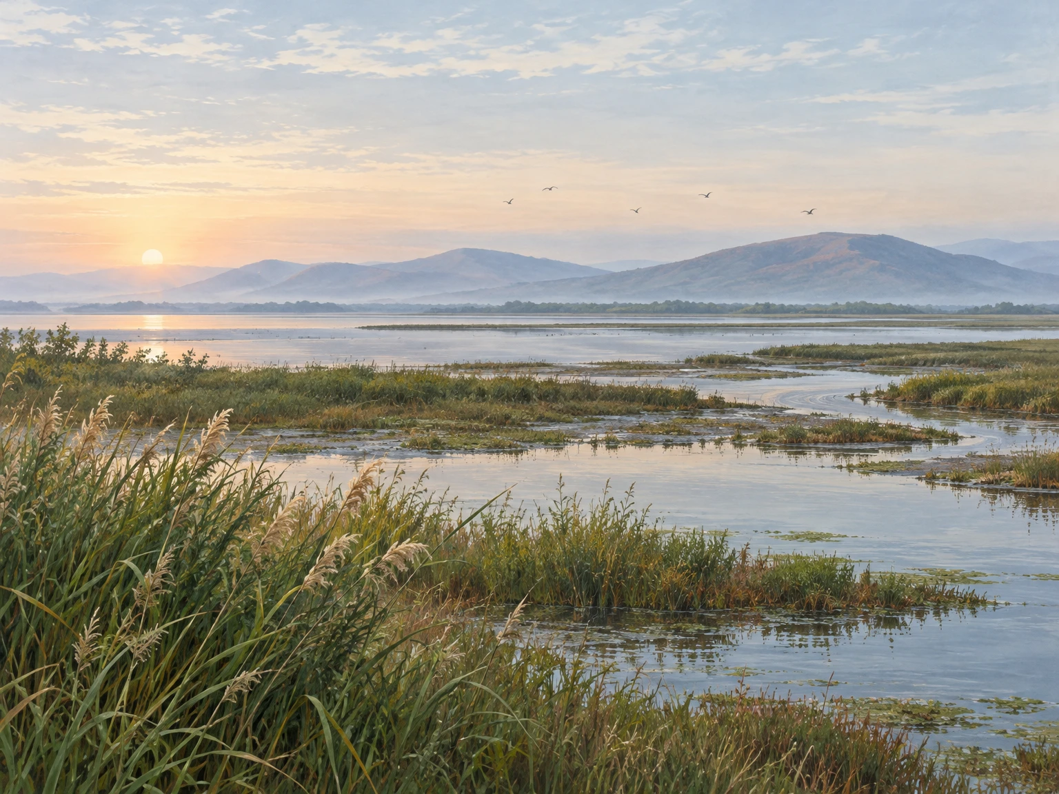
Original AI-generated editorial illustration of the northern Chilika wetland at dawn, with reed beds, shallow channels and a low hill horizon. Interpretive artwork, not a documentary photograph.
Publishing Metadata & Tagging
- Group: Odisha Tourism
- Section/Category: Society And Culture
- Destination: https://pcachary.in
- District: Khordha
- Edition: 2026-11-05
- Cycle: 1
- Tags: Odisha Tourism; Khordha; Society And Culture
Sources & checks
Evidence checked 25 October 2026.
- Khordha district profile — Government of Odisha.
- Khordha district history — Government of Odisha.
- Khordha District Survey Report (Laterite) — Government of Odisha; drainage and landform reference.
- Khordha tourism directory, Bhubaneswar, Atri, Mangalajodi and Chilika—Barkul — Government of Odisha.
- Khordha destination guide, Udayagiri-Khandagiri caves and Chilika Lake — Odisha Tourism; current access requires confirmation.
- Dhauli heritage bylaws — Archaeological Survey of India/National Monuments Authority.
- Chilika Lake factsheet — Wetlands of India.
- Chilika ecology and biodiversity — Chilika Development Authority.
- Finance Principal Secretary reviews development projects in Khordha — OMMCOM News, 23 October 2026.
- Governor visits Atri — OdishaBytes, 4 October 2026.
- Khordha tourist sites cry for development — OrissaPOST; date not shown in the retrieved page, checked 25 October 2026.
Evidence checked 5 November 2026. - IMD Bhubaneswar, 4 November 2026, 18:30 IST, Evening Weather Bulletin — district forecast and warning valid 4–6 November; not a road or site access clearance.
- OrissaPOST, 27 October 2026, Boat services on Chilika suspended till Oct 29 — reports a temporary suspension through 29 October; resumption was not confirmed by this source.
Disclaimer
This content is a collection of ancient history,books and various articles and collection of library and news and other post ; all details may not be the same. Readers are requested to verify the information themselves. Readers are not allowed to take any disciplinary action; content is only for educational purposes. If readers do not agree about the contents, they may send a personal comment to my personal email ID: achary.purna@gmail.com
