
District Overview & Geography
Kendrapara is Odisha’s low-lying eastern littoral: a district shaped less by a single skyline than by the meeting of rivers, creeks, mudflats, mangroves and the Bay of Bengal. Created from the former Cuttack district on 1 April 1993, it covers 2,644 square kilometres. Its official boundaries place Bhadrak to the north, Jajpur to the north-west, Cuttack to the west, Jagatsinghpur to the south and the Bay of Bengal to the east. The district headquarters is Kendrapara town, historically and devotionally known as Tulasi Khetra. District profile
This is the central coastal plain in its most tidal expression. The land is generally flat, with settlement, cultivation and transport following channels and embankments rather than hills. The Brahmani, Baitarani and Dhamra river systems are central to the district’s ecology. Near the coast, fresh water, tidal water and silt continually remake the edges of land. In the Bhitarkanika landscape, river mouths, estuaries and narrow creeks form a complex hydrological world rather than a single forest block. Odisha Tourism describes the mangrove country as being nourished by the Brahmani, Baitarani and Dhamra before they meet the sea. Odisha Tourism
Kendrapara has about 48 kilometres of coastline, but it should not be imagined as a continuous promenade. Its shore is a working and ecologically sensitive coast, with sandy stretches, river mouths, islands and protected marine habitat. Monsoon rain, cyclonic weather and tides are not background conditions here: they affect road travel, water levels, fishing and the availability of forest and boat access. The cooler, drier months usually make overland travel more comfortable, while post-monsoon greenery can make the coastal plain particularly beautiful. Visitors should nevertheless treat weather forecasts, cyclone advisories and local administrative notices as essential travel information.
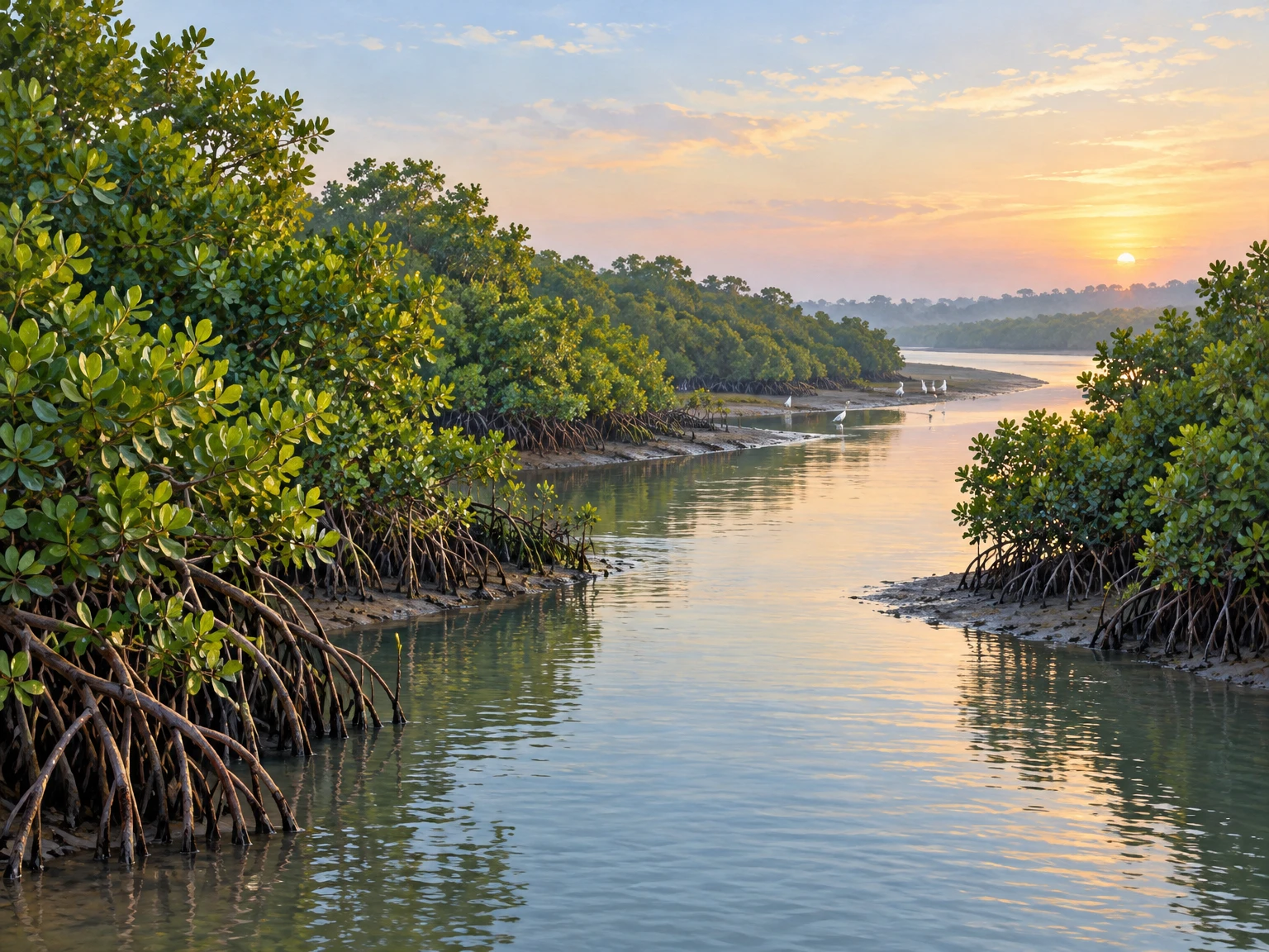
The district’s defining forest is mangrove forest. Mangroves are not simply trees beside water; they are a tidal ecosystem that stabilises sediment, gives shelter to aquatic life and creates roosting and feeding places for birds. In Bhitarkanika’s creeks, one may encounter the visual grammar of the wetland—interlaced roots, mud banks, brackish channels, water monitors, deer, kingfishers and wading birds—but wildlife is never an appointment. The most respectful experience is patient looking from an authorised route, without demanding proximity or treating animals as scenery.
A useful distinction helps a traveller read the map correctly. Bhitarkanika National Park is the 145-square-kilometre core national park notified on 16 September 1998. It sits within the larger Bhitarkanika Wildlife Sanctuary landscape, while the Ramsar wetland designation covers a still broader 650-square-kilometre wetland area. These are related but not interchangeable labels or boundaries. Odisha Forest Department and the Bhitarkanika Ramsar factsheet explain the protected-area framework.
Kendrapara’s human geography is equally watery. Markets, temple towns, former estate centres and ferry-dependent coastal settlements have long been connected by routes that respond to rivers as much as roads. It is a district where one should slow down: allow time for a changed tide, a delayed crossing, a village detour or a conservation restriction. That restraint is not an inconvenience to be overcome; it is part of understanding the place.
Mythological & Historical Significance
Kendrapara’s religious identity is inseparable from Shri Sidha Baladev Jew at Ichhapur. In local devotional understanding, the town is Tulasi Khetra, a sacred field associated with Baladev, elder brother of Jagannath. The district’s official account retells a story in which Balram defeats Kandrasura, marries his daughter Tulasi and settles here. This is a living sacred narrative, not a verifiable account of the district’s administrative origin, and it is best received as faith and local memory rather than as documentary history. Official district history
The Baldev Jew temple is therefore more than an attraction. Its rituals, food offerings, dress of the deities and annual processional traditions give Kendrapara town a cultural rhythm. The official temple page identifies Baladev as the principal deity worshipped with his brother and sister, and notes the seated Tulasi image within the complex. The associated chariot is called Brahma Taladhwaja Rath. Grand claims about its size occur in local temple description, but a visitor need not turn devotion into a record-book contest to appreciate the event’s significance. Shri Baldev Jew temple
Rasabali, the soft chhena-based sweet offered and associated with the temple, is Kendrapara’s best-known culinary emblem. It is not merely a dessert to tick off a list. In temple-centred food culture, prasad carries a relation between offering, ritual order and community. Ask locally about appropriate purchase and consumption, particularly during crowded observances, and do not assume that every vendor’s preparation has a temple connection.
Recorded political history introduces a different set of names: Kanika, Aul and Kujanga. The district history identifies these as former estates and associates their ruling houses respectively with the Bhanja, Dev and Sandha dynasties. Their palaces, temples and remembered patronage remain important to the cultural landscape. Such accounts should be read carefully. Estate histories often blend archival fact, family memory and later regional narration. The broad reality—a coast once governed through landed estates, linked to riverine commerce and later British administration—is more secure than every specific antiquarian claim made about early ports or classical references.
Maritime memory is especially strong. The official district history associates Jambu Island, Satabhaya and other coastal places with trading activity, and the story of Tapoi is widely connected in Odisha’s popular imagination with merchant voyages. These traditions illuminate how coastal communities remember the sea: as a route of exchange, risk, migration and longing. They do not, by themselves, establish the precise dates, scale or international reach of ancient trade.
Colonial-era infrastructure is easier to locate in the historical landscape. The district page records a lighthouse and port at False Point in the nineteenth century and describes Kendrapara municipality as established on 10 March 1869. It calls the municipality Odisha’s first and oldest; that superlative should be understood as the district website’s stated claim rather than repeated as an independently settled verdict. The period also left structures such as Hukitola, whose story joins famine relief, maritime logistics and engineering.
Kendrapara’s cultural history includes schools, libraries, music and participation in the freedom movement. The district history names figures including Narayan Birabar Samanta, Pitambar Jagadev, Asadulla, Amar Chatterjee and Sahadev Pradhan in its account of anti-colonial activity. It also recalls literary and musical circles around Bada Kotha. These references matter because they resist a narrow image of Kendrapara as only a wildlife destination. The district’s heritage is devotional and ecological, but also civic, educational and political.
Temple calendars remain living calendars. Chandan Jatra, Debasnan Purnima, Ratha Jatra, Jhulan Jatra, Gaja Lakshmi Puja, Dola Jatra and Olakana Melana are among the observances listed by the district administration. Lunar dates change each year, and local schedules can be altered by temple authorities or public conditions. Rather than arriving on the strength of an old internet date, travellers should verify the current year’s programme with local authorities or temple representatives. Festival and culture
Tourist Destinations & Hidden Gems
Bhitarkanika is Kendrapara’s great ecological encounter, but it rewards humility more than conquest. The national park and sanctuary are a tidal mangrove world, not a conventional zoo or a guaranteed wildlife show. Boat movement, designated paths and entry arrangements are conservation tools as well as visitor facilities. Estuarine crocodiles, water monitors, spotted deer, wild boar and diverse resident and migratory birds are associated with the area; their presence does not guarantee a sighting on any particular trip. The pleasure is often quieter: a bend in a creek, the changing texture of saline water, mangrove shade and the call of a bird beyond view.
The most important safety rule is also the simplest: remain in authorised boats and designated visitor areas, keep hands and feet inside a boat, never attempt to approach a bank or feed wildlife, and follow Forest Department instructions immediately. Crocodiles are wild animals in a habitat that belongs to them. Swimming, unsanctioned boating and casual exploration of creeks are irresponsible and dangerous. Do not use drones, loud music or flash photography where prohibited.
Odisha Tourism currently presents October to March as the preferred visiting period and lists a seasonal closure from 1 May to 31 July for crocodile breeding, with hours and fees subject to Forest Department norms. These are planning pointers rather than promises. Before leaving home, confirm current entry gates, permits, boat allocation, accommodation, weather closures, identity requirements and the day’s timings through official channels. Bhitarkanika visitor guidance
Gahirmatha, near the Bhitarkanika coast, demands even greater care in language and conduct. It is a Marine Wildlife Sanctuary and an internationally important Olive Ridley sea turtle nesting area. The district tourism page calls it Odisha’s turtle sanctuary and locates it between the Dhamra and Brahmani river mouths. This status is a reason for restraint, not a reason to pursue turtles. Nesting, beach access, boat movement and fishing-related regulation are subject to seasonal conservation rules. Never assume a beach can be entered, that a nesting event can be watched, or that a boat trip is authorised. Gahirmatha
If access is allowed, the ethical visitor stays with approved operators, maintains silence and distance, never uses artificial light around turtles, and accepts that the best outcome may be no direct animal encounter at all. The sanctuary’s significance lies in its protection of an entire marine and coastal process. It should not be reduced to a seasonal spectacle.
Hukitola on Jambu Island is one of the district’s most evocative historic sites. The large nineteenth-century building was constructed in 1866–67 during the Naanka famine, according to the district tourism page, to store rice imported by sea. Its sloping roof led rainwater towards large storage pots, an ingenious water-harvesting feature for an island structure. The page says INTACH restored it under the ICZM programme. The building’s material story—grain, rainwater, sea routes and coastal vulnerability—is richer than any romantic label of “forgotten palace.” Hukitola
Reaching Hukitola has traditionally involved travel to Kharinasi and then a water crossing. That information must not be mistaken for a standing invitation. Boat services, landing conditions, permissions, seasonal weather and safe access can change. Confirm locally and do not pressure boatmen to operate in unsuitable conditions. The island’s fragility is part of its historical meaning.
In Kendrapara town, begin at the Baldev Jew temple precinct and give it unhurried attention. Observe dress norms, photography rules and the flow of worshippers. The temple is close to town, but proximity should not produce casualness. If a festival is underway, expect crowds, traffic diversions and altered access. A temple visit is most rewarding when treated as an encounter with a living religious institution rather than an architectural stop between photographs.
The former estate landscapes of Aul, Rajkanika and Kujanga offer another way into the district. The official places-of-interest page describes Aul Palace near Aul township, Kanika Palace in Rajkanika block and Bada Kotha as a historic structure connected with Kendrapara’s former rulers and cultural life. These are meaningful heritage stops, but their condition, public access and interpretation may vary. Seek permission where needed; never enter fenced, residential or deteriorated buildings simply because they appear on a tourism page. Places of interest
Batighar, the lighthouse area associated with False Point, belongs to the maritime strand of a Kendrapara itinerary. The district portal calls it the first lighthouse installed on India’s eastern coast. The claim, like other historical superlatives, deserves attribution and further verification. What is beyond dispute is the coast’s long dependence on navigational knowledge, ports and warning systems. Check whether the site itself is publicly visitable before planning around it.
Some celebrated Buddhist sites often appear in broad Kendrapara travel circuits because road journeys can connect them with coastal stays. Ratnagiri, Udayagiri and Lalitgiri, however, are in neighbouring Jajpur district, not Kendrapara. They may make a worthwhile separate or combined itinerary, but should not be presented as Kendrapara attractions. Respecting district boundaries is a small but important form of accurate travel writing.
Recent News & Tourism Developments
The most useful recent Kendrapara news is ecological, and it needs to be handled without turning wildlife counts into tourism marketing. A Forest Department direct count conducted from 3 to 5 September 2026 recorded 132,279 colonial nesting birds in Bhitarkanika National Park, including 76,151 chicks, 28,064 nests and ten recorded species, according to reporting published by The New Indian Express on 12 September. The report compared the total with the 2025 monsoon count, but a single census does not explain causes or guarantee what a visitor will see. The New Indian Express, 12 September 2026
Earlier in the year, a boat-based crocodile count conducted from 8 to 10 January was reported to have recorded 1,858 estuarine crocodiles across Bhitarkanika’s rivers and creeks, compared with 1,826 in 2025. The figure was attributed to Forest Department officials in a 22 January report. A count is valuable conservation information, but it is not a claim that every animal was visible or that visitors will encounter crocodiles. The Hans India, 22 January 2026
On 26 October 2026, Urban Acres reported that veterinary doctors had conducted autopsies on four crocodiles found dead in and around Bhitarkanika over 19 days, while Divisional Forest Officer Varadaraj Gaonkar said the exact causes would be known after the post-mortem reports. This is secondary reporting, not a published official finding; a check of the Wildlife Odisha news page and park information page on 3 November found no final cause-of-death report. Possible net entanglement was discussed in the report but is not established as the cause. Urban Acres, 26 October 2026
For tourism access, the most recent clearly dated public update located for this edition is a 29 July 2026 report that Bhitarkanika would reopen from 1 August after the annual breeding-season closure. That is useful background, not a substitute for same-day confirmation in November. Conditions can change for weather, conservation work or administrative reasons. Prameya News, 29 July 2026
Odisha Tourism currently lists visitor hours as 08:00–17:00 and the annual crocodile-breeding closure as 1 May–31 July. These are general visitor details, not confirmation that a particular gate or boat is operating today. The Wildlife Odisha pages checked on 3 November offered general park information and a dated 2025 closure notice, but no current 2026 gate/boat-status notice; live access therefore remains unverified. Confirm the intended entry point, boat service and any weather or conservation restriction directly with the Forest Department before travelling.
Traveler Essentials
Bhubaneswar is the practical air gateway for most travellers, while Bhadrak and Cuttack are commonly used rail gateways depending on the intended route. From there, road travel leads towards Kendrapara town, Rajnagar, Pattamundai or coastal access points. Odisha Tourism lists Bhubaneswar airport, Bhadrak railway station and road access via Rajnagar for Bhitarkanika. Do not rely on a fixed journey duration: road condition, weather, starting point and final entry gate all matter. Getting to Bhitarkanika
Plan the district as two or three connected days rather than a hurried day trip. One day can be devoted to Kendrapara town, Baldev Jew and nearby heritage; another to authorised Bhitarkanika access; a further day may allow for a coastal or estate-history detour if conditions permit. Book only through currently verified providers, and confirm what a booking includes. Do not assume that an online listing guarantees a boat, guide, entry permit or room.
Dress for humidity, rain and insects: light full-sleeved clothing, a rain layer, sun protection, drinking water and footwear suitable for wet jetties are sensible. Carry identification where required. Mobile coverage and digital payment may be uneven away from towns, so make practical arrangements without treating local vendors as obliged to solve a traveller’s lack of preparation. Keep plastic out of boats and mangrove areas; carry waste back to an appropriate bin.
Food is one of the gentlest ways to understand Kendrapara. Rasabali is the signature sweet, especially in its devotional context. In local eateries, look for freshly prepared Odia meals based on rice, dal, seasonal vegetables and fish where appropriate to your diet. Ask what is local and available rather than demanding a standardised menu. In protected areas, do not carry food to feed birds, deer or reptiles.
A practical rhythm for a coastal district
A Kendrapara itinerary works best when it is built around confirmed access points rather than an ambitious list of pins. Kendrapara town, Rajnagar and the coastal river crossings serve different purposes; a map’s short straight-line distance can conceal a longer road journey or a boat leg. Before fixing an overnight stay, identify the authorised entry point for the wetland visit, ask which transport legs are actually operating and leave time for check-in and local instructions. If the official access plan changes, treat that as a reason to simplify the day, not to improvise an unapproved shortcut.
Water changes the pace here. Tides, rainfall and river levels influence the landscape that visitors come to see, and they can also change the safe or permitted way to reach a site. Ask the operator or Forest Department how much time is required for the currently approved route and when visitors must return. Do not assume a boat can depart whenever a group arrives, that a creek is navigable at all hours or that a crossing will be available after dark. Keep a buffer before onward rail or air travel rather than placing a tightly timed connection after a remote excursion.
For Bhitarkanika, a boat is a way to observe a protected habitat, not a safari vehicle in which to pursue animals. Stay seated as instructed, keep voices low, do not ask a boatman to leave an authorised route for a closer photograph and never throw food into the water. Binoculars can make distant birds easier to appreciate without disturbing them. A camera with a longer lens is more useful—and kinder—than trying to approach a nest, basking crocodile or shoreline animal. Any rule set by staff takes precedence over a general travel guide.
The same care applies to coast and island visits. Mudflats and tidal banks are not informal walking trails: surfaces can be soft, channels can refill and shore conditions change. Do not step off a designated path or boat to explore exposed ground. Gahirmatha is important precisely because it protects a sensitive marine and nesting landscape; a visitor must accept access restrictions and the possibility that the protected area cannot be entered. No turtle sighting, nesting activity or boat excursion should be promised to children or other travellers as the expected result of a trip.
Kendrapara town and its temple precinct offer a useful counterpoint to the wetland. Visit during the hours confirmed locally, dress and behave in a way that respects worshippers, and ask before photographing people, rituals or restricted spaces. During Rath Yatra and other observances, ordinary traffic and access patterns may change. If a festival is the purpose of the visit, confirm the date for that year with the temple or district administration; a recurring lunar festival cannot be placed reliably from a previous year’s calendar.
Heritage sites deserve a similarly measured approach. Hukitola, former estate buildings and the False Point lighthouse area each carry histories of trade, famine, administration and navigation, but a site’s appearance in a government tourism list does not mean that every room or parcel is open to visitors. Check opening arrangements and seek permission where the property is managed, occupied or fragile. Avoid climbing on masonry, removing objects or treating a working religious or community place as an empty set. A local guide’s account can add meaning; distinguish oral interpretation from a documented date or official record in your own notes.
A little flexibility makes the district more rewarding. Keep one weather-dependent activity optional, carry water and a light rain layer, and have a town-based alternative if a boat or coastal route is cancelled. Use locally available services only after confirming the price, inclusions and return arrangements, especially for a remote crossing. These simple checks protect visitors’ time while recognising that fishing, worship, conservation and residents’ daily travel matter more than a visitor’s fixed timetable.
The district is best visited with a conservation-minded temperament. Keep voices low on water, avoid bright lights around sensitive coastal habitat, never request risky close approaches for photographs and listen to local warnings about tides and weather. A respectful visit leaves room for the fact that a mangrove creek, a temple ritual and an island monument all have purposes beyond tourism.
Sources & checks
Evidence checked 3 November 2026. Article body originally sourced 25 October 2026; current visitor-information and crocodile-autopsy status refreshed 3 November 2026.
- Kendrapara district profile — Government of Odisha, date not stated.
- Kendrapara district history — Government of Odisha, date not stated.
- Tourist places, Gahirmatha, Hukitola and Shri Baldev Jew — Government of Odisha, dates not stated.
- Bhitarkanika National Park — Odisha Tourism, current page lists 08:00–17:00 and seasonal closure, but does not verify live gate or boat operation.
- Wildlife Odisha news and Bhitarkanika National Park details — official Wildlife Odisha pages checked 3 November 2026; general information only, no current 2026 visitor-status or autopsy-result notice found on these pages.
- Bhitarkanika Ramsar factsheet — Indian Wetlands portal, date not stated.
- Nesting bird census report — The New Indian Express, 12 September 2026.
- Crocodile count report — The Hans India, 22 January 2026.
- Crocodile mortality and pending post-mortem reports — Urban Acres, 26 October 2026; secondary report attributing autopsies and pending causes to the DFO; no final cause established in the report.
- Bhitarkanika reopening report — Prameya News, 29 July 2026.
- Cover image provenance: original AI-generated illustrative art created on 25 October 2026; it is not a documentary photograph.
Disclaimer
This content is a collection of ancient history,books and various articles and collection of library and news and other post ; all details may not be the same. Readers are requested to verify the information themselves. Readers are not allowed to take any disciplinary action; content is only for educational purposes. If readers do not agree about the contents, they may send a personal comment to my personal email ID: achary.purna@gmail.com
