
Jharsuguda is often introduced through its rail junction, airport and industrial skyline. That description is useful, but incomplete. The district also holds a markedly older landscape: river valleys, low wooded hills, agricultural settlements, shrines sustained by daily worship, and a protected rock shelter whose markings raise difficult questions about early human expression. Its visitor experience is therefore not a single circuit of “sights”. It is an encounter with western Odisha’s layered geography, community memory and modern mobility.
The district’s places deserve an unhurried approach. A waterfall is not merely a picnic backdrop; it is part of a seasonal stream system. A cave inscription is not an invitation to touch, trace or photograph at any cost; it is a fragile archaeological record. A temple is first a living place of worship, not a stage set. Travel well here by making room for these distinctions.
District Overview & Geography
Jharsuguda lies in western Odisha, close to the state’s border with Chhattisgarh. The district administration places Sundargarh to its north, Sambalpur to its east, Bargarh to its south and Chhattisgarh to its west. It was constituted as a separate district on 1 January 1994 after having formed part of Sambalpur district. Administratively it has one subdivision and five blocks and tehsils: Jharsuguda, Lakhanpur, Kolabira, Laikera and Kirmira, according to the district profile. These are contemporary administrative facts, distinct from the much older histories of the local estates and settlements described in district tradition.
Its terrain belongs to the undulating transition country of western Odisha. Towns and industrial corridors occupy flatter stretches, while rocky rises, forest edges and foothills reappear beyond them. The district profile records agriculture, minerals and industry together, a useful reminder that cultivation, forest-linked livelihoods and manufacturing have all shaped the region (district profile). Coal, aluminium, steel and power-related activity are conspicuous parts of the modern economy, but they should not obscure the social worlds of villages, markets, worship places and farm fields around them.
Water gives this terrain its structure. The district profile and tourism pages describe the Ib as a defining local river; the district places the Chandi shrine near its bank. Tributary streams cut through hard rock and become especially dramatic after rain. The Koilighughar listing identifies the waterfall with the Ahiraj stream. Water volumes and access can change with rainfall and local management, so static descriptions do not establish safe current conditions. Reservoir margins and riverine lowlands add another visual register to the dry-season landscape.
The climate follows the broad rhythm of interior Odisha: very hot summers, a monsoon season that renews streams and vegetation, and a relatively cooler, drier winter. For most visitors, the post-monsoon to winter period is the most comfortable window for combining town sites, temples and landscape stops. Monsoon brings the strongest waterfall flow but also slippery rock, swollen watercourses and uncertain road conditions. In peak summer, begin early, carry drinking water and avoid treating exposed hillsides or stone platforms as casual all-day destinations.
Forest appears here in fragments, slopes and reserve landscapes rather than as a single tourism spectacle. The district profile notes forested localities; the IGNCA report locates Vikramkhol in Lakhanpur tehsil, approached via Belpahar. This forest-edge setting should not be treated as a guaranteed public trail. Such places are not open-air amusement grounds. Trees, undergrowth, insects, birds and small wildlife are part of a living habitat, and visitors should not assume that every track is publicly open or safe. No current site-specific wildlife inventory or access condition was verified for this edition; it is better to observe quietly and seek local official guidance than to promise sightings.
Jharsuguda’s cultural speechscape is similarly plural. Odia is widely used, while Sambalpuri and other community languages are part of regional life. A sensitive visitor listens rather than presuming that one label represents every neighbourhood or community. In markets and tea stalls, the most meaningful travel skill is ordinary courtesy: ask before photographing people, do not interrupt worship, and let local residents set the tone of an interaction.
Mythological & Historical Significance
The name Jharsuguda is tied in district narratives to older local forms and to the histories of estates such as Rampur, Kolabira, Padampur and Kudabaga. The district history page preserves accounts of local rulers, conflicts in the colonial period and later railway and postal milestones. These accounts are valuable as a record of local historical memory, but they should not be converted into a seamless, independently verified chronology. The district itself is a modern administrative creation of 1994; its terrain and communities have much deeper histories.
One of the most significant material links to that deeper past is Vikramkhol, also spelled Bikramkhol. The Archaeological Survey of India’s protected-monument list includes “Vikramkhol rock inscriptions” in Jharsuguda. The Indira Gandhi National Centre for the Arts report describes a rock-art shelter in Lakhanpur tehsil, discovered by K. P. Jayaswal in 1933, with engravings, a surviving painted honeycomb-like motif and occupational evidence including microliths. Its assessment assigns the art on stylistic and archaeological grounds to a broad Mesolithic-to-Chalcolithic horizon.
That broad attribution is more responsible than sensational claims. Vikramkhol has long attracted speculation because some marks have been compared with letter-like forms. Comparison is not decipherment. The signs have not yielded a universally accepted readable text, and visitors should resist declarations that the shelter contains a proven “first script” or a settled message from antiquity. The IGNCA report and a scholarly overview of rock-shelter research in the lower Mahanadi region provide context for the evidence and its limits. What is secure is its importance as a protected archaeological site where engraving, paint, rock surface, occupation debris and landscape belong together.
The shelter teaches a useful lesson about heritage. Prehistoric art does not become more meaningful when visitors add their own names, rub a surface for a photograph or attempt a tracing. Even well-intended touching can damage already weathered marks. If local authorities permit a visit, remain on the indicated path, keep flash and physical contact to a minimum, and accept closure or restrictions without argument. Protection is not a loss to tourism; it is the condition that makes future understanding possible.
Ulapgarh’s hill-fort ruins, Kolabira Fort and Ushakothi cave are named in the district history as historical locations. They are best approached as sites requiring verification, not as guaranteed excursion products. Ruins in rural and forest-edge settings can involve private land, seasonal tracks, limited interpretation or conservation constraints. The responsible traveller asks locally about current access and does not climb unstable masonry, remove stones or present unverified stories as archaeology.
Sacred geography is more immediately visible. Jhadeswar Temple, beyond Purunabasti near Jharsuguda railway station, is dedicated to Shiva. The district’s Jhadeswar Temple page says the lingam is regarded by devotees as self-manifest and that its actual age is unknown. This is an important distinction: the self-manifest character is a devotional belief, while the available official account notes a small temple erected in 1916 by Gujarati contractor Mulju Jagmal and subsequent arrangements for worship. The shrine’s value is not diminished by historical uncertainty. It lies precisely in the continuity of belief, service and place.
At Pahadi Mandir, Shiva worship is associated with a hilltop setting near Jharsuguda town. The ascent and view are part of its appeal, but the hill should not be treated as an adventure course. Footing, crowd levels and weather vary. Chandi Mandir near Brajarajnagar offers another form of sacred landscape: the district describes the Chandipitha as a natural rock cave near the Ib River. Here, stone, riverbank and deity form a single devotional environment. Dress and behaviour should follow local custom; remove footwear where required, avoid obstructing rituals and seek permission before photographing interiors or worshippers.
Kukurjanga’s Patita Paban Jagannath tradition is a major expression of local Vaishnava devotion. The district’s culture and heritage page records a dream narrative in which a ruler is instructed to establish Jagannath worship. It also presents conflicting construction dates, including 1215 and 1570, while referring to an older sculptural find. The disagreement is itself worth acknowledging. The dream belongs to sacred tradition; the differing dates show why visitors and writers should avoid claiming a definitive foundation year. What can be said confidently is that the temple remains a living centre of Jagannath worship and is associated with a distinctive local Ratha Yatra.
Other district traditions listed on the culture and heritage page include Ranjta observances in Jharsuguda and Kolabira, the Gokulastami Jatra of Rajpur, and the Sabita Rath Yatra at Gumadera in Belpahar. Their ritual calendars depend on lunar observance and annual local arrangements. A festival name is not a fixed travel booking guarantee. Confirm the current year’s date, procession route, crowd guidance and photography etiquette through local organisers or the district administration before planning around it.
Tourist Destinations & Hidden Gems
Koilighughar waterfall is a prominent landscape destination listed in the district tourism directory. The official Koilighughar waterfall page places it near Kushmelbahal in Lakhanpur block, around 55 kilometres from Jharsuguda, where the Ahiraj stream descends over rock. The same description notes a Maheshwarnath shrine and a Shivaratri fair. The combination explains the site’s character: it is simultaneously a seasonal water landscape, a local social outing and a place of worship.
Visit with humility toward moving water. After rain, apparently shallow channels can become forceful and rock surfaces can turn dangerously slick. Do not enter pools, jump from ledges or encourage others to swim; no verified safety supervision or water conditions were available for this edition. Stand back from edges, keep children close and leave before dark. Carry litter out, especially plastic bottles and food packaging. The waterfall is most beautiful when its stream, rocks, shrine and forest margin are treated as one place rather than as a disposable picnic venue.
The less dramatic pleasure of Koilighughar comes from time: the changing sound of water, the warm colour of exposed stone and the transition from road to wooded stream corridor. It is worth allowing a margin in the day rather than trying to combine it with too many distant stops. Conditions after rain, local crowding and roadwork can all change a plan. A hired vehicle or locally informed driver is more practical than relying on an assumed public-transport frequency, which has not been verified.
Vikramkhol is Jharsuguda’s quietest major heritage encounter, though “quiet” must not be confused with easy access. The district and IGNCA documentation locate the protected shelter in Lakhanpur tehsil, approached via Belpahar, rather than in the centre of town. It rewards visitors interested in archaeology, geology and questions rather than finished answers. Look for the relationship between natural overhang, weathered rock and human marking. Do not expect a museum-style display or infer that all marks are equally visible in every season.
Because this is a protected monument within a sensitive landscape, confirm permission, route and current conservation instructions before departure. Do not enter unmarked forest tracks or rely on old online directions. The most worthwhile interpretation is patient and modest: people used this shelter long ago; the surviving visual record is complex; scholars still debate portions of its meaning; and preservation takes precedence over a visitor’s desire for close access.
Jhadeswar Temple makes an accessible stop for travellers based in Jharsuguda town. Its small forested setting gives it a different atmosphere from a large urban shrine. Arrive as a worshipper’s guest, even if your purpose is historical curiosity. Offerings, queues and prayer times are managed locally, and no opening hours should be presumed from static web pages. The nearby old-town context also makes it a useful place from which to think about how a railway-era town expanded around much older sacred points.
Pahadi Mandir offers a compact hill-and-town perspective. Rather than treating the view as the only purpose, notice the way the shrine places Shiva worship within a raised landscape. Go in daylight, wear secure footwear and avoid the climb during heavy rain or when visibility is poor. It is not appropriate to assume that every stair, railing or approach will be usable at all times.
Chandi Mandir at Brajarajnagar brings visitors toward the Ib corridor. The cave setting is central to the shrine’s identity, and it deserves a slower, less intrusive visit than a standard monument stop. Riverbanks can be unstable or seasonally altered; admire the setting without going close to unsafe water or attempting boating. Brajarajnagar is also a reminder that Jharsuguda’s cultural landscape sits alongside an industrial one. Neither cancels the other.
Kukurjanga is a rewarding cultural detour for those willing to approach it through ritual rather than spectacle. The temple’s local Jagannath practices and Ratha Yatra carry meanings that cannot be reduced to unusual architecture or an event photograph. If attending during a festival, expect crowds, give processional space, follow volunteer or police instructions and do not push toward the chariot. On ordinary days, a respectful short visit can be more revealing than an attempt to force a festival experience.
Belpahar and Rajpur offer another route into living culture. Belpahar is connected with the Gumadera Sabita Rath Yatra, while Rajpur’s Gokulastami Jatra is described by the district as an agrarian folk observance associated with cattle welfare and farming life. These are not “hidden gems” in the sense of undiscovered sites. They are known community traditions whose integrity depends on visitors not consuming them as novelty. Confirm annual observances rather than publishing guessed dates.
For a broader western Odisha itinerary, tourism material sometimes groups Jharsuguda with Hirakud Dam, Debrigarh Wildlife Sanctuary and the leaning temple at Huma. They are worthwhile regional excursions, but they are not in Jharsuguda district: Hirakud and Huma are in Sambalpur district, while Debrigarh is in Bargarh district. Plan them as separate journeys with separate permissions, routes and time, not as attractions that can be casually folded into a short Jharsuguda day.
Recent News & Tourism Developments
The most concrete district-level mobility update located for this edition is dated 16 October 2026. OMMCOM News reported that an Atal Bus Stand at Belpahar was inaugurated, bus services were flagged off from it, and a 30-bed community health centre at Rajpur was inaugurated. The same report said that a foundation stone was laid for an Atal Bus Stand at Lakhanpur. The distinction matters: Belpahar’s stand was reported as opened, while the Lakhanpur facility remained at the foundation-stage announcement and should not be described as complete.
For visitors, a new terminal does not by itself establish a reliable timetable, destination list or booking system. Check bus operators and local official notices close to travel. A district retender connected with Belpahar facility-management services was also noted during research, but it does not independently establish any change in operations. Public infrastructure news should be read as a reason to verify conditions, not as a promise of seamless travel.
Aviation is another area where careful wording is necessary. The New Indian Express reported on 16 October 2026 that an airport advisory committee discussed a proposed ₹2,100 crore expansion of Veer Surendra Sai Airport, including runway and terminal development, and that land acquisition was underway. The report quoted proposals for additional connections and passenger facilities. A 15 October report likewise described land acquisition as a dependency.
These reports concern proposals and reported approvals, not completed airport infrastructure or guaranteed new routes. No primary sanction order was located in the research for this edition, and published accounts differ over land figures. It would be inaccurate to promise an international airport, new flights or finished facilities. For travellers, the current practical advice remains simple: use the airport as an available approach point only after checking the airline’s live schedule and the airport’s notices.
Research checked on 24 October 2026 did not verify a newer district-specific tourism project, new heritage opening or festival date; refresh district notices before publication. That absence is worth saying plainly. It does not mean that local culture has paused; it means that responsible travel writing should not manufacture novelty from general Odisha news or turn preliminary announcements into completed attractions.
The more durable tourism development story is stewardship. Vikramkhol’s protected status, temple communities’ continuing care, and sensible management of waterfall crowds matter as much as new terminals. Better access is welcome only when it does not lead to damaged rock art, polluted streams, unsafe water entry or disturbance at shrines. Visitors can contribute by choosing local services where appropriate, carrying waste back, respecting restrictions and sharing accurate rather than exaggerated information.
Traveler Essentials
Jharsuguda can be approached by air, rail and road. The district’s How to Reach page identifies Veer Surendra Sai Airport and Jharsuguda Junction as the principal air and rail gateways. Both are useful orientation points, but neither page nor this article should be treated as a live timetable. Flight availability, train stoppages, platform arrangements and road diversions must be checked directly with carriers, Indian Railways and current local information.
By road, Jharsuguda connects into western Odisha’s network toward Sambalpur, Bargarh, Sundargarh and the Chhattisgarh side. Distances on old tourism pages are directional aids rather than journey guarantees. Build in daylight time for rural attractions, particularly Koilighughar and any heritage site beyond the main town. If travelling by self-drive vehicle, ensure fuel, phone charge and offline mapping before leaving urban corridors. Do not drive into a flooded crossing or continue down an unverified forest road simply because a map marks it.
A practical first visit can be organised around a town base. Use one day for Jhadeswar, Pahadi Mandir and a considered visit to Kukurjanga or Brajarajnagar. Reserve another day for Koilighughar, subject to weather and local conditions. Vikramkhol should be a separate, pre-confirmed heritage outing rather than an impulsive add-on. This slower design reduces rushed driving and leaves space for the fact that worship, rain or conservation guidance may reshape the plan.
November through February generally offers the most comfortable conditions for town walking and longer road journeys. The post-monsoon months can be particularly attractive around streams, but waterfall rocks remain hazardous. Summer travel is possible with an early schedule and realistic expectations about heat. During monsoon, consult current weather and district advisories, and do not frame high water as a photographic opportunity. There is no verified safe-swimming or recreational-boating recommendation for the district’s waterfalls, rivers or reservoir edges in the sources used here.
Accommodation and dining choices should be confirmed before arrival rather than assumed from search listings. Jharsuguda town and industrial centres are the likeliest bases for conventional lodging, while rural excursion areas may have limited services. Ask a hotel or local driver for current, practical advice, but judge claims carefully. A recommendation for a tea stall, meal or route is local knowledge, not necessarily an official safety clearance.
Food is best approached through the wider culinary grammar of western Odisha rather than a list of invented “must-eat” specialties. Depending on the establishment and season, travellers may encounter rice-based meals, dal, seasonal vegetables, leafy preparations, fried snacks and sweets familiar across Odisha and Sambalpuri-speaking regions. Ask what is freshly prepared, state dietary needs politely and avoid expecting a village kitchen or temple precinct to function as a restaurant. Where food is offered in a sacred setting, follow the host community’s customs.
Pack light cotton clothing for heat, a rain layer after the monsoon begins, sturdy footwear for uneven ground, water, sun protection and a small bag for personal waste. At temples, modest clothing is the simplest sign of respect. At archaeological sites, leave stones, plants and surfaces untouched. At waterfalls, stay away from ledges and fast water. At festivals, keep pathways open for residents, performers and emergency movement.
Photography requires tact. Seek consent for close portraits. Do not photograph worship, offerings or temple interiors where it is discouraged. Do not fly drones at sacred places, forest areas or heritage sites without explicit authorisation. Geotagging a vulnerable location can increase pressure on it; share directions responsibly and never encourage trespass. The best souvenir from Jharsuguda is not a carved rock fragment, a picked flower or a dramatic claim online, but a clearer appreciation of a district where landscape, labour, faith and memory remain inseparable.
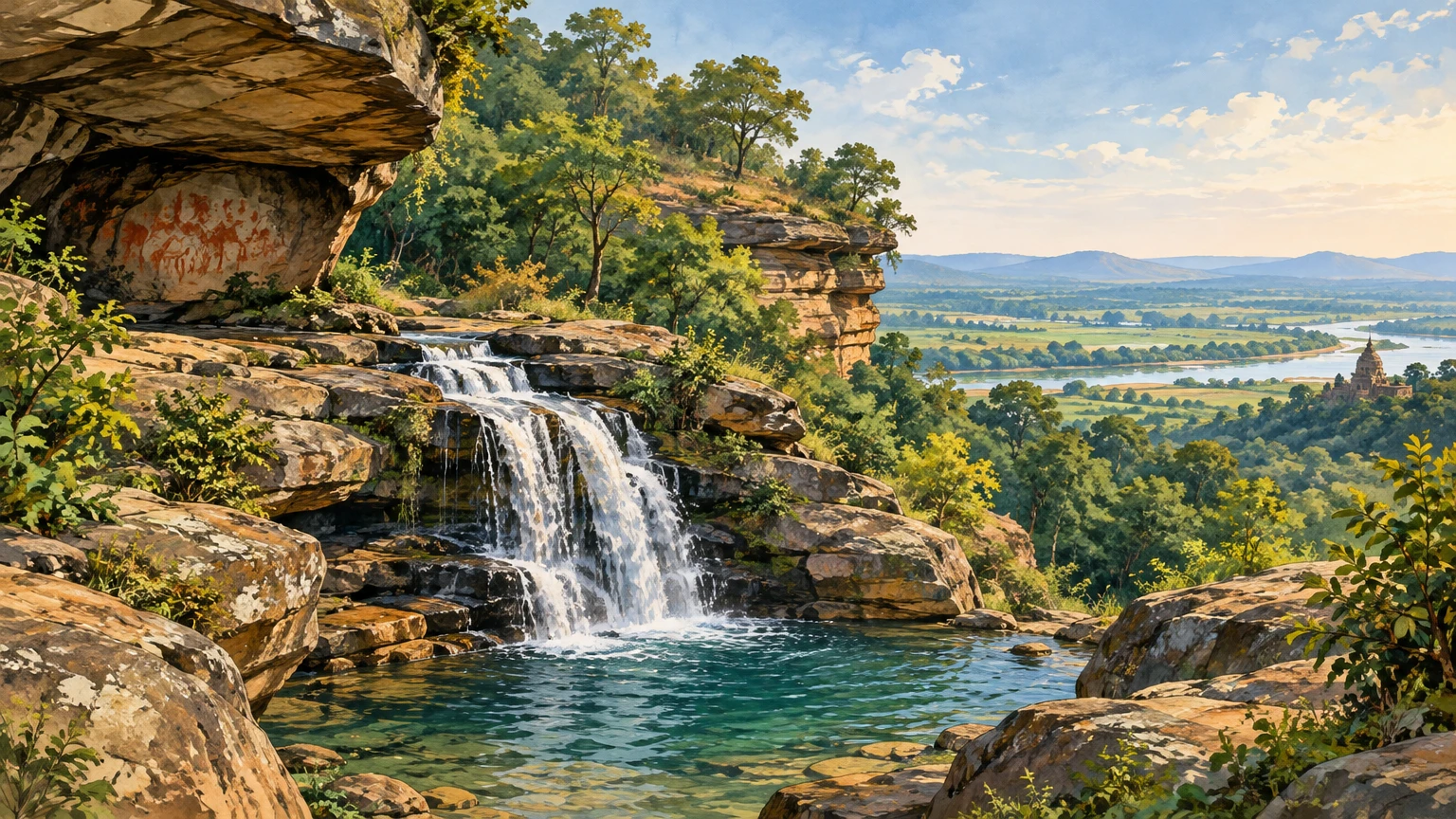
Featured illustration: Original AI-generated, text-free editorial artwork made for this article. It evokes the district’s stream-and-sandstone landscape and rock-shelter heritage, not a documentary depiction of one identified site. Alt text: “A forest-edged stream falls over layered sandstone into a pool beneath a green western Odisha hillside.”
Disclaimer
This content is a collection of ancient history,books and various articles and collection of library and news and other post ; all details may not be the same. Readers are requested to verify the information themselves. Readers are not allowed to take any disciplinary action; content is only for educational purposes. If readers do not agree about the contents, they may send a personal comment to my personal email ID: achary.purna@gmail.com
