
District Overview & Geography
Nabarangpur is a large, predominantly rural district in south-western Odisha, a place best understood through its changing ground rather than as a compact checklist of sights. Its landscapes move between cultivated plains, low hills, forested tracts, seasonal streams and the wider Indravati basin. The district headquarters, Nabarangpur town, is one useful starting point, but the district’s cultural and natural sites are dispersed across considerable distances. A rewarding visit therefore needs time, realistic route planning and an acceptance that roads, weather and local access shape the day as much as any itinerary.
The district became administratively separate on 2 October 1992, after having been part of Koraput district. The official district introduction gives its area as 5,294 square kilometres and records 1,583.4 square kilometres of forest area. Those figures offer a useful sense of scale, though they should not be mistaken for a map of publicly accessible forest or a guide to recreation. Forests are working ecological and community landscapes, as well as areas subject to protection and regulation. The official 2011 Census table records a population of 1,220,946 and a Scheduled Tribe share of 55.79 percent; these are historical census figures, not a statement about the district’s current population. Government of Odisha district profile
The district’s official profile also lists one subdivision, ten tahsils and ten blocks. This administrative scale matters to a visitor: a district headquarters is not a substitute for checking which local authority serves a particular destination. Verify current directions, permissions and advisories for the specific place rather than assuming a general tourism page covers every locality. The area and forest figures are useful context, not an access map or a promise of facilities.
The Indravati is central to Nabarangpur’s geography. The district administration notes that the river forms part of the boundary with Koraput. This is important for travellers reading broad “Indravati” itineraries: a reservoir view, road junction or watershed mentioned in a neighbouring district is not automatically in Nabarangpur. The river system links agriculture, settlement and seasonal movement, while smaller watercourses feed falls and stream valleys in the uplands. In the rains, these watercourses can transform quickly; a quiet cascade in a dry-season photograph may become unsafe during a spell of heavy rain.
Nabarangpur’s climate follows the broad seasonal rhythm of inland southern Odisha. The hot months can make long outdoor excursions tiring; the monsoon greens the countryside and strengthens waterfalls, but also brings slippery rock, muddy approaches, reduced visibility and the possibility of local disruption. The post-monsoon months and cooler season are often the most comfortable time for unhurried travel, walking around towns and visiting outdoor places. That is a practical preference rather than a guarantee of conditions. Before leaving, travellers should check the latest India Meteorological Department forecast, district advisories and the condition of their particular road.
Agriculture remains an important part of the district’s everyday economy and visual character. Fields, village ponds, roadside trees and market settlements are not scenery placed around attractions; they are the lived terrain through which a visitor passes. This matters especially when travelling through villages. Ask before photographing people, homes, religious observances or craft work. Do not turn Adivasi communities into an attraction or assume that a person’s dress, language or occupation provides an invitation to personal questions or photographs. Nabarangpur’s communities are contemporary, varied and changing, with their own social, professional and cultural lives.
The district’s culture page lists Odia alongside several regional and Adivasi languages. Treat language as part of living community life, not a tourist display. A few courteous Odia greetings, patience in shops and markets, and respect for local guidance go further than trying to classify people by community. Culture and heritage, Nabarangpur district
Odisha Tourism lists Nabarangpur alongside Koraput, Malkangiri, Rayagada, Gajapati and Ganjam within its South Odisha region. Its page also names attractions in other districts, so it is regional context rather than a Nabarangpur itinerary. Keep district boundaries and actual travel time in view rather than trying to fit dispersed places into a rushed “tribal circuit.” Odisha Tourism’s South Odisha overview
Mythological & Historical Significance
Nabarangpur’s past has several layers, and they need different kinds of reading. Archaeological remains, inscriptions, local sacred memory, administrative records and later historical narratives do not all carry the same evidentiary weight. A careful visitor can appreciate the richness of the district without forcing every hill, shrine or ruin into a simple and certain chronology.
One notable archaeological landscape is Podagad, near Umerkote. The district tourism page describes Podagad as associated with the ancient Nala dynasty and points to caves, inscriptions, rock structures and material remains in the surrounding hills. These associations make Podagad significant, but the official tourism text itself should be read as a destination introduction rather than a final archaeological report. Questions of political control, chronology and the identification of particular remains require scholarly corroboration. The enduring value of Podagad is precisely that it is a landscape where terrain, memory and fragmentary evidence invite careful attention rather than instant certainty. Government of Odisha, Podagad
Older regional histories have sometimes fitted Nabarangpur too neatly into long chains of dynasties. The municipal history page offers one such layered account, connecting the area with shifting political formations, Jeypore rule, its period as a Koraput subdivision and later resettlement history. It also acknowledges that early regional history is scant. That caveat deserves to be kept in the foreground. The best interpretation is not that the past is empty, but that historians must distinguish evidence from retrospective identification and local attribution. Nabarangpur municipality history
That same municipal account says the Nabarangpur subdivision was created in 1941 and records that some refugees from East Pakistan were settled in the Umerkote subdivision in 1958 under the Dandakaranya Project. These are important administrative events, but they do not tell the whole story of individual families, the people already living in the area, or later changes. Read them as one part of a layered regional history, not as a shortcut for assigning a single identity to present-day residents.
Sacred geography is another living historical layer. Maa Bhandargharani is revered in Nabarangpur town as a protecting local deity, while Maa Pendrani is associated with a widely held local sacred tradition. The district’s culture page recounts the Pendrani story as part of community belief. Visitors should receive it as living religious memory, not as a documented biography that can be independently proven or disproven by a casual traveller. Temples are places of worship before they are heritage stops. Dress modestly, remove footwear where asked, do not step into restricted spaces, and do not photograph rituals or devotees without clear consent. Culture and heritage, Nabarangpur district
Mondei is one of the district’s important post-harvest cultural observances, held in different localities. The district’s culture page connects the name with “Mondi,” a small market, and describes gatherings that can include fairs and performance. That description is a starting point, not a fixed programme: dates, location and local arrangements are not a single district-wide visitor schedule. A traveller who hopes to attend should confirm the specific event close to the date with local authorities or hosts, ask what is appropriate and be prepared for an event intended primarily for its community. Do not assume there will be a public stage, visitor facilities or permission to photograph. Respectful presence is more valuable than access.
The cultural page also notes craft traditions associated with the district, including Dhanya Laxmi paddy-art work in Dabugaon and earthen work at Tonda near Papadahandi. It describes locally made boxes, toys, sticks, chains, pedestals and puja articles as well. These references are an invitation to learn about skill, material and maker, not to bargain aggressively for a souvenir. If a workshop or seller welcomes conversation, ask how the work is made, whether photography is acceptable and how purchases can support the maker fairly. The page does not confirm that any craft activity is open for visits on demand, or provide a current directory of makers; do not arrive expecting a demonstration.
Papadahandi carries a modern history that deserves a quiet, serious visit. On 24 August 1942, during the Quit India movement, colonial police fired on a procession near the flooded Turi River. Sources differ over the death toll. The municipal history page gives 19 people killed, 100 injured and 140 arrested; an August 2007 article in Odisha Review says 12 died at the scene and three later in hospital, a total of 15. A 2025 draft district survey report repeats the 19 figure in its reference to a memorial. Rather than choose a convenient single number, visitors should recognise both the documented discrepancy and the shared fact: Papadahandi was the site of grave colonial violence and anti-colonial sacrifice. Odisha Review’s account of the August Revolution is a useful starting point, alongside the municipal narrative.
Memorials connected with this history are not “hidden gems” in the usual tourism sense. They are sites of civic remembrance. Speak softly, do not climb on structures, and avoid turning a place associated with death into a backdrop for entertainment photography. Nabarangpur’s history is not only ancient ruins or sacred legend; it also includes the political courage and suffering remembered at Papadahandi.
Tourist Destinations & Hidden Gems
Chandan Dhara, in the Jharigam area, is one of the district’s listed natural destinations. The official tourist-places page presents it as a waterfall amid wooded terrain and notes a Shiva association at the site. Its appeal comes from the meeting of water, rock, shade and sacred practice, not from an obligation to pursue an adventure activity. The flow, footing and appearance can vary sharply with rainfall. During the monsoon and immediately after heavy rain, stay well back from slippery edges and fast water. Do not enter pools, climb wet rock or assume that a familiar-looking place is safe for swimming. Carry drinking water, take litter away and follow instructions from local authorities or caretakers. Nabarangpur tourist places
A waterfall visit is best planned as a landscape visit. Pause at viewpoints rather than forcing access to every ledge. Keep sound low, particularly near shrines. Avoid disposable plates, plastic bottles and amplified music. This is not merely etiquette: waterfalls and stream corridors are fragile places where crowding, litter and careless movement can alter the experience for residents and other visitors. The available official descriptions are static destination information, not confirmation of current facilities, entry rules, opening hours or road conditions. Verify those locally before setting out.
Podagad offers a different kind of excursion: less a monument in the conventional museum sense than a historical landscape of hills, ruins and interpretive uncertainty. Go with enough daylight and do not attempt isolated paths without reliable local advice. Remains should be viewed, not touched, moved, marked or taken away. Inscriptions and stone fragments are sources of historical knowledge; a visitor’s responsibility is to leave them where they are. The idea that a ruin must look grand to be meaningful is misleading. At Podagad, the material fragments and the questions they raise are part of the experience.
Umerkote is an important town for travellers moving through the northern side of the district and a practical base for understanding Podagad’s setting. It should not be reduced to a transit point. Spend time in the town’s ordinary public life: a morning market, tea stop or walk through commercial streets can reveal more about the district’s rhythms than a hurried series of photographs. At the same time, travellers should not assume particular accommodation standards, transport schedules or restaurant choices without checking close to departure.
Around Nabarangpur town, Hirli Dongri is listed in the 2025 draft District Survey Report as a hill park and viewpoint. The same draft inventory names Kelia Shiva Temple, Ghumareswar, Bhairaghumar, Papadahandi and the Sahid Smruti Stambha among the district’s places of interest. This is useful as a starting list, but it is not a live visitor directory. It does not establish that every site is currently open, maintained for visitors, easy to reach or appropriate for unsupervised exploration. Draft District Survey Report 2025
The list is varied: hill viewpoints, water landscapes, shrines and a memorial serve different purposes and call for different kinds of visit. A town-focused stop, a history-focused excursion around Podagad and a waterfall outing are better treated as separate possibilities than as a guaranteed circuit. Papadahandi is a memorial landscape, not a photo stop to fit between attractions. Before choosing even one cluster, check current access and road conditions; the draft inventory does not provide a verified route plan.
Ghumareswar and Bhairaghumar are often mentioned for temple-and-waterfall or hill-and-waterfall settings. They should be approached with particular care because small water landscapes can be the most deceptive. Rainfall upstream can change flow without warning, rock may be unstable, and paths may be unmarked. Do not treat them as swimming sites or arrange informal boating. If local authorities, forest staff or residents advise against entering an area, accept the restriction without argument. Responsible travel sometimes means turning back.
Kelia Shiva Temple is included in the draft survey report’s destination inventory. Its presence signals local religious and cultural importance, but travellers should avoid extrapolating from a single listing into claims about age, founding patron, ritual calendar or visitor services. The same restraint applies to shrines across Nabarangpur. It is entirely possible to value a temple’s atmosphere and continuing worship without inventing a grand architectural pedigree for it.
A more meaningful “hidden” dimension of Nabarangpur lies not in unmarked locations but in attentive encounters with public culture. The district’s religious places, local markets and craft references reward curiosity that is patient and non-intrusive. Seek permission before entering a village lane for photography, respect a refusal, and buy directly from makers when invited. Do not ask people to pose in “traditional” dress, and do not enter forests or cultivation areas simply because a map shows a track. The most responsible discovery is often an ordinary place encountered with good manners.
Food is best approached in the same spirit. District-level official sources used here do not provide a reliable current guide to named dishes, eateries or cooking demonstrations. Rather than inventing a culinary canon, eat where food is freshly prepared, ask hosts or shopkeepers what is available that day, and explain dietary requirements clearly. Carry water and simple snacks for long road stretches, but minimise packaging. If offered a local preparation in a home or community setting, accept or decline graciously; hospitality is not a performance contract.
Recent News & Tourism Developments
At the 9 November 2026 recheck, the latest Nabarangpur local forecast displayed by the India Meteorological Department was still dated 8 November: for 9 November it lists 19–29°C, partly cloudy sky with haze and no warning. This district forecast is not a site-specific guarantee; recheck IMD and local advisories close to travel. The official district Tourist Places page remains a destination listing, while Odisha Tourism’s Nabarangpur page gives general route guidance and conflicting gateway figures; neither page supplied a dated site-by-site opening or road-access notice. Confirm a specific attraction’s access locally before departure. The sources checked did not establish a newly completed tourism facility or newly opened attraction; that is a limit of those sources, not proof that none exists. The 2025 draft District Survey Report is an inventory, not evidence that visitor infrastructure has since been completed.
The most relevant recent transport reporting concerns the Raipur–Visakhapatnam economic corridor. On 17 October 2026, The New Indian Express reported that the 465-kilometre corridor includes an approximately 240-kilometre Odisha section linking Nabarangpur and Koraput. The report concerned development and an inspection at Pottangi in Koraput district. The report projected reduced distance and travel time only after completion. Those projections belong to the project’s future, not to present travel advice for Nabarangpur; a safety inspection in neighbouring Koraput does not certify every connecting road. Advanced tech to ensure safer travel on Raipur–Visakhapatnam economic corridor
A second New Indian Express report, dated 8 October 2026, said an engineer’s May 2026 report had described a two-lane Nabarangpur bypass with paved shoulders on NH-26 as under construction. It also reported an ongoing National Human Rights Commission proceeding in which comments were sought. Neither the article nor the reported proceeding verifies that the bypass is complete or available as a traveller’s route. Check current navigation, road authority notices and local advice before a long drive. NHRC seeks activist’s response to report on NH projects in four Odisha districts
Weather and water management also shaped late October reporting. On 24 October 2026, Pragativadi reported the opening of two Indravati Reservoir gates in Nabarangpur district as a precaution during a cyclone threat. That was a dated event, not a current warning for November. Reservoir releases, rainfall alerts and road conditions can change rapidly, so travellers should consult official alerts close to travel rather than rely on a past report. Indravati Reservoir gates opened as cyclone threat looms over Odisha
These reports underline a useful principle: development news is not an itinerary. A corridor under construction, a planned improvement or a temporary water-management action may affect travel, but none should be converted into promises of faster journeys, open roads or recreation access. In a district where nature and infrastructure can change conditions from week to week, the most up-to-date local confirmation is more valuable than a glossy assumption.
Traveler Essentials
Odisha Tourism’s Nabarangpur guide contains conflicting gateway details: its Quick Information section lists Jayapur Airport (43 km), Visakhapatnam International Airport (200 km) and Jayapur Railway Station (45 km), while its How to Reach text instead identifies Biju Patnaik International Airport in Bhubaneswar as the nearest airport and makes a broad rail-connectivity claim. Treat these as directory notes, not a verified fastest gateway or current timetable; compare live flights and trains with onward road travel for the actual destinations you plan to visit. Odisha Tourism’s Nabarangpur guide
Odisha Tourism describes highway, bus and cab connections, but its guide does not give live bus timings, route closures or site-by-site access. It lists a Nabarangpur Tourist Development Officer at the Collectorate (P.O./Dist: Nabarangpur, PIN 764059), mobile 9937165927 and oritournabarangapur@gmail.com. Ask about a specific route or attraction before departure; the directory listing is not confirmation of same-day access. Odisha Tourism tourist offices
For a rail arrival, compare live train times with the onward vehicle you can actually arrange, and leave a generous transfer buffer rather than scheduling an outdoor visit tightly around arrival.
By road, Nabarangpur is connected through the southern Odisha and neighbouring-state highway network. Private vehicle, hired vehicle and bus journeys should be planned with daylight, weather and rest breaks in mind. Do not rely on old travel blogs for travel duration. Confirm the route, fuel availability and return options locally, particularly when heading toward dispersed rural destinations. Keep downloaded maps, but remember that offline mapping does not establish whether a forest road is open, safe or legally accessible.
Odisha Tourism’s emergency-health page lists Govt Hospital, Nabarangpur, ambulance number 108 and tourist helpline 1800-11-1363. Treat it as a static directory and confirm current contacts and availability; for urgent needs, use current local emergency services rather than relying on an old tourism listing. Odisha Tourism hospitals and emergency information
Pack for variable conditions: breathable clothing for daytime heat, a light layer for cooler evenings, reliable footwear with grip, rain protection outside the dry season, insect protection, drinking water and a small personal first-aid kit. Keep power banks and essential medicines with you. At waterfalls, choose stable ground and treat barriers, warning signs and local instructions as non-negotiable. Never enter floodwater, stand beneath unstable slopes, climb over safety structures or swim in unfamiliar pools.
For temples, clean and modest clothing is appropriate. Ask before taking photographs and do not photograph worshippers, priests, offerings or interiors where this is unwelcome. At memorials, carry the same restraint. At markets and craft settings, ask before photographing goods or people, pay agreed prices fairly, and avoid handling work without permission. These habits are small but meaningful ways of recognising that Nabarangpur is home, workplace and sacred landscape before it is a destination.
Finally, leave room for uncertainty. Confirm access, weather, local permissions, event dates, road conditions, accommodation and any charges shortly before travelling. Do not expect every place listed in a government document to function as a developed tourist site. Nabarangpur repays visitors who travel with curiosity, patience and respect for the people and landscapes that make its history continue in the present.
Sources and image provenance
Evidence checked 25 October 2026; time-sensitive material rechecked 9 November 2026.
- About Nabarangpur — Government of Odisha; district formation, area, forest area and administrative profile.
- District profile — Government of Odisha; 2011 Census figures, not current population data.
- Culture and heritage — Government of Odisha; local cultural descriptions and traditions.
- Tourist places — Government of Odisha; static destination listing, not current access or facilities.
- Podagad — Government of Odisha; destination/history notes, archaeological claims treated cautiously.
- Draft District Survey Report 2025 — Government of Odisha; draft inventory, not current visitor-access verification.
- History — Nabarangpur Municipality/SUJOG; undated historical account.
- The Immortal Martyrs of the August Revolution in Orissa — Pabitra Mohan Barik, Odisha Review, August 2007; Papadahandi casualty figure differs from the municipal account.
- Advanced tech to ensure safer travel on Raipur–Visakhapatnam economic corridor — The New Indian Express, 17 October 2026; project under development.
- NHRC seeks activist’s response to report on NH projects in four Odisha districts — The New Indian Express, 8 October 2026; does not verify completion.
- Indravati Reservoir gates opened as cyclone threat looms over Odisha — Pragativadi, 24 October 2026; dated event, not a current warning.
- South Odisha — Odisha Tourism; regional context, not a Nabarangpur route guide.
- Hospitals List & Emergency Medical Care — Odisha Tourism; static health and emergency directory.
- IMD Local Weather Report and Forecast for Nabarangpur — page dated 8 November 2026; for 9 November it listed 19–29°C, partly cloudy sky with haze and no warning; checked 9 November 2026.
- Nabarangpur destination | Odisha Tourism — gateway figures conflict within the page; no current attraction-access status; checked 9 November 2026.
- Tourist Offices | Odisha Tourism — official directory listing; checked 8 November 2026.
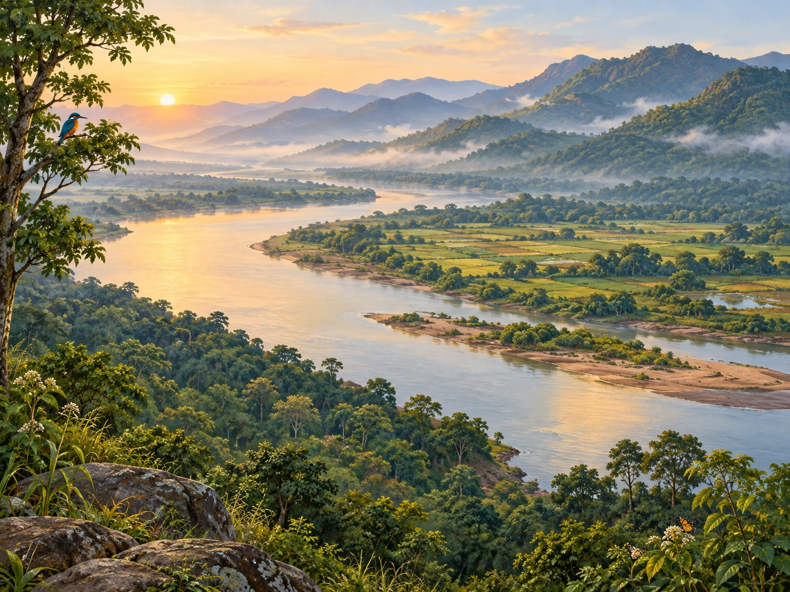
- Original text-free landscape illustration generated specifically for this article on 25 October 2026; no third-party image used.
Disclaimer
This content is a collection of ancient history,books and various articles and collection of library and news and other post ; all details may not be the same. Readers are requested to verify the information themselves. Readers are not allowed to take any disciplinary action; content is only for educational purposes. If readers do not agree about the contents, they may send a personal comment to my personal email ID: achary.purna@gmail.com
